
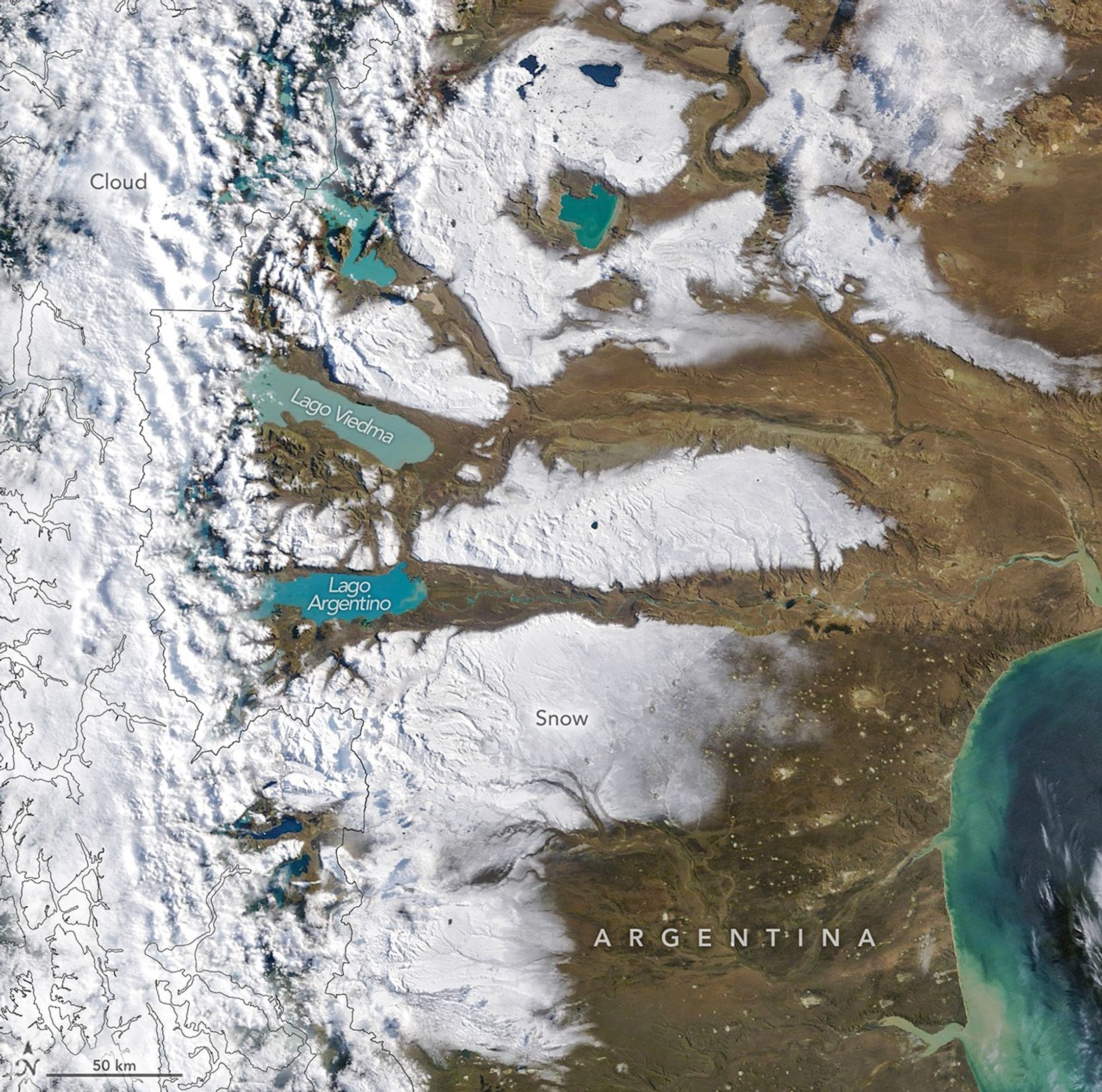
On the eastern, arid side of the Andes, the plains of southern Argentina stretch from the mountains to the Atlantic coast. The landscape often appears dry and brown, interrupted by colorful glacier-fed lakes, but a storm in early April 2026 blanketed swaths of the land in white. The MODIS (Moderate Resolution Imaging Spectroradiometer) on NASA’s Terra satellite captured this image of the snowy Patagonian Desert on the morning of April 3.
Early fall has been wetter than normal in southern Patagonia, said atmospheric scientist René Garreaud of the Universidad de Chile, noting that satellite-based estimates showed above-average precipitation from late March through early April. Much of the region’s precipitation tends to fall on the western, windward side of the Andes, he said. “But strong winds are capable of blowing some snow east into the Argentinian side, as beautifully reflected in the MODIS image.”
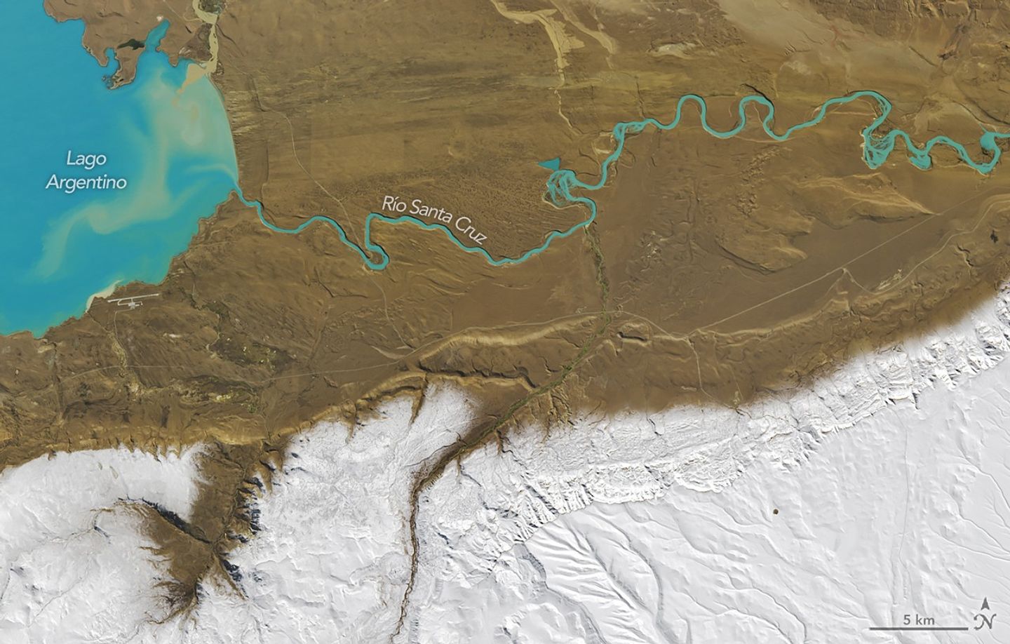
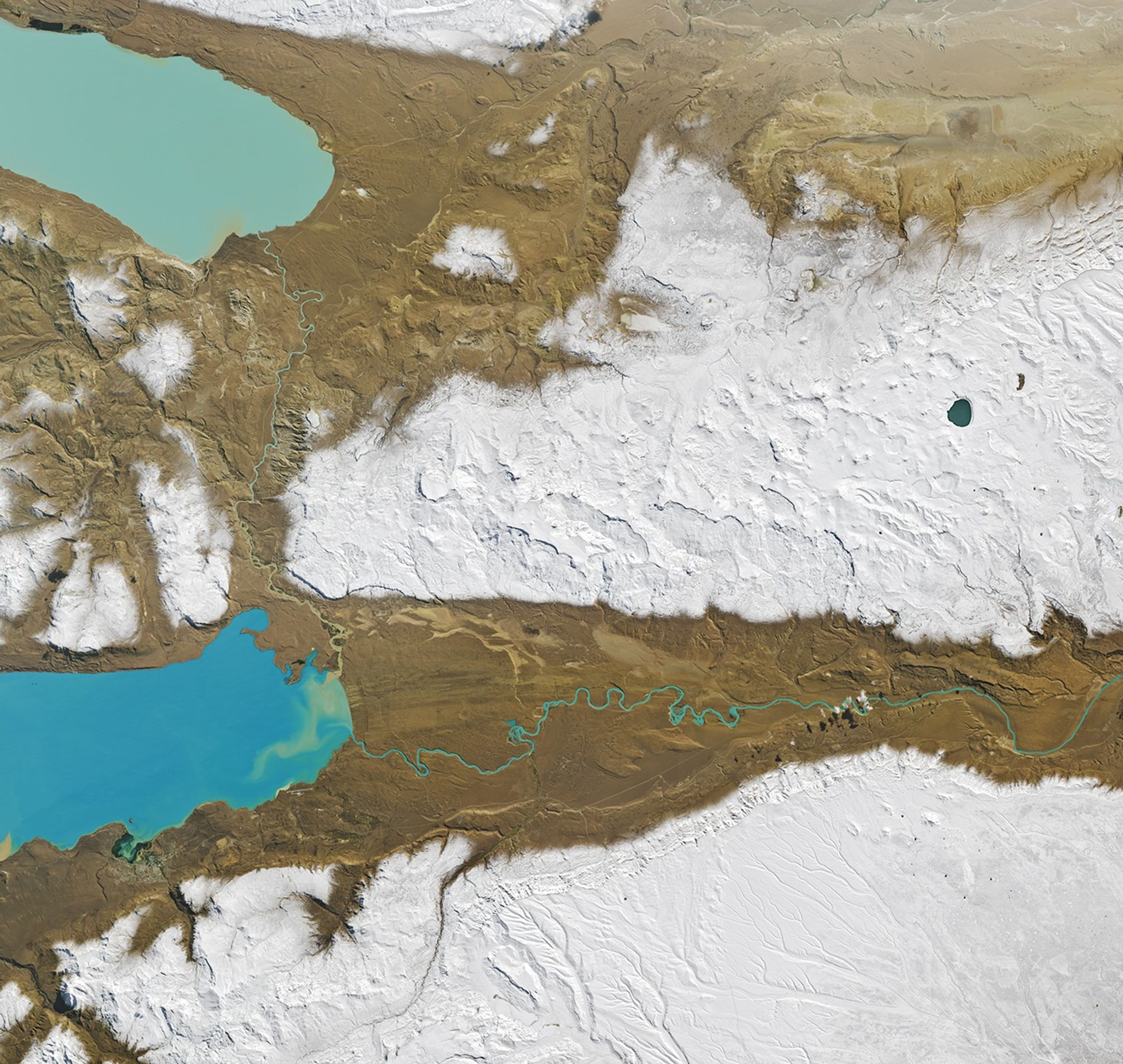
Snow clings to the higher elevations, while valleys draining the large glacial lakes are bare. In this detailed Landsat image, a stark snow line appears along the outlet of Lago Argentino. Also note the color of the water. Lago Argentino and other nearby lakes contain an abundance of fine sediment, or glacial flour, pulverized by southern Patagonia’s plentiful glaciers. This suspended sediment makes the lakes appear milky blue or turquoise.
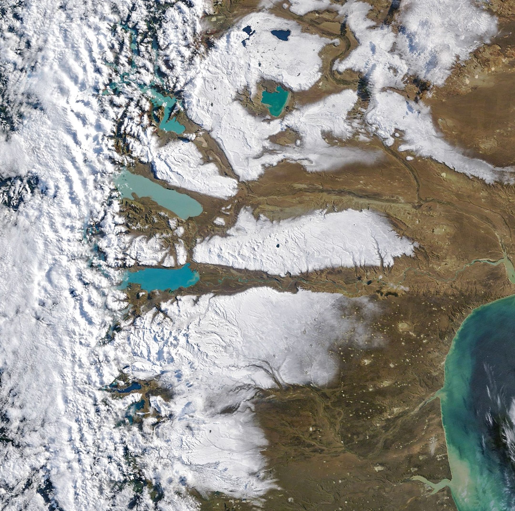
Though snow was widespread across the desert after the early-season storm, the wintry splendor was fleeting. A satellite view from the afternoon of April 4 showed that snow had melted from all but the highest mountain areas.
NASA Earth Observatory images by Michala Garrison, using MODIS data from NASA EOSDIS LANCE and GIBS/Worldview, and Landsat data from the U.S. Geological Survey. Story by Lindsey Doermann.
References & Resources
- AntarcticGlaciers.org (2026, March 19) Southern Annual Mode: Southern Westerly Winds in Patagonia. Accessed April 8, 2026.
- NASA Earth Observatory (2019, June 11) Los Glaciares National Park, Argentina. Accessed April 8, 2026.
- NASA Earth Observatory (2019, May 20) How Glaciers Turn Lakes Turquoise. Accessed April 8, 2026.
- NASA Earth Observatory (2011, March 11) Glacial Lakes of Patagonia. Accessed April 8, 2026.
You may also be interested in:
Stay up-to-date with the latest content from NASA as we explore the universe and discover more about our home planet.

Clouds of dust lofted from the Sahara Desert brought hazy skies and muddy rain to Western Europe.

An advancing cold front kicked up a sharp line of sand and other small particles that swept over the high…

Reed-covered mounds exposed by declining water levels reveal an unexpected network of freshwater springs that feed directly into the lake…
Discover More from NASA Earth Science
Subscribe to Earth Observatory Newsletters
Subscribe to the Earth Observatory and get the Earth in your inbox.
Earth Observatory Image of the Day
NASA’s Earth Observatory brings you the Earth, every day, with in-depth stories and stunning imagery.

Explore Earth Science

Earth Science Data
Open access to NASA’s archive of Earth science data

from NASA https://ift.tt/RWmL2HX


No comments:
Post a Comment