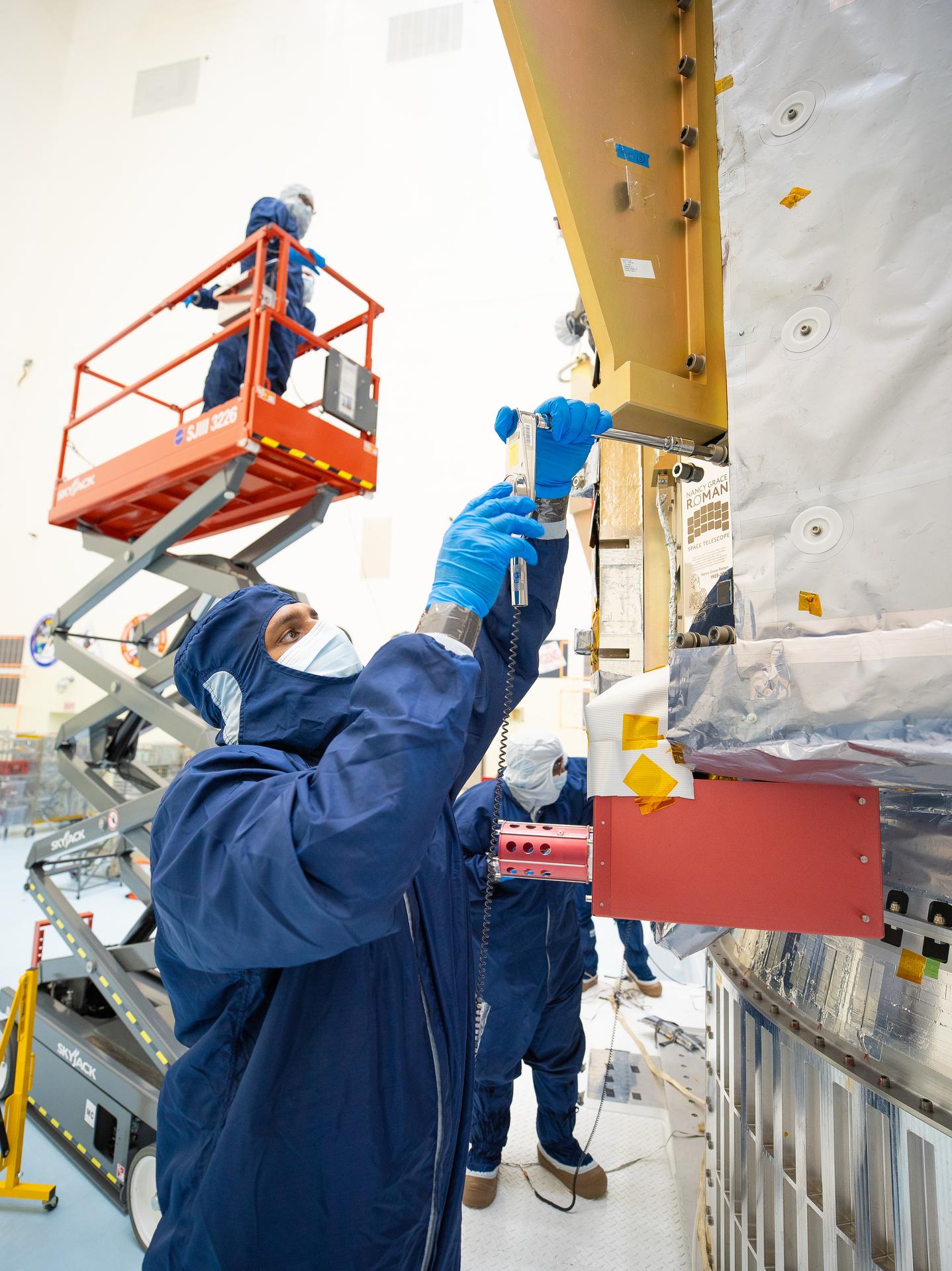
On July 27, technicians at NASA’s Kennedy Space Center in Florida installed a memory card containing 1,350,144 names as part of a commemorative plaque on the Nancy Grace Roman Space Telescope. The names were submitted by people globally, including astronauts from Artemis II and Artemis III. The memory card will travel with the Roman observatory to the Sun-Earth Lagrange point 2, or L2, about one million miles from Earth, where the Sun’s and Earth’s gravity balance out.
Roman is named after Dr. Nancy Grace Roman, NASA’s first chief astronomer and one of the architects of the agency’s modern science program. Roman championed space-based observatories that could study the universe from above Earth’s hazy atmosphere while making their data broadly available to the scientific community.
NASA and SpaceX are targeting launch for no earlier than 7:26 a.m. EDT Sunday, Aug. 30 aboard a SpaceX Falcon Heavy from Launch Complex 39A at Kennedy.
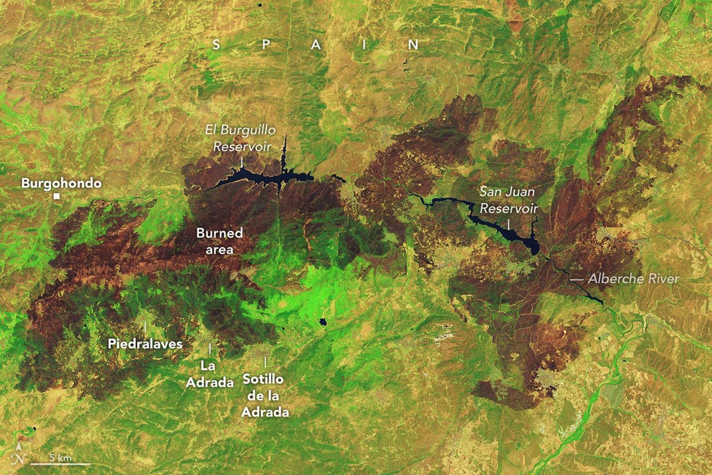
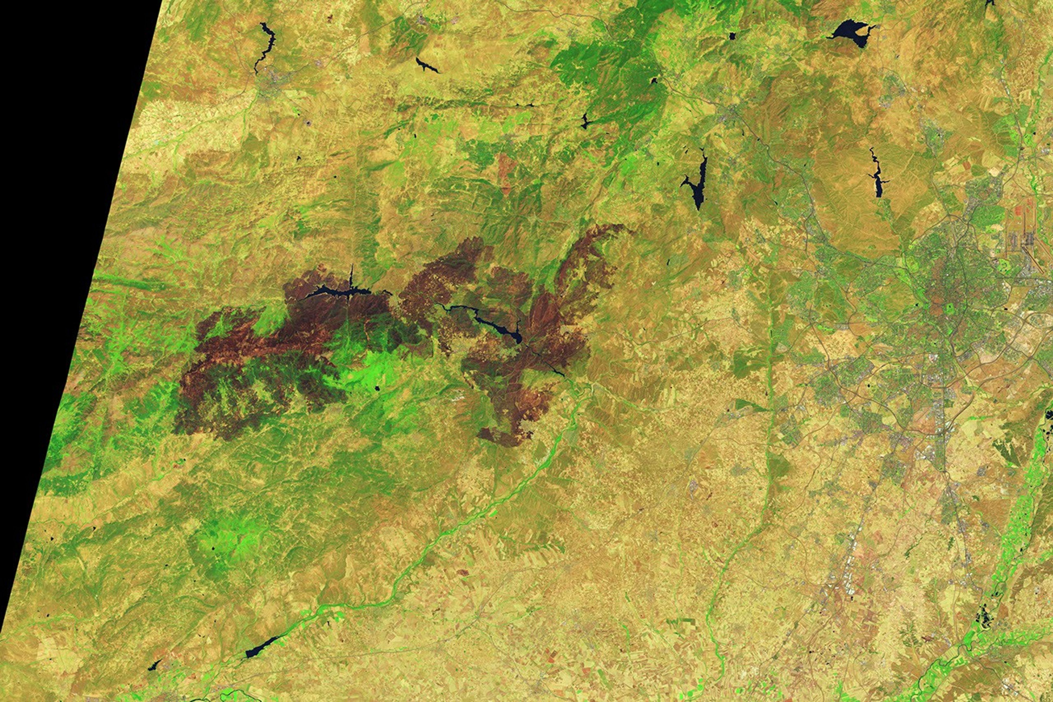
Charred landscapes surround reservoirs in central Spain in an image captured by the OLI (Operational Land Imager) on Landsat 9 on July 29, 2026. The false-color image combines observations at visible, near-infrared, and shortwave-infrared wavelengths (bands 6-5-3), making it easier to distinguish brown burned vegetation from green unburned vegetation.
NASA Earth Observatory / Lauren Dauphin
Wildland fires occur across Europe every summer, but those that erupted in Spain and France in July 2026 were among the largest and most disruptive the two countries have faced in decades. Some of the most consequential fires emerged in southwestern France’s Gironde Department and Spain’s Ávilaand Madrid provinces in mid-July, where blazes forced hundreds of thousands of people to evacuate and destroyed hundreds of homes.
Government officials in Spain say that a fire in Ávila, after charring around 50,000 hectares(124,000 acres), isthe largest on record, surpassing a blazethat burned in Larouco, Quiroga, and Oencia in 2025. NASA satellites first observed signs of the Ávila fire burning near Burgohondo on July 22 and July 23. By July 24, it had merged with fires in neighboring provinces, pushing the total area burned to 77,000 hectares, an area about the size of New York City.
The image above, captured by Landsat 9, shows charred landscapes around Burgohondo on July 29, 2026. In the false-color image, unburned vegetation appears light green, and burned areas appear brown. The two reservoirs in the center of the image were heavily affected. Flames tore through homes, restaurants, campgrounds, marinas, and other infrastructure surrounding the reservoirs, according to news reports.
A similar crisis unfolded in southwestern France, west of Bordeaux. One of the largest fires to burn in France this decade charred more than 42,000 hectares, prompting large-scale evacuations and devastating the village of Le Porge. As of late July, fires had burned more than 90,000 hectares across France, more than any other season in decades, according to data from the European Forest Fire Information System.
Environmental conditions months before the fires ignited made the landscape in both Spain and France particularly susceptible to burning, according to an analysis conducted by researchers with The State of Wildfires Project. Unusually wet winter weather enhanced vegetation growth in grasslands, shrublands, and forest understories, and then a series of sweltering heat waves and a period of drought parched the vegetation and primed it to burn. Several days of strong winds reaching 65 kilometers (40 miles) per hour at times served as the final trigger, the researchers found, fanning flames and encouraging rapid spread.
On July 25, conditions at fires in southwestern France grew so intense that French firefighters reported the formation of a pyrocumulonimbus—a towering type of “fire cloud” that draws convective energy from the heat of the fires. An international group of atmospheric scientists and fire experts who track the unusual clouds has documented the occasional formation of the clouds in Spain and Portugal in recent decades, but members of the group note that this is the first report of a fire in France producing one.
Thousands of firefighters and military personnel have battled fires in both countries. Crews have used aircraft to attack the fires with water and flame retardant, while teams on the ground have constructed firebreaks using tools ranging from bulldozers to hand tools. Firefighters gained the advantage by late July, allowing authorities to start lifting evacuation orders. However, forecasters are warning that the risk of fire in the coming days remains high due to the persistence of hot, dry conditions.
Government satellite data are part of a global system of observations used to track fire behavior and analyze emerging trends. Among the real-time wildfire monitoring tools that NASA makes available are FIRMS (Fire Information for Resource Management System) and the Worldview browser.
NASA Earth Observatory image by Lauren Dauphin, using Landsat data from the U.S. Geological Survey. Story by Adam Voiland.
Students Take on Airborne Field Research with NASA
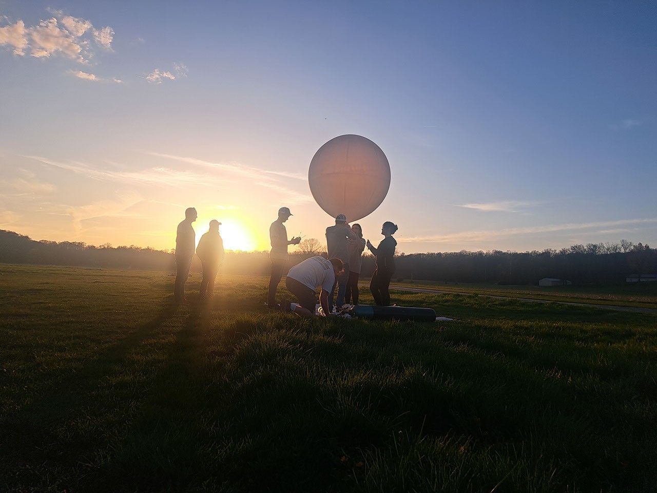
The gusty wind didn’t make it easy to hold tight to a balloon so large. The balloon, a scientific instrument called an ozonesonde, was about to be released into the atmosphere above the Texas Gulf Coast by students from NASA’s SARP (Student Airborne Research Program), which concluded its summer session July 27. The balloon’s job was to measure ozone concentrations as it rose through the atmosphere.
The SARP students in the atmosphere group prepare a weather balloon by filling it up with helium. The weather balloon will measure ozone in the atmosphere as it rises.
NASA/Sofie Bates
A dozen of the 48 undergraduate students participated in atmospheric field research. Guided by instrument scientists, university professors, and graduate students, the SARP students prepared the ozonesondes for takeoff. They chemically treated instrument cells attached to the sensor, wrangled the balloons during inflation, and finally, released them into the sky. As the balloons flew, the students monitored the data.
“This research program is a unique experience for students where they have the opportunity to see the different careers related to Earth system science,” said Yaitza Luna-Cruz, program manager for NASA’s Early Career Research Program at NASA Headquarters in Washington.
Each student was assigned to one of four disciplines: atmospheric science, oceans, terrestrial ecology, or hydrology. They gathered field data, designed individual research projects, and presented their findings at the end of the program. When possible, they cross-checked their measurements with NASA satellite missions.
SARP students and instrument scientists walk away from NASA’s Gulfstream G-V aircraft after their science flight.
NASA/Erica McNamee
“This is such an awesome experience,” said Marin Stevens, a chemistry student from the University of Colorado at Colorado Springs, minutes after she released the ozonesonde into the atmosphere. “It’s way beyond what I would have expected.”
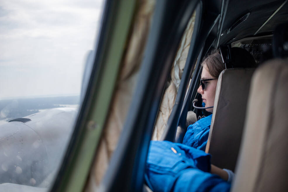
Airborne science was a highlight of the program. Five science aircraft supported the program this year, including NASA’s Gulfstream G-III, GV, and C-20A, Dynamic Aviation’s B200, and a P-III from the National Oceanic and Atmospheric Administration. Students worked alongside scientists operating various instruments, such as a laser designed to collect measurements on particulates in the atmosphere.
For many students, their time in Houston was their first foray into field research, and, like the students releasing the balloons, they were eager to continue to learn and experience hands-on science. After the first two weeks, the cohort split into two, with half of the students traveling to California and half to Virginia to continue their research.
SARP students celebrate finishing their first flight by making the NASA worm.
NASA/Sofie Bates
“The coolest part of SARP is the passion everyone has,” said Joelle Hopkins, SARP project manager, NASA Headquarters. “It’s so enjoyable to work with scientists, faculty, and graduate mentors who are passionate about the science, sharing the science with the students, and building the next generation of scientists.”
The annual eight-week program enhances what students are learning in the classroom by giving them hands-on field experience. It is designed to be a steppingstone into a career in field research or other STEM fields. Students participate in all aspects of a scientific campaign, including data collection, data analysis, and research. They attend science lectures and workshops, join research flights, and accompany scientists into the field.
To learn more about NASA’s Airborne Science Program, visit:
NASA Johnson Interns Shaping the Future of Exploration
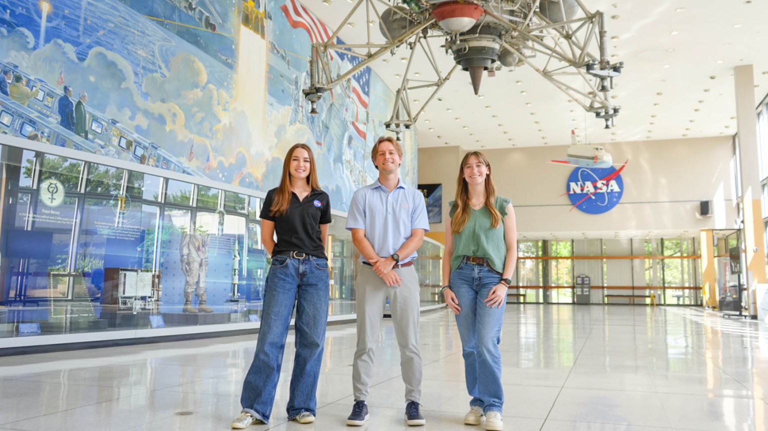
NASA’s Johnson Space Center interns pose for a group photo in the Teague Auditorium in Houston. From left are Macie Landon, John Graham Reynolds, and Morgan Gridley.
Credits: NASA/Sumer Loggins
NASA interns at Johnson Space Center are applying their talents to real-world projects while working alongside the engineers, scientists, communicators, and innovators advancing human spaceflight. Learn how these students are gaining hands-on experience, contributing to real missions, and preparing to join the nation’s highly skilled and competitive aerospace workforce.
Meet the students behind the work and discover what inspired them to pursue careers at NASA.
Macie Landon — Moon Base Program Strategic Communications
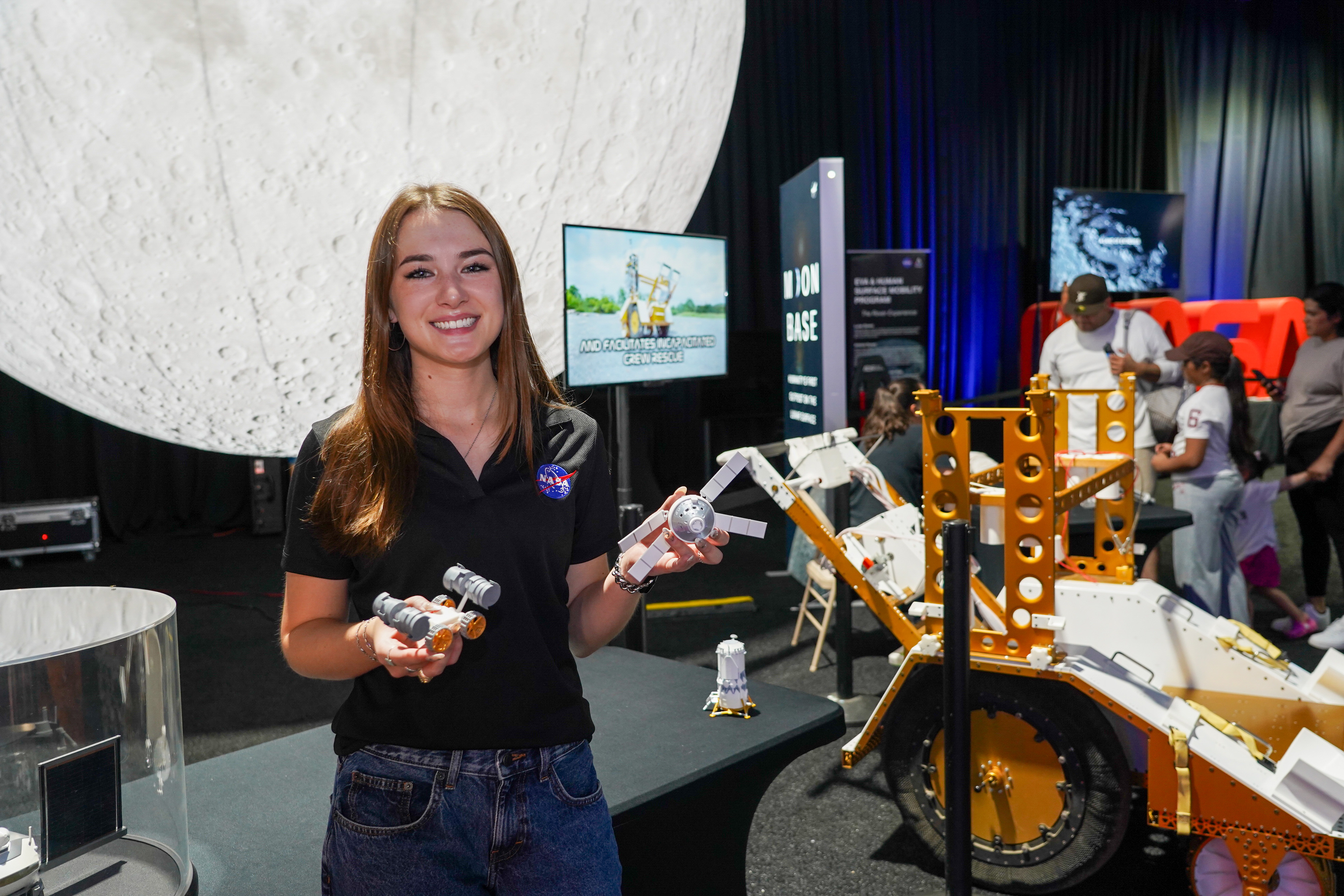
Macie Landon shares information about NASA’s Moon Base Program with visitors at the agency’s exhibit during FIFA Fan Festival in East Downtown Houston.
Being able to translate complex concepts into media that the public can understand and take inspiration from is hugely important.
Macie Landon
Moon Base Program Strategic Communications Intern
Macie Landon is helping tell the story of humanity’s first outpost on the lunar surface. Using graphic design, 3D modeling, video production, and other multimedia tools, she creates visual content that supports public outreach and internal communications for the Moon Base Program.
Landon’s path to NASA began with a lifelong interest in space, science fiction, art, and video games. While studying visualization at Texas A&M University, she planned to pursue a career in gaming or feature animation before discovering she could apply those same creative skills at NASA.
Her first internship was with the Graphics and Visualization Lab at NASA’s Glenn Research Center in Cleveland, where she created 3D models for virtual reality simulations.
“I had no idea I could pursue multimedia design at NASA,” Landon said. “I loved it and was so inspired by the creative force across all NASA centers.”
After building connections at Glenn, Landon applied for a summer internship at Johnson, where she continues using design to help communicate NASA’s human space exploration goals.
“Everyone at NASA is so smart, helpful, and willing to share their stories,” she said. “Almost every day I have at least one memorable and surprising moment.”
Landon has also gained an appreciation for the collaboration behind NASA’s missions.
“Through my two internships, I’ve learned how thousands of people from different backgrounds work together toward the same goal of benefiting humanity,” she said.
Working in strategic communications has changed the way Landon views STEM careers.
“Without someone sharing the stories of NASA’s work, much of it would go unseen,” she said. “The creatives at NASA are key to inspiring the next generation.”
In addition to creating multimedia products, Landon regularly engages with the public at outreach events, answering questions from audiences of all ages and backgrounds.
“I’ve learned a lot about how to have meaningful and impactful conversations with people,” she said.
Looking ahead, Landon hopes to continue using design and storytelling to help people better understand NASA’s missions while inspiring future explorers.
“I hope that through my work as a NASA intern, I continue to inspire the next generation of scientists, creatives, explorers, and more to be part of NASA’s mission in bettering humanity,” she said.
For students considering careers in STEM, Landon encourages them to follow what genuinely interests them.
“Explore what you truly love. You may discover there’s a place for your skills at NASA, too.”
John Graham Reynolds — AI and Machine Learning
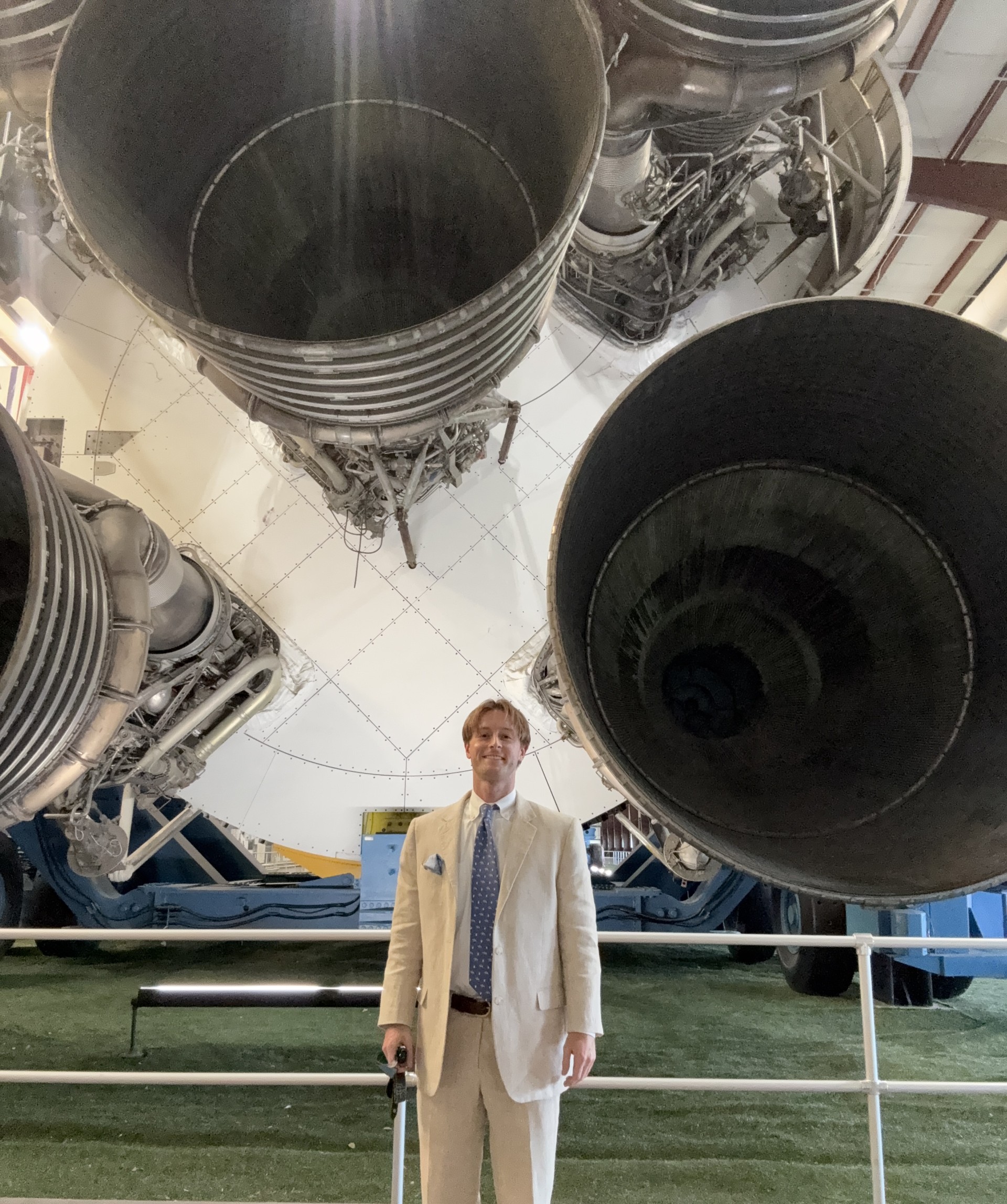
John Graham Reynolds stands in front of the Saturn V rocket at Rocket Park.
I am a small cog in the big NASA wheel, but I know my tiny steps enable a much larger leap for mankind.
John Graham Reynolds
AI and Machine Learning Research Engineer Intern
John Graham Reynolds develops generative artificial intelligence systems in NASA’s Advanced Operations Concepts Lab that help improve mission support and engineering operations for NASA’s Orion Program and other aspects of human spaceflight.
Before joining NASA, Reynolds worked for four years as a professional engineer. Looking for an opportunity to make a greater impact, he returned to graduate school and sought work that aligned with his passion for meaningful innovation.
“NASA is the greatest symbol of American ingenuity and a beacon for public progress,” Reynolds said. “Applying here was a no-brainer.”
As a graduate intern, Reynolds has contributed to technologies that support NASA’s human spaceflight missions.
One achievement he is especially proud of came during the Artemis II mission, when his team’s flagship AI system provided engineering support for the Orion spacecraft.
The system provided operators of the Orion Flight Software console in the Orion Mission Evaluation Room with an AI-powered interface to quickly access and summarize internal engineering documentation, allowing engineers to analyze faults, troubleshoot issues, and contribute to Orion operations during Artemis II.
“Helping support a mission that carried humans farther from Earth than ever before was an incredible experience,” he said.
Working alongside NASA engineers has also changed the way Reynolds thinks about a career in STEM.
“NASA is filled with smart people, but above all else, it is filled with people who are passionate about what they do,” he said. “That overwhelming sense of passion and purpose regularly reminds me of the value STEM careers provide.”
Reynolds says one of the biggest lessons he has learned is that innovation depends on collaboration.
“Always be open to the ideas of others, and they will be open to you,” he said. “No one can solve every problem. Teamwork, collaboration, and consideration are the greatest agents of improvement.”
Mentorship and networking have also played an important role in his internship experience.
“Connecting with full-time staff and other interns has opened many doors for me,” Reynolds said. “I know those connections will support me for the rest of my life, inside and outside of NASA.”
Looking ahead, Reynolds hopes to continue developing technologies that strengthen NASA’s missions and advance the future of space exploration.
For students considering a career at NASA, Reynolds encourages them to stay curious and follow what genuinely interests them.
“Find what you love, even if it isn’t STEM,” he said. “Explore anything and everything that interests you. Never stop.”
Morgan Gridley — Photography
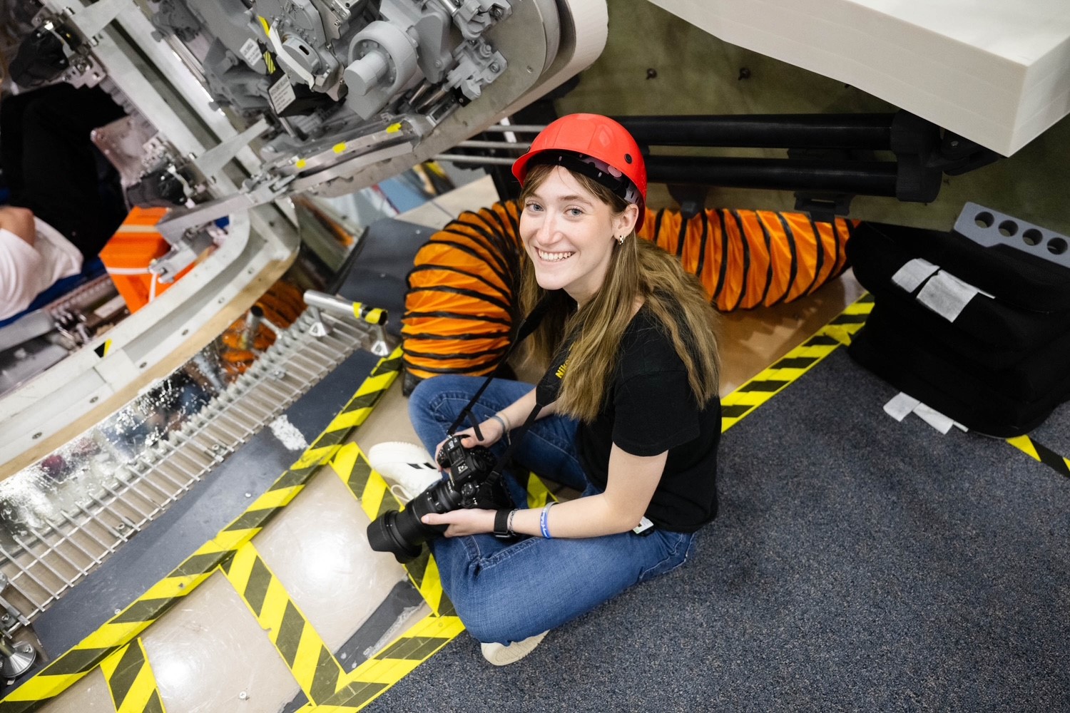
Morgan Gridley photographs activity inside NASA’s Orion spacecraft mockup at the Space Vehicle Mockup Facility at NASA’s Johnson Space Center in Houston.
NASA/Josh Valcarcel
Seeing my work used to communicate NASA’s missions and milestones has been incredibly rewarding. It’s shown me the real impact photography can have.
morgan gridley
Photography Intern
Morgan Gridley is helping document the next chapter of human spaceflight as a photography intern at Johnson. From astronaut portraits and crew training to major mission announcements, her photographs help tell the story of NASA’s missions. Now in her second summer internship, Gridley is building on the experience that first sparked her passion for documenting exploration.
“Working alongside so many talented photographers, engineers, scientists, astronauts, and creatives has shown me how many different ways people contribute to NASA’s mission,” Gridley said.
Gridley learned about the internship after NASA photographer Bill Stafford, an East Texas A&M University alumnus, shared the opportunity with faculty. Her professor passed it along to the class, and Gridley immediately applied.
“I’ve always loved space and exploration, so it seemed like an incredible experience,” she said.
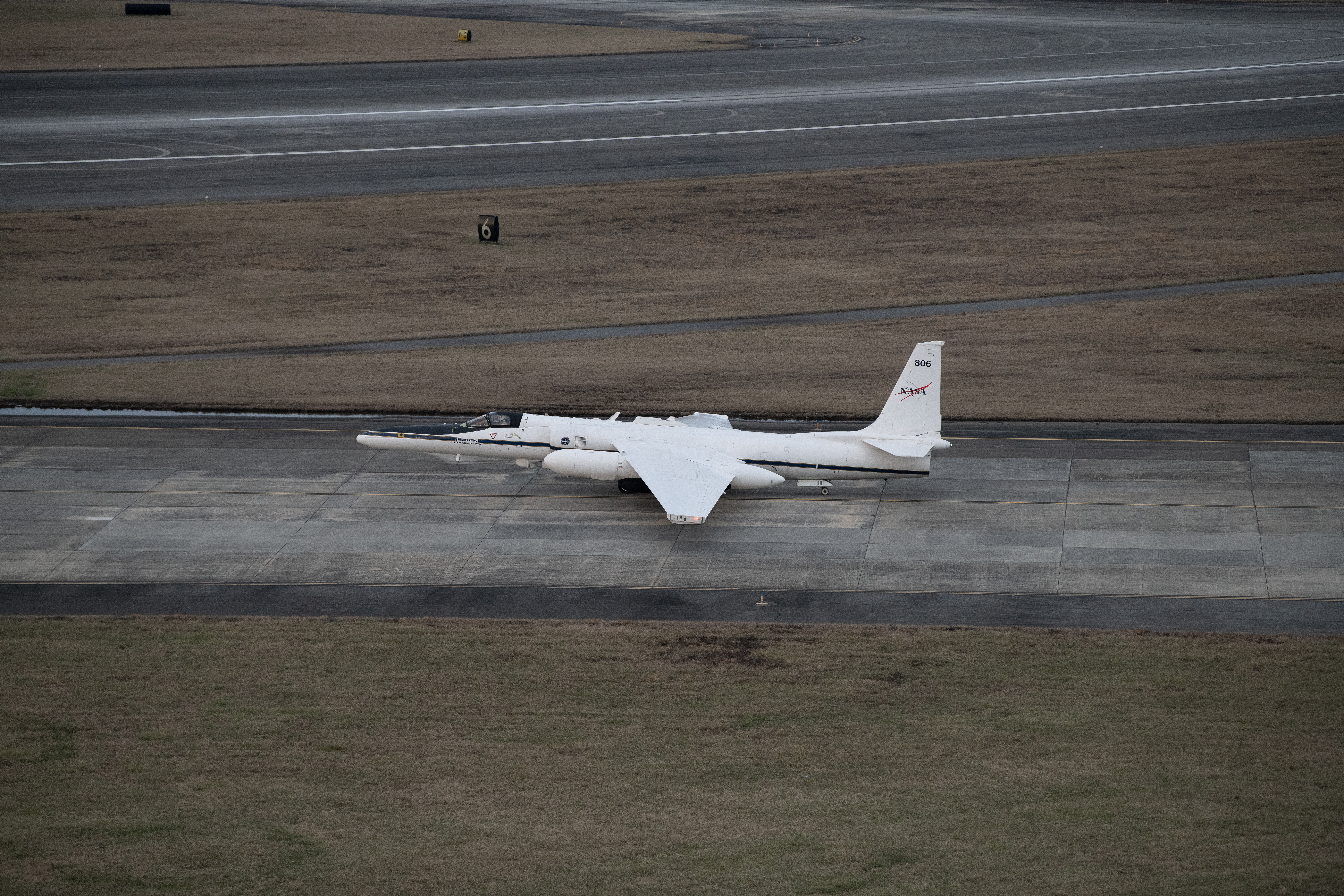
Gridley’s work included photographing one of NASA’s WB-57 aircraft during takeoff. Those images later supported news coverage highlighting the aircraft’s role in aerial imaging during the Texas floods.
She also served as one of the photographers covering the Artemis III crew announcement, with some of her images appearing in news coverage of the historic milestone.
Gridley credits her mentors with helping her grow throughout both internships.
“I consider every member of my team to be one of my mentors,” she said. “Even after my first internship ended, I stayed in touch by sharing my work and receiving feedback on my photos.”
Photographing astronauts in the studio has become one of Gridley’s favorite assignments.
“When I first started photography, I mostly focused on landscapes and didn’t enjoy taking portraits,” she said. “Now, portrait photography is my favorite part of what I do.”
Looking ahead, Gridley hopes to continue documenting NASA’s work as part of the photography team.
“Being able to capture moments that are part of NASA’s history has been an amazing experience, and I’d love the opportunity to continue telling those stories through photography,” she said.
For students considering careers in STEM and the creative arts, Gridley encourages them to stay curious and embrace new opportunities.
“Don’t be afraid to step outside your comfort zone,” she said. “Staying open to new experiences can lead you to opportunities and interests you never expected.”
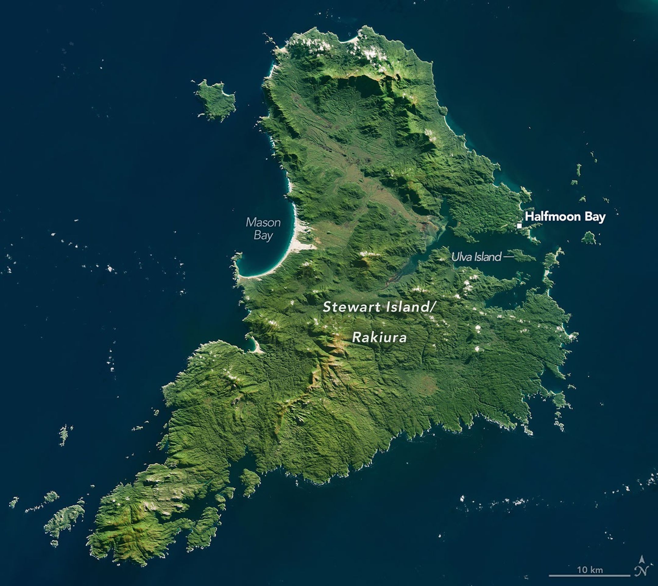
Stewart Island/Rakiura, New Zealand’s third largest and southernmost inhabited island, appears in a rare, mostly cloud-free image acquired with the OLI (Operational Land Imager) on Landsat 9 on May 14, 2026.
NASA Earth Observatory/Michala Garrison
Stewart Island/Rakiura is the third-largest island in New Zealand, diminutive in comparison to the country’s North Island and South Island. Yet it hosts a population of one of the largest of the kiwi: the Stewart Island tokoeka. This flightless bird, a subspecies of the Southern brown kiwi (Apteryx australis), numbers in the thousands on the island, dwarfing its human population of approximately 500.
The avian national icon is just one slice of the natural riches on Stewart Island/Rakiura, a roughly triangular piece of land about 30 kilometers (19 miles) south of the South Island. Rakiura National Park covers about 85 percent of the bright green island. And as the Māori name—Rakiura, meaning “glowing skies”—suggests, it’s a prime location for viewing the aurora australis.
On the northern half of the island, podocarp and hardwood forests featuring coniferous trees with ancient lineages blanket the land. Other areas are covered in shrublands and wetlands, as well as coastal dunes such as those lining Mason Bay. A diversity of birdlife, including the kiwi, populates these relatively untouched ecosystems. The tall trees of the podocarp forests produce various fruits attractive to avian inhabitants, such as bellbirds, with their pure-toned calls, and the rare kākāpō, the world’s heaviest and only flightless parrot species.
Waves wash onto the rocky shore of Stewart Island/Rakiura near Halfmoon Bay on July 3, 2010.
Lindsey Doermann
One notable haven for birds lies on Ulva Island, located within the inlet near Halfmoon Bay (Oban). Rats, which once preyed on bird eggs and chicks there, were deemed eradicated in 1997, and the island has mostly remained free of non-native predators. Conservationists have since embarked on a project on the much larger Stewart Island/Rakiura to eliminate rats, possums, feral cats, and hedgehogs.
When darkness falls, Stewart Island/Rakiura’s human denizens can look skyward for the chance to observe stars, auroras, nearby dwarf galaxies, and other features of the Southern Hemisphere night sky. In 2019, the remote and sparsely inhabited island was designated an International Dark Sky Sanctuary.
Amateur astronomers there and in other places with good night-sky views might search for objects of interest through Hubble’s Night Sky Challenge. In May, when this image was acquired, targets imaged by NASA’s Hubble Space Telescope that were also visible from Earth’s southern latitudes included a star cluster called the Jewel Box and a peculiar elliptical galaxy known as Centaurus A, which may have resulted from two galaxies colliding.
NASA Earth Observatory image by Michala Garrison, using Landsat data from the U.S. Geological Survey. Photo and story by Lindsey Doermann.