Students at Framingham State University (FSU) in Massachusetts will speak with astronauts living, working, and doing research aboard the International Space Station at 12:15 p.m. EST Friday, Jan. 19. The 20-minute, Earth-to-space call will air live on NASA Television and the agency’s website.
from NASA Breaking News http://ift.tt/2EPbRtM
via IFTTT

Wednesday, 17 January 2018

Friday, 12 January 2018
NASA, NOAA to Announce 2017 Global Temperatures, Climate Conditions
Climate experts from NASA and the National Oceanic and Atmospheric Administration (NOAA) will provide the annual release of data on global temperatures and discuss the most important climate trends of 2017 during a media teleconference at 11 a.m. EST Thursday, Jan. 18.
from NASA Breaking News http://ift.tt/2EBVXT7
via IFTTT
from NASA Breaking News http://ift.tt/2EBVXT7
via IFTTT
Idaho Students to Speak with NASA Astronaut on International Space Station
Students from 10 schools in Idaho will speak with a NASA astronaut living and working aboard the International Space Station at 11:25 a.m. EST Tuesday, Jan. 17.
from NASA Breaking News http://ift.tt/2D7kRy0
via IFTTT
from NASA Breaking News http://ift.tt/2D7kRy0
via IFTTT
Multi-planet System Found Through Crowdsourcing

A system of at least five exoplanets has been discovered by citizen scientists through a project called Exoplanet Explorers, part of the online platform Zooniverse, using data from NASA's Kepler space telescope. This is the first multi-planet system discovered entirely through crowdsourcing. A study describing the system has been accepted for publication in The Astronomical Journal.
Thousands of citizen scientists got to work on Kepler data in 2017 when Exoplanet Explorers launched. It was featured on a program called Stargazing Live on the Australia Broadcasting Corporation (ABC). On the final night of the three-day program, researchers announced the discovery of a four-planet system. Since then, they have named it K2-138 and determined that it has a fifth planet -- and perhaps even a sixth, according to the new paper.
Another batch of 2017 Kepler data was recently uploaded to Exoplanet Explorers for citizen scientists to peer through. Astronomers have not yet searched through most of it for planets.
NASA's Ames Research Center manages the Kepler and K2 missions for NASA's Science Mission Directorate. NASA's Jet Propulsion Laboratory in Pasadena, California, managed Kepler mission development. Ball Aerospace & Technologies Corporation operates the flight system with support from the Laboratory for Atmospheric and Space Physics at the University of Colorado in Boulder.
News Media Contact
Elizabeth Landau
Jet Propulsion Laboratory, Pasadena, California
818-354-6425
Elizabeth.R.Landau@jpl.nasa.gov
Alison Hawkes
Ames Research Center, California's Silicon Valley
650-604-0281
alison.j.hawkesbak@nasa.gov
2018-006
from News and Features http://ift.tt/2D4UWHf
via IFTTT
NASA's Aerospace Safety Advisory Panel Releases 2017 Annual Report
The Aerospace Safety Advisory Panel (ASAP), an advisory committee that reports to NASA and Congress, has issued its 2017 annual report examining NASA's safety performance over the past year and highlighting accomplishments, issues and concerns to agency and government officials.
from NASA Breaking News http://ift.tt/2D66ysm
via IFTTT
from NASA Breaking News http://ift.tt/2D66ysm
via IFTTT
GeoCarb: A New View of Carbon Over the Americas

A new NASA Earth science mission in the early stages of design may achieve a transformational advance in our understanding of the global carbon cycle by mapping concentrations of key carbon gases from a new vantage point: geostationary orbit. Satellites in geostationary orbit travel at the same speed as Earth's rotation, allowing them to remain over the same place on Earth's surface at all times.
The Geostationary Carbon Observatory (GeoCarb), targeted for launch in the early 2020s, will build on the success of NASA's Orbiting Carbon Observatory-2 (OCO-2) mission by placing a similar instrument on a commercial SES-Government Solutions communications satellite flying in geostationary orbit. Its longitude will allow "wall-to-wall" observations over the Americas between 55 degrees North and South latitude -- from the southern tip of Hudson Bay to the southern tip of South America. Perched 22,236 miles (35,800 kilometers) above the Americas, GeoCarb will collect 10 million daily observations of the concentrations of carbon dioxide, methane, carbon monoxide and solar-induced fluorescence (SIF) at a spatial resolution of about 3 to 6 miles (5 to 10 kilometers).
The abundance and distribution of carbon-bearing gases in the atmosphere are determined by both the exchange of carbon between Earth's land areas, oceans and the atmosphere, and their transport by prevailing winds. These exchanges are best understood by making frequent, densely spaced observations. While satellites in sun-synchronous, polar low-Earth orbits like OCO-2 provide global coverage, they have long revisit times, large gaps in coverage, and always look at the landscape at the same time of day. Because weather affects ecosystems on timescales of days to weeks, polar orbiting satellites may miss these changes and how they interconnect with the activities of living organisms -- information that is crucial to developing better models of Earth system processes.
"GeoCarb will complement measurements by OCO-2 and other low-Earth orbiting satellites by filling in data gaps in both time and space," said Principal Investigator Berrien Moore of the University of Oklahoma in Norman. "It will be more of a regional mapping mission than a global sampling mission."
Moore said that just as geostationary weather satellites can sit and stare at storms and map them, GeoCarb will let us see how different weather patterns influence carbon dioxide and methane concentrations. "That's the power a geostationary orbit brings," he said. "Data from OCO-2 have already shown that large-scale weather patterns such as El Niño and La Niña affect the large-scale pattern of atmospheric carbon dioxide concentrations, and that's extremely important."
GeoCarb will address a number of unanswered questions in carbon cycle science, with a focus on the Americas. For example, to what extent does the Amazonia basin remove carbon dioxide from the atmosphere and store it in forests, and are methane emission estimates over the continental United States underestimated?
GeoCarb will also be the first U.S. satellite to measure methane near Earth's surface, information that will be useful for the energy industry. Methane leakage from natural gas production costs U.S. industry $5 billion to $10 billion a year.
Like OCO-2, GeoCarb's oxygen spectral band, which is needed to convert abundances of carbon gases to concentrations, will also measure SIF. This faint glow, emitted by the chlorophyll molecules in the leaves of plants, is an indicator that photosynthesis -- the process by which plants convert sunlight into chemical energy and capture carbon from the atmosphere -- is occurring. GeoCarb will make daily, near wall-to-wall measurements of SIF under all weather conditions, allowing scientists and others to track the effects of drought on photosynthesis in forests, crops and grasslands.
GeoCarb stands on the foundation set by OCO-2, which was built by NASA's Jet Propulsion Laboratory in Pasadena, California. Like OCO-2, GeoCarb uses a grating spectrometer, but adds a fourth spectral band to measure carbon monoxide and methane. It will use the same detector technology, algorithms and calibration techniques as OCO-2.
"We would never be able to do GeoCarb without OCO-2," said Moore. "In designing our instrument we said, let's do OCO, but in geostationary orbit. We're building on JPL's work in designing and building OCO-2 and processing its data. In fact, many members of our science team are also working on the OCO-2 mission."
The GeoCarb instrument views reflected light from Earth through a narrow slit. When the slit is projected onto Earth's surface, it sees an area measuring about 1,740 miles (2,800 kilometers) from north to south and about 3.7 miles (6 kilometers) from east to west. In comparison, OCO-2's swath is about 6.2 miles (10 kilometers) wide. GeoCarb stares at that area for about 4-1/2 seconds, then the slit is moved half a slit width -- 1.9 miles, or 3 kilometers -- to the west, allowing for double sampling. With this technique, GeoCarb can scan the entire continental United States in about 2-1/4 hours, and from Brazil to South America's West Coast in about 2-3/4 hours. It is not designed to observe the oceans, as reflectivity over the oceans is too low to provide useful data.
GeoCarb's exact orbital slot will be assigned by SES-Government Solutions. A slot farther to the west will favor U.S. observations over South America, and vice versa for a slot farther to the east. In the future, Moore says two to three more GeoCarb-like instruments placed in geostationary orbit at different longitudes could provide near-global coverage of Earth's terrestrial landscape outside of the poles.
Moore says GeoCarb and TEMPO, another NASA atmospheric chemistry/air quality mission currently in development, are serving as pathfinders for geostationary, commercially-hosted NASA Earth-observing missions. "If we can work out the legal and practical day-to-day issues, I can see these missions changing the face of Earth science from space. You don't have to pay for a separate spacecraft or launcher. You're essentially buying condo space on a spacecraft and paying for data downlink. The future here is very exciting."
News Media Contact
Alan Buis
Jet Propulsion Laboratory, Pasadena, California
818-354-0474
Alan.Buis@jpl.nasa.gov
2018-008
from News and Features http://ift.tt/2D1vkdr
via IFTTT
Steep Slopes on Mars Reveal Structure of Buried Ice

Researchers using NASA's Mars Reconnaissance Orbiter (MRO) have found eight sites where thick deposits of ice beneath Mars' surface are exposed in faces of eroding slopes.
These eight scarps, with slopes as steep as 55 degrees, reveal new information about the internal layered structure of previously detected underground ice sheets in Mars' middle latitudes.
The ice was likely deposited as snow long ago. The deposits are exposed in cross section as relatively pure water ice, capped by a layer one to two yards (or meters) thick of ice-cemented rock and dust. They hold clues about Mars' climate history. They also may make frozen water more accessible than previously thought to future robotic or human exploration missions.
Researchers who located and studied the scarp sites with the High Resolution Imaging Science Experiment (HiRISE) camera on MRO reported the findings today in the journal Science. The sites are in both northern and southern hemispheres of Mars, at latitudes from about 55 to 58 degrees, equivalent on Earth to Scotland or the tip of South America.
"There is shallow ground ice under roughly a third of the Martian surface, which records the recent history of Mars," said the study's lead author, Colin Dundas of the U.S. Geological Survey's Astrogeology Science Center in Flagstaff, Arizona. "What we've seen here are cross-sections through the ice that give us a 3-D view with more detail than ever before."
Windows into underground ice
The scarps directly expose bright glimpses into vast underground ice previously detected with spectrometers on NASA's Mars Odyssey (MRO) orbiter, with ground-penetrating radar instruments on MRO and on the European Space Agency's Mars Express orbiter, and with observations of fresh impact craters that uncover subsurface ice. NASA sent the Phoenix lander to Mars in response to the Odyssey findings; in 2008, the Phoenix mission confirmed and analyzed the buried water ice at 68 degrees north latitude, about one-third of the way to the pole from the northernmost of the eight scarp sites.
The discovery reported today gives us surprising windows where we can see right into these thick underground sheets of ice," said Shane Byrne of the University of Arizona Lunar and Planetary Laboratory, Tucson, a co-author on today's report. "It's like having one of those ant farms where you can see through the glass on the side to learn about what's usually hidden beneath the ground."
Scientists have not determined how these particular scarps initially form. However, once the buried ice becomes exposed to Mars' atmosphere, a scarp likely grows wider and taller as it "retreats," due to sublimation of the ice directly from solid form into water vapor. At some of them, the exposed deposit of water ice is more than 100 yards, or meter, thick. Examination of some of the scarps with MRO's Compact Reconnaissance Imaging Spectrometer for Mars (CRISM) confirmed that the bright material is frozen water. A check of the surface temperature using Odyssey's Thermal Emission Imaging System (THEMIS) camera helped researchers determine they're not seeing just thin frost covering the ground.
Researchers previously used MRO's Shallow Radar (SHARAD) to map extensive underground water-ice sheets in middle latitudes of Mars and estimate that the top of the ice is less than about 10 yards beneath the ground surface. How much less? The radar method did not have sufficient resolution to say. The new ice-scarp studies confirm indications from fresh-crater and neutron-spectrometer observations that a layer rich in water ice begins within just one or two yards of the surface in some areas.
Astronauts' access to Martian water
The new study not only suggests that underground water ice lies under a thin covering over wide areas, it also identifies eight sites where ice is directly accessible, at latitudes with less hostile conditions than at Mars' polar ice caps. "Astronauts could essentially just go there with a bucket and a shovel and get all the water they need," Byrne said.
The exposed ice has scientific value apart from its potential resource value because it preserves evidence about long-term patterns in Mars' climate. The tilt of Mars' axis of rotation varies much more than Earth's, over rhythms of millions of years. Today the two planets' tilts are about the same. When Mars tilts more, climate conditions may favor buildup of middle-latitude ice. Dundas and co-authors say that banding and color variations apparent in some of the scarps suggest layers "possibly deposited with changes in the proportion of ice and dust under varying climate conditions."
This research benefited from coordinated use of multiple instruments on Mars orbiters, plus the longevities at Mars now exceeding 11 years for MRO and 16 years for Odyssey. Orbital observations will continue, but future missions to the surface could seek additional information.
"If you had a mission at one of these sites, sampling the layers going down the scarp, you could get a detailed climate history of Mars," suggested MRO Deputy Project Scientist Leslie Tamppari of NASA's Jet Propulsion Laboratory, Pasadena, California. "It's part of the whole story of what happens to water on Mars over time: Where does it go? When does ice accumulate? When does it recede?"
The University of Arizona operates HiRISE, which was built by Ball Aerospace & Technologies Corp., Boulder, Colorado. The Johns Hopkins University Applied Physics Laboratory, Laurel, Maryland, leads MRO's CRISM investigation. The Italian Space Agency provided MRO's SHARAD instrument, Sapienza University of Rome leads SHARAD operations, and the Planetary Science Institute, based in Tucson, Arizona, leads U.S. involvement in SHARAD. Arizona State University, Tempe, leads the Odyssey mission's THEMIS investigation. JPL, a division of Caltech in Pasadena, California, manages the MRO and Odyssey projects for the NASA Science Mission Directorate in Washington. Lockheed Martin Space, Denver, built both orbiters and supports their operation.
News Media Contact
Guy Webster
Jet Propulsion Laboratory, Pasadena, Calif.
818-354-6278
guy.webster@jpl.nasa.gov
Jennifer LaVista
U.S. Geological Survey, Denver
303-202-4764
jlavista@usgs.gov
Laurie Cantillo / Dwayne Brown
NASA Headquarters, Washington
202-358-1077 / 202-358-1726
laura.l.cantillo@nasa.gov / dwayne.c.brown@nasa.gov
2018-007
from News and Features http://ift.tt/2ATd8xy
via IFTTT
Thursday, 11 January 2018
NASA Awards Engineering, Research Support Contract
NASA has selected HX5, LLC of Fort Walton Beach, Florida, to perform engineering, research and scientific support at NASA’s Glenn Research Center in Cleveland.
from NASA Breaking News http://ift.tt/2ExC8ML
via IFTTT
from NASA Breaking News http://ift.tt/2ExC8ML
via IFTTT
NASA's Great Observatories Team Up to Find Magnified and Stretched Image of Distant Galaxy

An intensive survey deep into the universe by NASA's Hubble and Spitzer space telescopes has yielded the proverbial needle-in-a-haystack: the farthest galaxy yet seen in an image that has been stretched and amplified by a phenomenon called gravitational lensing.
The embryonic galaxy named SPT0615-JD existed when the universe was just 500 million years old. Though a few other primitive galaxies have been seen at this early epoch, they have essentially all looked like red dots, given their small size and tremendous distances. However, in this case, the gravitational field of a massive foreground galaxy cluster not only amplified the light from the background galaxy but also smeared the image of it into an arc (about 2 arcseconds long).
"No other candidate galaxy has been found at such a great distance that also gives you the spatial information that this arc image does. By analyzing the effects of gravitational lensing on the image of this galaxy, we can determine its actual size and shape," said the study's lead author, Brett Salmon of the Space Telescope Science Institute in Baltimore. He is presenting his research at the 231st meeting of the American Astronomical Society in Washington.
First predicted by Albert Einstein a century ago, the warping of space by the gravity of a massive foreground object can brighten and distort the images of far more distant background objects. Astronomers use this "zoom lens" effect to go hunting for amplified images of distant galaxies that otherwise would not be visible with today's telescopes.
SPT0615-JD was identified in Hubble's Reionization Lensing Cluster Survey (RELICS) and companion S-RELICS Spitzer program. "RELICS was designed to discover distant galaxies like these that are magnified brightly enough for detailed study," said Dan Coe, principal investigator of RELICS. RELICS observed 41 massive galaxy clusters for the first time in infrared with Hubble to search for such distant lensed galaxies. One of these clusters was SPT-CL J0615-5746, which Salmon analyzed to make this discovery. Upon finding the lens-arc, Salmon thought, "Oh, wow! I think we're on to something!"
By combining the Hubble and Spitzer data, Salmon calculated the lookback time to the galaxy of 13.3 billion years. Preliminary analysis suggests the diminutive galaxy weighs in at no more than 3 billion solar masses (roughly 1/100th the mass of our fully grown Milky Way galaxy). It is less than 2,500 light-years across, half the size of the Small Magellanic Cloud, a satellite galaxy of our Milky Way. The object is considered prototypical of young galaxies that emerged during the epoch shortly after the big bang.
The galaxy is right at the limits of Hubble's detection capabilities, but just the beginning for the upcoming NASA James Webb Space Telescope's powerful capabilities, said Salmon. "This galaxy is an exciting target for science with the Webb telescope as it offers the unique opportunity for resolving stellar populations in the very early universe." Spectroscopy with Webb will allow for astronomers to study in detail the firestorm of starbirth activity taking place at this early epoch, and resolve its substructure.
NASA's Jet Propulsion Laboratory, Pasadena, California, manages the Spitzer Space Telescope mission for NASA's Science Mission Directorate, Washington, D.C. Science operations are conducted at the Spitzer Science Center at Caltech in Pasadena. Spacecraft operations are based at Lockheed Martin Space, Littleton, Colorado. Data are archived at the Infrared Science Archive housed at IPAC at Caltech. Caltech manages JPL for NASA.
The Hubble Space Telescope is a project of international cooperation between NASA and ESA (European Space Agency). NASA's Goddard Space Flight Center in Greenbelt, Maryland, manages the telescope. The Space Telescope Science Institute (STScI) in Baltimore conducts Hubble science operations. STScI is operated for NASA by the Association of Universities for Research in Astronomy, Inc., in Washington.
News Media Contact
Guy Webster
Jet Propulsion Laboratory, Pasadena, Calif.
818-354-6278
guy.webster@jpl.nasa.gov
Ray Villard
Space Telescope Science Institute, Baltimore, Maryland
410-338-4514
villard@stsci.edu
Laurie Cantillo / Dwayne Brown
NASA Headquarters, Washington
202-358-1077 / 202-358-1726
laura.l.cantillo@nasa.gov / dwayne.c.brown@nasa.gov
2018-005
from News and Features http://ift.tt/2ExUUnc
via IFTTT
NASA Space Telescopes Provide a 3-D Journey Through the Orion Nebula

Astronomers and visualization specialists from NASA's Universe of Learning program have combined visible and infrared vision of the Hubble and Spitzer space telescopes to create an unprecedented, three-dimensional, fly-through view of the picturesque Orion Nebula, a nearby star-forming region.
This visualization explores the Orion Nebula using both visible and infrared light. The sequence begins with a wide-field view of the sky showing the plane of our Milky Way Galaxy, then zooms down to the scale of the Orion Nebula. The visible light observation (from the Hubble Space Telescope) and the infrared light observation (from the Spitzer Space Telescope) are compared first in two-dimensional images, and then in three-dimensional models.
Viewers experience this nearby stellar nursery "up close and personal" as the new digital visualization ferries them among newborn stars, glowing clouds heated by intense radiation, and tadpole-shaped gaseous envelopes surrounding protoplanetary disks.
Using actual scientific imagery and other data, combined with Hollywood techniques, a team at the Space Telescope Science Institute in Baltimore, and the Caltech/Infrared Processing and Analysis Center (IPAC) in Pasadena, California, has created the best and most detailed multi-wavelength visualization yet of this photogenic nebula. The fly-through enables people to experience and learn about the universe in an exciting new way.
The three-minute movie, which shows the Orion Nebula in both visible and infrared light, was released to the public today. It is available to planetariums and other centers of informal learning worldwide to help audiences explore fundamental questions in science such as, "How did we get here?"
"Being able to fly through the nebula's tapestry in three dimensions gives people a much better sense of what the universe is really like," explained the Space Telescope Science Institute's visualization scientist Frank Summers, who led the team that developed the movie. "By adding depth and structure to the amazing images, this fly-through helps elucidate the universe for the public, both educating and inspiring."
"Looking at the universe in infrared light gives striking context for the more familiar visible-light views. This movie provides a uniquely immersive chance to see how new features appear as we shift to wavelengths of light normally invisible to our eyes," said Robert Hurt, lead visualization scientist at IPAC.
One of the sky's brightest nebulas, the Orion Nebula, is visible to the naked eye. It appears as the middle "star" in the sword of the constellation Orion, the Hunter, and is located about 1,350 light-years away. At only 2 million years old, the nebula is an ideal laboratory for studying young stars and stars that are still forming. It offers a glimpse of what might have happened when the Sun was born 4.6 billion years ago.
The three-dimensional video provides a look at the fantastic topography of the nebula. A torrent of ultraviolet radiation and stellar winds from the massive, central stars of the Trapezium star cluster has carved out a cavernous bowl-like cavity in the wall of a giant cloud of cold molecular hydrogen laced with dust.
Astronomers and visualizers worked together to make a three-dimensional model of the depths of this cavernous region, like plotting mountains and valleys on the ocean floor. Colorful Hubble and Spitzer images were then overlaid on the terrain.
The scientific visualization takes the viewer on a breathtaking flight through the nebula, following the contours of the gas and dust. By toggling between the Hubble and Spitzer views, the movie shows strikingly different details of the Orion Nebula.
Hubble sees objects that glow in visible light, which are typically in the thousands of degrees. Spitzer is sensitive to cooler objects with temperatures of just hundreds of degrees. Spitzer's infrared vision pierces through obscuring dust to see stars embedded deep into the nebula, as well as fainter and less massive stars, which are brighter in infrared than in visible light. The new visualization helps people experience how the two telescopes provide a more complex and complete picture of the nebula.
The visualization is one of a new generation of products and experiences being developed by NASA's Universe of Learning program. The effort combines a direct connection to the science and scientists of NASA's astrophysics missions with attention to audience needs to enable youth, families and lifelong learners to explore fundamental questions in science, experience how science is done, and discover the universe for themselves.
The three-dimensional interpretation is guided by scientific knowledge and scientific intuition. Starting with the two-dimensional Hubble and Spitzer images, Summers and Hurt worked with experts to analyze the structure inside the nebula. They first created a visible-light surface, and then an underlying structure of the infrared features.
To give the nebula its ethereal feel, Summers wrote a special rendering code for efficiently combining the tens of millions of semi-transparent elements of the gas. The customized code allows Summers to run this and other visualizations on desktop workstations, rather than on a supercomputing cluster.
The other components of the nebula were isolated into image layers and modeled separately. These elements included stars, protoplanetary disks, bow shocks, and the thin gas in front of the nebula called "the veil." After rendering, these layers and the gaseous nebula are brought back together to create the visualization.
The three-dimensional structures serve as scientifically reasonable approximations for imagining the nebula. "The main thing is to give the viewer an experiential understanding, so that they have a way to interpret the images from telescopes," explained Summers. "It's a really wonderful thing when they can build a mental model in their head to transform the two-dimensional image into a three-dimensional scene."
This movie demonstrates the power of multi-wavelength astronomy. It helps audiences understand how science is done -- how and why astronomers use multiple regions of the electromagnetic spectrum to explore and learn about our universe. It is also whetting astronomers' appetites for what they will see with NASA's James Webb Space Telescope, which will show much finer details of the deeper, infrared features.
More visualizations and connections between the science of nebulas and learners can be explored through other products produced by NASA's Universe of Learning, such as ViewSpace. ViewSpace is a video exhibit currently at almost 200 museums and planetariums across the United States. Visitors can go beyond video to explore the images produced by space telescopes with interactive tools now available for museums and planetariums.
NASA's Universe of Learning materials are based upon work supported by NASA under award number NNX16AC65A to the Space Telescope Science Institute, working in partnership with Caltech/IPAC, Jet Propulsion Laboratory, Smithsonian Astrophysical Observatory, and Sonoma State University.
News Media Contact
Elizabeth Landau
Jet Propulsion Laboratory, Pasadena, California
818-354-6425
Elizabeth.R.Landau@jpl.nasa.gov
Ann Jenkins / Ray Villard
Space Telescope Science Institute, Baltimore, Maryland
410-338-4488 / 410-338-4514
jenkins@stsci.edu / villard@stsci.edu
Written by Ann Jenkins
2018-004
from News and Features http://ift.tt/2D1qhuf
via IFTTT
Wednesday, 10 January 2018
NASA, Partners Discuss Power for Future Space Exploration
NASA and its partners will host a news conference at noon EST (9 a.m. PST) Thursday, Jan. 18, at the National Atomic Testing Museum in Las Vegas, to discuss a recent experiment involving a new power source that could provide the safe, efficient and plentiful energy needed for future robotic and human space exploration missions.
from NASA Breaking News http://ift.tt/2FmZyWr
via IFTTT
from NASA Breaking News http://ift.tt/2FmZyWr
via IFTTT
Subscribe to:
Posts (Atom)
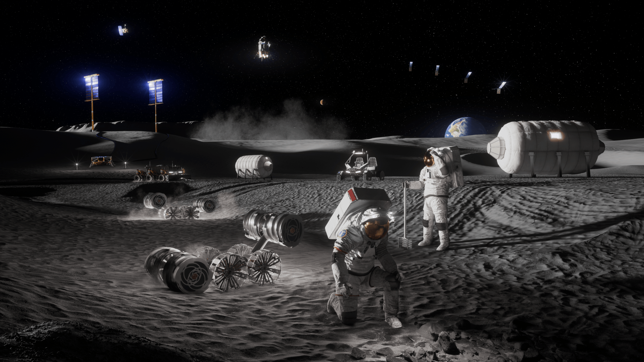
NASA Announces $1 Million to Students for Moon Base Challenge
Artist’s concept depicting astronauts, habitats, rovers, power systems, and cargo operations supporting sustained human activities at the Mo...
-
NASA has exercised the second option of its Information Technology and Multimedia Services (ITAMS) contract with DB Consulting Group, Inc., ...
-
Science Earth Observatory A Subtle Return of La Niña Earth Earth Observatory Image of the Day EO Explorer All Topics ...
