NASA astronauts A.J. (Drew) Feustel and Ricky Arnold, and crewmate Oleg Artemyev of the Russian space agency Roscosmos, will discuss their upcoming mission to the International Space Station in a news conference at 2 p.m. EST Thursday, Dec. 7, at NASA’s Johnson Space Center in Houston.
from NASA Breaking News http://ift.tt/2j52Rbd
via IFTTT

Friday, 1 December 2017

Thursday, 30 November 2017
Exoplanet Has Smothering Stratosphere Without Water

A NASA-led team has found evidence that the oversized exoplanet WASP-18b is wrapped in a smothering stratosphere loaded with carbon monoxide and devoid of water. The findings come from a new analysis of observations made by the Hubble and Spitzer space telescopes.
The formation of a stratosphere layer in a planet's atmosphere is attributed to "sunscreen"-like molecules, which absorb ultraviolet (UV) and visible radiation coming from the star and then release that energy as heat. The new study suggests that the "hot Jupiter" WASP-18b, a massive planet that orbits very close to its host star, has an unusual composition, and the formation of this world might have been quite different from that of Jupiter and gas giants in other planetary systems.
"The composition of WASP-18b defies all expectations," said Kyle Sheppard of NASA's Goddard Space Flight Center in Greenbelt, Maryland, lead author of the paper published in the Astrophysical Journal Letters. "We don't know of any other extrasolar planet where carbon monoxide so completely dominates the upper atmosphere."
Quick Facts:
Planet: WASP-18b
Mass: 10 times the mass of Jupiter
Distance from Earth: 325 light-years
Orbital period: 23 hours
On Earth, ozone absorbs UV in the stratosphere, protecting our world from a lot of the Sun's harmful radiation. For the handful of exoplanets with stratospheres, the absorber is typically thought to be a molecule such as titanium oxide, a close relative of titanium dioxide, used on Earth as a paint pigment and sunscreen ingredient.
The researchers looked at data collected for WASP-18b, located 325 light-years from Earth, as part of a survey to find exoplanets with stratospheres. The heavyweight planet, which has the mass of 10 Jupiters, has been observed repeatedly, allowing astronomers to accumulate a relatively large trove of data. This study analyzed five eclipses from archived Hubble data and two from Spitzer.
From the light emitted by the planet's atmosphere at infrared wavelengths, beyond the visible region, it's possible to identify the spectral fingerprints of water and some other important molecules. The analysis revealed WASP-18b's peculiar fingerprint, which doesn't resemble any exoplanet examined so far. To determine which molecules were most likely to match it, the team carried out extensive computer modeling.
"The only consistent explanation for the data is an overabundance of carbon monoxide and very little water vapor in the atmosphere of WASP-18b, in addition to the presence of a stratosphere," said Nikku Madhusudhan a co-author of the study from the University of Cambridge, United Kingdom. "This rare combination of factors opens a new window into our understanding of physical and chemical processes in exoplanetary atmospheres."
The findings indicate that WASP-18b has hot carbon monoxide in the stratosphere and cooler carbon monoxide in the layer of the atmosphere below, called the troposphere. The team determined this by detecting two types of carbon monoxide signatures, an absorption signature at a wavelength of about 1.6 micrometers and an emission signature at about 4.5 micrometers. This is the first time researchers have detected both types of fingerprints for a single type of molecule in an exoplanet's atmosphere.
In theory, another possible fit for the observations is carbon dioxide, which has a similar fingerprint. The researchers ruled this out because if there were enough oxygen available to form carbon dioxide, the atmosphere also should have some water vapor.
To produce the spectral fingerprints seen by the team, the upper atmosphere of WASP-18b would have to be loaded with carbon monoxide. Compared to other hot Jupiters, this planet's atmosphere likely would contain 300 times more "metals," or elements heavier than hydrogen and helium. This extremely high metallicity would indicate WASP-18b might have accumulated greater amounts of solid ices during its formation than Jupiter, suggesting it may not have formed the way other hot Jupiters did.
"The expected launch of the James Webb Space Telescope and other future space-based observatories will give us the opportunity to follow up with even more powerful instruments and to continue exploring the amazing array of exoplanets out there," said Avi Mandell, an exoplanet scientist at Goddard and the second author of the paper.
For more information about NASA's Hubble Space Telescope, visit:
For more information about NASA's Spitzer Space Telescope, visit:
News Media Contact
Elizabeth Landau
Jet Propulsion Laboratory, Pasadena, California
818-354-6425
elizabeth.landau@jpl.nasa.gov
Written by Elizabeth Zubritsky, NASA's Goddard Space Flight Center
2017-307
from News and Features http://ift.tt/2ilMZnV
via IFTTT
Wednesday, 29 November 2017
NASA Finds VA Metro Area Is Sinking Unevenly

A new NASA-led study shows that land in the Hampton Roads, Virginia, metropolitan area is sinking at highly uneven rates, with a few trouble spots subsiding 7 to 10 times faster than the area average. Whereas earlier estimates had suggested the area is subsiding evenly, the new study found that major differences in subsidence rates occur only a few miles apart.
Hampton Roads has one of the highest rates of relative sea level rise -- the combined effects of sinking land and rising seas -- along the U.S. East Coast, about an inch (23 millimeters) every five years. It has experienced a steady and dramatic increase in high-tide flooding over the last 90 years. Accurate, local subsidence maps are necessary for the area to prepare for increasing flood risks in the future. The region comprises seven Virginia cities, including Norfolk and Virginia Beach, as well as Naval Station Norfolk, the country's largest naval base.
The new study, published in the journal Scientific Reports, found that much-higher-than-average subsidence is occurring at Craney Island, a depository for material dredged from shipping channels, and at the Norfolk Naval Shipyard, where the subsidence was most likely related to local construction during the study period. In other areas with similarly high subsidence rates, the causes of the sinking are not known.
Researchers from NASA's Jet Propulsion Laboratory in Pasadena, California, and Old Dominion University (ODU) in Norfolk found the variations in subsidence by analyzing synthetic aperture radar (SAR) images acquired between 2007 and 2011 by the Japan Aerospace Exploration Agency's ALOS-1 satellite. Processing the data with state-of-the-art image processing techniques, the researchers were able to document how the land surface had changed from the time of the first ALOS-1 image to 2011. To tie in that relative data set with existing, lower-resolution maps of earlier subsidence, as well as to put the results into a framework already familiar to decision-makers, the researchers developed a new strategy to integrate the processed SAR measurements with Global Positioning System (GPS) observations.
The result was the first high-resolution estimates of vertical land motion in Hampton Roads. The new estimates have a spatial resolution of about 100 feet (30 meters), whereas earlier estimates were based on data from GPS stations located 10 to 15 miles apart (about 20 kilometers).
The production of the new maps was a pilot project between JPL and ODU to assess the feasibility of using space-borne SAR data to map subsidence in Hampton Roads, according to lead author David Bekaert of JPL. He noted that the techniques developed to make these maps integrating SAR and GPS measurements could be used to map subsidence at other locations.
The ALOS-1 data set used in this study is relatively small, with the satellite acquiring an image of the area only once every 46 days at best. Bekaert and coauthors look forward to using data from the future NASA-Indian Space Research Organizaton Synthetic Aperture Radar (NISAR) mission, scheduled to launch in 2021, and from the European Space Agency's Sentinel-1 constellation, which currently acquires a new image of the Hampton Roads area every 12 days. NISAR will also acquire an image every 12 days, but because of its longer operating wavelength and higher resolution, it is well placed to extend subsidence mapping into more challenging rural areas and wetlands.
"Continuing, regularly acquired SAR data will allow us to reduce the uncertainty in our subsidence rate estimates, which is important for decision-making," Bekaert said.
Coauthor Ben Hamlington (ODU) noted, "Information regarding subsidence should be incorporated into land use decisions and taken into consideration for future planning." He has presented preliminary findings from this study to several planning and emergency management committees in Hampton Roads.
Hamlington said, "We had a need for high-resolution images of subsidence, but we didn't have the expertise and technology to do the analysis ourselves here at ODU. Collaborating with JPL helped us build capacity for the future, and also get immediate results."
NASA's associate program manager for disasters, John Murray of NASA's Langley Research Center in Hampton, connected the ODU and JPL scientists. The study was funded by NASA's Earth Science Disasters Program and the Commonwealth Center for Recurrent Flooding Resiliency, jointly operated by ODU and the College of William & Mary, Norfolk.
The paper in Scientific Reports is titled "Spaceborne Synthetic Aperture Radar Survey of Subsidence in Hampton Roads, Virginia (USA)."
News Media Contact
Alan Buis
Jet Propulsion Laboratory, Pasadena, California
818-354-0474
Alan.Buis@jpl.nasa.gov
Jon Cawley
Old Dominion University, Norfolk, Virginia
757-683-6479
jcawley@odu.edu
Written by Carol Rasmussen
NASA's Earth Science News Team
2017-306
from News and Features http://ift.tt/2hZilww
via IFTTT
NASA Builds its Next Mars Rover Mission

In just a few years, NASA's next Mars rover mission will be flying to the Red Planet.
At a glance, it looks a lot like its predecessor, the Curiosity Mars rover. But there's no doubt it's a souped-up science machine: It has seven new instruments, redesigned wheels and more autonomy. A drill will capture rock cores, while a caching system with a miniature robotic arm will seal up these samples. Then, they'll be deposited on the Martian surface for possible pickup by a future mission.
This new hardware is being developed at NASA's Jet Propulsion Laboratory, Pasadena, California, which manages the mission for the agency. It includes the Mars 2020 mission's cruise stage, which will fly the rover through space, and the descent stage, a rocket-powered "sky crane" that will lower it to the planet's surface. Both of these stages have recently moved into JPL's Spacecraft Assembly Facility.
Mars 2020 relies heavily on the system designs and spare hardware previously created for Mars Science Laboratory's Curiosity rover, which landed in 2012. Roughly 85 percent of the new rover's mass is based on this "heritage hardware."
"The fact that so much of the hardware has already been designed -- or even already exists -- is a major advantage for this mission," said Jim Watzin, director of NASA's Mars Exploration Program. "It saves us money, time and most of all, reduces risk."
Despite its similarities to Mars Science Laboratory, the new mission has very different goals. Mars 2020's instruments will seek signs of ancient life by studying terrain that is now inhospitable, but once held flowing rivers and lakes, more than 3.5 billion years ago.
To achieve these new goals, the rover has a suite of cutting-edge science instruments. It will seek out biosignatures on a microbial scale: An X-ray spectrometer will target spots as small as a grain of table salt, while an ultraviolet laser will detect the "glow" from excited rings of carbon atoms. A ground-penetrating radar will be the first instrument to look under the surface of Mars, mapping layers of rock, water and ice up to 30 feet (10 meters) deep, depending on the material.
The rover is getting some upgraded Curiosity hardware, including color cameras, a zoom lens and a laser that can vaporize rocks and soil to analyze their chemistry.
"Our next instruments will build on the success of MSL, which was a proving ground for new technology," said George Tahu, NASA's Mars 2020 program executive. "These will gather science data in ways that weren't possible before."
The mission will also undertake a marathon sample hunt: The rover team will try to drill at least 20 rock cores, and possibly as many as 30 or 40, for possible future return to Earth.
"Whether life ever existed beyond Earth is one of the grand questions humans seek to answer," said Ken Farley of JPL, Mars 2020's project scientist. "What we learn from the samples collected during this mission has the potential to address whether we're alone in the universe."
JPL is also developing a crucial new landing technology called terrain-relative navigation. As the descent stage approaches the Martian surface, it will use computer vision to compare the landscape with pre-loaded terrain maps. This technology will guide the descent stage to safe landing sites, correcting its course along the way.
A related technology called the ranger trigger will use location and velocity to determine when to fire the spacecraft's parachute. That change will narrow the landing ellipse by more than 50 percent.
"Terrain-relative navigation enables us to go to sites that were ruled too risky for Curiosity to explore," said Al Chen of JPL, the Mars 202 entry, descent and landing lead. "The range trigger lets us land closer to areas of scientific interest, shaving miles -- potentially as much as a year -- off a rover's journey."
This approach to minimizing landing errors will be critical in guiding any future mission dedicated to retrieving the Mars 2020 samples, Chen said.
Site selection has been another milestone for the mission. In February, the science community narrowed the list of potential landing sites from eight to three. Those three remaining sites represent fundamentally different environments that could have harbored primitive life: an ancient lakebed called Jezero Crater; Northeast Syrtis, where warm waters may have chemically interacted with subsurface rocks; and a possible hot springs at Columbia Hills.
All three sites have rich geology and may potentially harbor signs of past microbial life. A final landing site decision is still more than a year away.
"In the coming years, the 2020 science team will be weighing the advantages and disadvantages of each of these sites," Farley said. "It is by far the most important decision we have ahead of us."
News Media Contact
Andrew Good
Jet Propulsion Laboratory, Pasadena, Calif.
818-393-2433
andrew.c.good@jpl.nasa.gov
2017-305
from News and Features http://ift.tt/2hYAVEZ
via IFTTT
Wednesday, 22 November 2017
New York Students to Speak with NASA Astronauts on Space Station
Students at U.S. Military Academy in West Point, New York, will speak with NASA astronauts living, working and doing research aboard the International Space Station at 9:15 a.m. EST Monday, Nov. 27.
from NASA Breaking News http://ift.tt/2jeIgAE
via IFTTT
from NASA Breaking News http://ift.tt/2jeIgAE
via IFTTT
NASA to Highlight Science on Next Resupply Mission to Space Station
NASA will host a media teleconference at 1 p.m. EST Wednesday, Nov. 29, to discuss a number of science investigations and instruments launching to the International Space Station on the next SpaceX commercial resupply mission.
from NASA Breaking News http://ift.tt/2hLSlVb
via IFTTT
from NASA Breaking News http://ift.tt/2hLSlVb
via IFTTT
Drone Race: Human Versus Artificial Intelligence

Drone racing is a high-speed sport demanding instinctive reflexes -- but humans won't be the only competitors for long.
Researchers at NASA's Jet Propulsion Laboratory in Pasadena, California, put their work to the test recently. Timing laps through a twisting obstacle course, they raced drones controlled by artificial intelligence (A.I.) against a professional human pilot.
The race, held on Oct. 12, capped off two years of research into drone autonomy funded by Google. The company was interested in JPL's work with vision-based navigation for spacecraft -- technologies that can also be applied to drones. To demonstrate the team's progress, JPL set up a timed trial between their A.I. and world-class drone pilot Ken Loo.
The team built three custom drones (dubbed Batman, Joker and Nightwing) and developed the complex algorithms the drones needed to fly at high speeds while avoiding obstacles. These algorithms were integrated with Google's Tango technology, which JPL also worked on.
The drones were built to racing specifications and could easily go as fast as 80 mph (129 kph) in a straight line. But on the obstacle course set up in a JPL warehouse, they could only fly at 30 or 40 mph (48 to 64 kph) before they needed to apply the brakes.
"We pitted our algorithms against a human, who flies a lot more by feel," said Rob Reid of JPL, the project's task manager. "You can actually see that the A.I. flies the drone smoothly around the course, whereas human pilots tend to accelerate aggressively, so their path is jerkier."
Compared to Loo, the drones flew more cautiously but consistently. Their algorithms are still a work in progress. For example, the drones sometimes moved so fast that motion blur caused them to lose track of their surroundings.
Loo attained higher speeds and was able to perform impressive aerial corkscrews. But he was limited by exhaustion, something the A.I.-piloted drones didn't have to deal with.
"This is definitely the densest track I've ever flown," Loo said. "One of my faults as a pilot is I get tired easily. When I get mentally fatigued, I start to get lost, even if I've flown the course 10 times."
While the A.I. and human pilot started out with similar lap times, after dozens of laps, Loo learned the course and became more creative and nimble. For the official laps, Loo averaged 11.1 seconds, compared to the autonomous drones, which averaged 13.9 seconds.
But the latter was more consistent overall. Where Loo's times varied more, the A.I was able to fly the same racing line every lap.
"Our autonomous drones can fly much faster," Reid said. "One day you might see them racing professionally!"
Without a human pilot, autonomous drones typically rely on GPS to find their way around. That's not an option for indoor spaces like warehouses or dense urban areas. A similar challenge is faced by autonomous cars.
Camera-based localization and mapping technologies have various potential applications, Reid added. These technologies might allow drones to check on inventory in warehouses or assist search and rescue operations at disaster sites. They might even be used eventually to help future robots navigate the corridors of a space station.
News Media Contact
Andrew Good
Jet Propulsion Laboratory, Pasadena, Calif.
818-393-2433
andrew.c.good@jpl.nasa.gov
2017-302
from News and Features http://ift.tt/2iDUp2D
via IFTTT
Cassini Image Mosaic: A Farewell to Saturn

In a fitting farewell to the planet that had been its home for over 13 years, the Cassini spacecraft took one last, lingering look at Saturn and its splendid rings during the final leg of its journey and snapped a series of images that has been assembled into a new mosaic.
Cassini's wide-angle camera acquired 42 red, green and blue images, covering the planet and its main rings from one end to the other, on September 13, 2017. Imaging scientists stitched these frames together to make a natural color view. The scene also includes the moons Prometheus, Pandora, Janus, Epimetheus, Mimas and Enceladus.
There is much to remember and celebrate in marking the end of the mission. Cassini's exploration of Saturn and its environs was deep, comprehensive and historic.
"Cassini's scientific bounty has been truly spectacular -- a vast array of new results leading to new insights and surprises, from the tiniest of ring particles to the opening of new landscapes on Titan and Enceladus, to the deep interior of Saturn itself," said Robert West, Cassini's deputy imaging team leader at NASA's Jet Propulsion Laboratory in Pasadena, California.
The Cassini imaging team had been planning this special farewell view of Saturn for years. For some, when the end finally came, it was a difficult goodbye.
"It was all too easy to get used to receiving new images from the Saturn system on a daily basis, seeing new sights, watching things change," said Elizabeth Turtle, an imaging team associate at the Johns Hopkins University Applied Physics Laboratory, Laurel, Maryland. "It was hard to say goodbye, but how lucky we were to be able to see it all through Cassini's eyes!"
For others, Cassini's farewell to Saturn is reminiscent of another parting from long ago.
"For 37 years, Voyager 1's last view of Saturn has been, for me, one of the most evocative images ever taken in the exploration of the solar system," said Carolyn Porco, former Voyager imaging team member and Cassini's imaging team leader at the Space Science Institute in Boulder, Colorado. "In a similar vein, this 'Farewell to Saturn' will forevermore serve as a reminder of the dramatic conclusion to that wondrous time humankind spent in intimate study of our Sun's most iconic planetary system."
Launched in 1997, the Cassini spacecraft orbited Saturn from 2004 to 2017. The mission made numerous dramatic discoveries, including the surprising geologic activity on Saturn's moon Enceladus and liquid methane seas on Saturn's largest moon, Titan. Cassini ended its journey with a dramatic plunge into Saturn's atmosphere on Sept. 15, 2017, returning unique science data until it lost contact with Earth.
The Cassini-Huygens mission is a cooperative project of NASA, ESA (European Space Agency) and the Italian Space Agency. NASA's Jet Propulsion Laboratory, a division of Caltech in Pasadena, manages the mission for NASA's Science Mission Directorate, Washington. The Cassini orbiter and its two onboard cameras were designed, developed and assembled at JPL. The imaging team consists of scientists from the U.S., England, France, and Germany. The imaging operations center and team leader are based at the Space Science Institute in Boulder, Colorado.
More information about Cassini:
News Media Contact
Preston Dyches
Jet Propulsion Laboratory, Pasadena, Calif.
818-354-7013
preston.dyches@jpl.nasa.gov
Steve Mullins
CICLOPS/Space Science Institute, Boulder, Colo.
720-974-5859
media@ciclops.org
2017-303
from News and Features http://ift.tt/2B1pIuL
via IFTTT
Tuesday, 21 November 2017
NASA Links Port-City Sea Levels to Regional Ice Melt

A new NASA tool links changes in sea level in 293 global port cities to specific regions of melting land ice, such as southern Greenland and the Antarctic Peninsula. It is intended to help coastal planners prepare for rising seas in the decades to come.
All coastal cities will see some impacts of global sea level rise. But the new tool shows that, for example, New York City is more strongly affected by melting ice in northeastern Greenland than in southwestern Greenland; while Sydney has a greater risk from the rapidly melting Antarctic Peninsula than from East Antarctica.
A paper describing the new tool, titled "Should coastal planners have concern over where land ice is melting?," was recently published in the journal Science Advances. The research team is Eric Larour, Erik Ivins and Surendra Adhikari of NASA's Jet Propulsion Laboratory in Pasadena, California.
Melting ice and rising ocean temperatures contribute about evenly to global sea level rise today. Individual cities are also affected by local conditions such as land sinking. Other Web-based resources such as the U.S. Climate Resilience Toolkit address some of these issues, but the new NASA tool is the only resource to match specific melting ice locations with their effects on the world's ports.
Water from melted ice on land doesn't spread evenly across the world's oceans because of a gravitational push-pull between ice and ocean. As a melting glacier or ice sheet dwindles, it loses mass, causing its local gravitational pull on nearby ocean water to diminish. Seawater that had been pulled toward the ice by the force of gravity flows away -- in other words, sea level drops in the vicinity of a melting glacier but rises farther away. When this spatial pattern can be attributed to a given glacier or ice sheet, it is known as a sea level fingerprint.
To calculate this and other influences on sea level such as Earth's rotation, Larour and his colleagues used a dynamic mathematical formula called the adjoint method, which is used in seismic and meteorological studies. The method enables fast computation of the sensitivity of a model's output to its inputs -- in this case, the sensitivity of sea level to ice melting. They used the method with JPL's well-tested computer model of ice sheet melting, the Ice Sheet System Model, to develop their new tool, called Gradient Fingerprint Mapping.
Users of the tool need no specialized training or extreme computer power; they simply download it, input data or projections of ice loss, and let it evolve the shifting ice and water patterns forward into the future. The result: a detailed profile of the sensitivity of sea level at any of these cities to changes in ice anywhere in the world.
Calculations of sea level fingerprints have been made in previous studies but tended to be cumbersome and spatially coarse, Larour said. The new tool provides an overall mechanism for rapidly computing high-resolution results using a variety of potential data sets.
Gradient Fingerprint Mapping is not dependent on a particular climate change scenario, Larour said. "You can apply the method to any type of melting scenario that you want." That means it will retain its utility as improved projections of ice loss become available in the future.
The computations show that the specific location of mass loss in Greenland is crucial, as it greatly affects the local sea level predictions for many major coastal cities in North America and Europe. The spatial details of Antarctic melting are important for areas south of the equator in South America, Africa and South Asia.
Among some intriguing results, Larour said, are those for New York, London and Oslo. Greenland's northeastern ice stream was shown to have an outsized effect on New York's local sea level, but the island's southern glaciers had little influence. London was more strongly affected by Greenland's northwestern and western glaciers. And Norway is so close to Greenland, the island's gravitational fingerprint is contributing to sea level decrease in Oslo.
The authors note that ocean dynamics can accelerate or offset the changes in sea level from gravitational fingerprints -- particularly in New York, where the contribution of melting ice to accelerated sea level rise is minor compared to other sources.
"This is really a new capability," Larour said. "Now a coastal planner can understand and see how the melting or growing of a given ice sheet could be detrimental or beneficial to a specific location."
Access the tool at:
News Media Contact
Alan Buis
Jet Propulsion Laboratory, Pasadena, California
818-354-0474
Alan.Buis@jpl.nasa.gov
Written by Pat Brennan
NASA Sea Level Portal
2017-301
from News and Features http://ift.tt/2zYkBwm
via IFTTT
Monday, 20 November 2017
Solar System's First Interstellar Visitor Dazzles Scientists

Astronomers recently scrambled to observe an intriguing asteroid that zipped through the solar system on a steep trajectory from interstellar space-the first confirmed object from another star.
Now, new data reveal the interstellar interloper to be a rocky, cigar-shaped object with a somewhat reddish hue. The asteroid, named 'Oumuamua by its discoverers, is up to one-quarter mile (400 meters) long and highly-elongated-perhaps 10 times as long as it is wide. That aspect ratio is greater than that of any asteroid or comet observed in our solar system to date. While its elongated shape is quite surprising, and unlike asteroids seen in our solar system, it may provide new clues into how other solar systems formed.
The observations and analyses were funded in part by NASA and appear in the Nov. 20 issue of the journal Nature. They suggest this unusual object had been wandering through the Milky Way, unattached to any star system, for hundreds of millions of years before its chance encounter with our star system.
"For decades we've theorized that such interstellar objects are out there, and now - for the first time - we have direct evidence they exist," said Thomas Zurbuchen, associate administrator for NASA's Science Mission Directorate in Washington. "This history-making discovery is opening a new window to study formation of solar systems beyond our own."
Immediately after its discovery, telescopes around the world, including ESO'sVery Large Telescopein Chile, were called into action to measure the object's orbit, brightness and color. Urgency for viewing from ground-based telescopes was vital to get the best data.
Combining the images from theFORS instrumenton the ESO telescope using four different filters with those of other large telescopes, a team of astronomers led by Karen Meech of the Institute for Astronomy in Hawaii found that 'Oumuamua varies in brightness by a factor of 10 as it spins on its axis every 7.3 hours. No known asteroid or comet from our solar system varies so widely in brightness, with such a large ratio between length and width. The most elongated objects we have seen to date are no more than three times longer than they are wide.
"This unusually big variation in brightness means that the object is highly elongated: about ten times as long as it is wide, with a complex, convoluted shape," said Meech. "We also found that it had a reddish color, similar to objects in the outer solar system, and confirmed that it is completely inert, without the faintest hint of dust around it."
These properties suggest that 'Oumuamua is dense, composed of rock and possibly metals, has no water or ice, and that its surface was reddened due to the effects of irradiation from cosmic rays over hundreds of millions of years.
A few large ground-based telescopes continue to track the asteroid, though it's rapidly fading as it recedes from our planet. Two of NASA's space telescopes (HubbleandSpitzer) are tracking the object the week of Nov. 20. As of Nov. 20, 'Oumuamua is travelling about 85,700 miles per hour (38.3 kilometers per second) relative to the Sun. Its location is approximately 124 million miles (200 million kilometers) from Earth -- the distance between Mars and Jupiter - though its outbound path is about 20 degrees above the plane of planets that orbit the Sun. The object passed Mars's orbit around Nov. 1 and will pass Jupiter's orbit in May of 2018. It will travel beyond Saturn's orbit in January 2019; as it leaves our solar system, 'Oumuamua will head for the constellation Pegasus.
Observations from large ground-based telescopes will continue until the object becomes too faint to be detected, sometime after mid-December. NASA's Center for Near-Earth Object Studies (CNEOS) continues to take all available tracking measurements to refine the trajectory of 1I/2017 U1 as it exits our solar system.
This remarkable object was discovered Oct. 19by the University of Hawaii's Pan-STARRS1 telescope, funded by NASA'sNear-Earth Object Observations(NEOO) Program, which finds and tracks asteroids and comets in Earth's neighborhood. NASA Planetary Defense Officer Lindley Johnson said, "We are fortunate that our sky survey telescope was looking in the right place at the right time to capture this historic moment. This serendipitous discovery is bonus science enabled by NASA's efforts to find, track and characterize near-Earth objects that could potentially pose a threat to our planet."
Preliminary orbital calculations suggest that the object came from the approximate direction of the bright star Vega, in the northern constellation of Lyra. However, it took so long for the interstellar object to make the journey - even at the speed of about 59,000 miles per hour (26.4 kilometers per second) -- that Vega was not near that position when the asteroid was there about 300,000 years ago.
While originally classified as a comet, observations from ESO and elsewhere revealed no signs of cometary activity after it slingshotted past the Sun on Sept. 9 at a blistering speed of 196,000 miles per hour (87.3 kilometers per second).
The object has since beenreclassified as interstellar asteroid1I/2017 U1 by the International Astronomical Union (IAU), which is responsible for granting official names to bodies in the solar system and beyond. In addition to the technical name, the Pan-STARRS team dubbed it 'Oumuamua (pronounced oh MOO-uh MOO-uh), which is Hawaiian for "a messenger from afar arriving first."
Astronomers estimate that an interstellar asteroid similar to 'Oumuamua passes through the inner solar system about once per year, but they are faint and hard to spot and have been missed until now. It is only recently that survey telescopes, such as Pan-STARRS, are powerful enough to have a chance to discover them.
"What a fascinating discovery this is!" said Paul Chodas, manager of the Center for Near-Earth Object Studies at NASA's Jet Propulsion Laboratory, Pasadena, California. "It's a strange visitor from a faraway star system, shaped like nothing we've ever seen in our own solar system neighborhood."
For more on NASA's Planetary Defense Coordination Office:
To watch a NASA Planetary Defense video on International Asteroid Day:
https://www.youtube.com/watch?v=VYO-mpoC8_s
Click here for interstellar asteroid FAQs:
http://ift.tt/2z5FvZeNews Media Contact
DC Agle
Jet Propulsion Laboratory, Pasadena, Calif.
agle@jpl.nasa.gov
Dwayne Brown / Laurie Cantillo
NASA Headquarters, Washington
202-358-1726 / 202-358-1077
dwayne.c.brown@nasa.gov / laura.l.cantillo@nasa.gov
Roy Gal
University of Hawaii Institute for Astronomy
301-728-8637
roygal@hawaii.edu
2017-300
from News and Features http://ift.tt/2zYaV4K
via IFTTT
NASA Astronaut Available for Interviews Before Space Station Mission
NASA astronaut Scott Tingle will be available at 6 a.m. EST Friday, Dec. 1 for live satellite interviews one last time prior to his upcoming launch to the International Space Station Dec. 17, on what will be his first mission in space.
from NASA Breaking News http://ift.tt/2mLi4T1
via IFTTT
from NASA Breaking News http://ift.tt/2mLi4T1
via IFTTT
Subscribe to:
Posts (Atom)
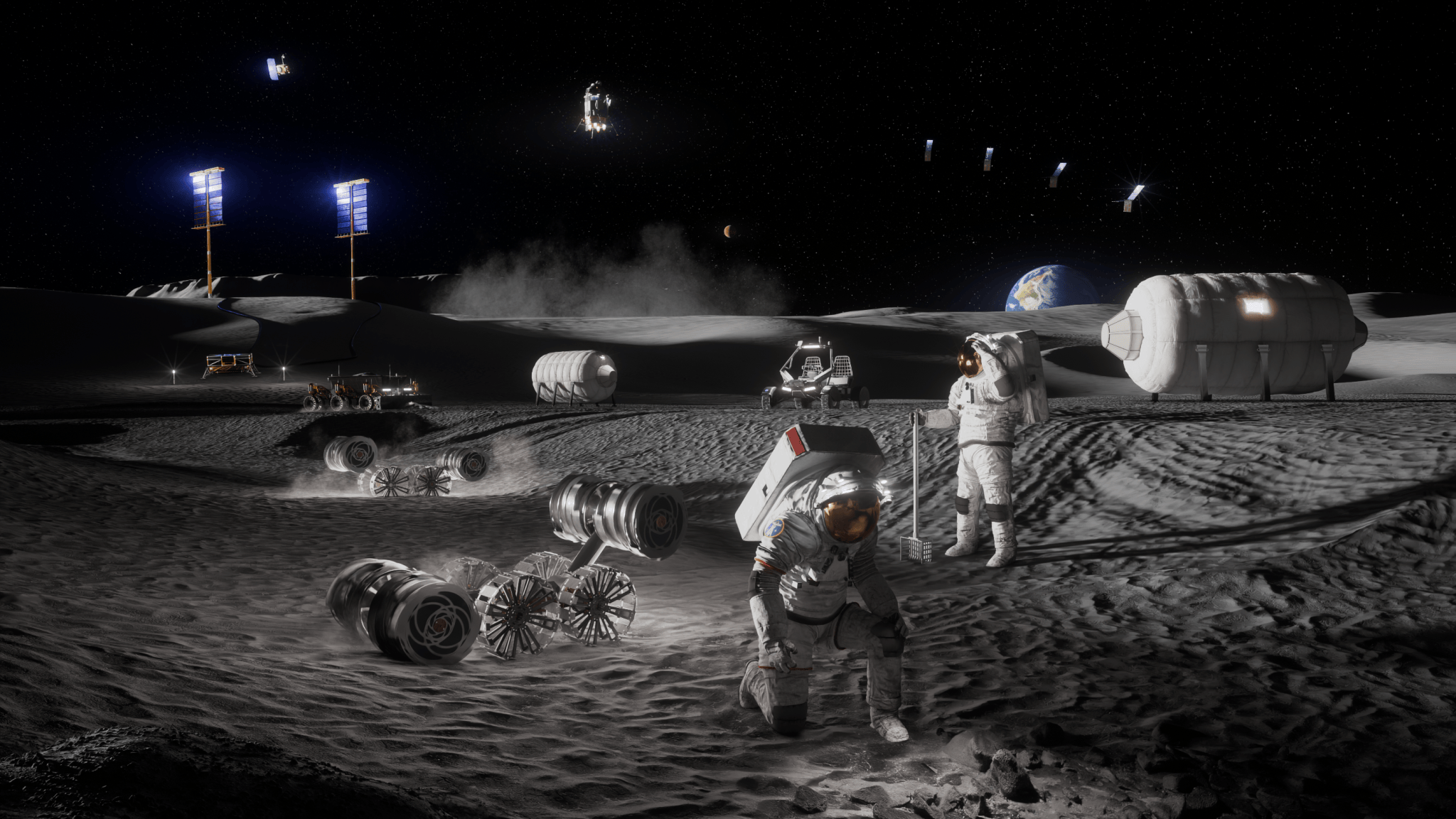
NASA Announces $1 Million to Students for Moon Base Challenge
Artist’s concept depicting astronauts, habitats, rovers, power systems, and cargo operations supporting sustained human activities at the Mo...
-
NASA has exercised the second option of its Information Technology and Multimedia Services (ITAMS) contract with DB Consulting Group, Inc., ...
-
Science Earth Observatory A Subtle Return of La Niña Earth Earth Observatory Image of the Day EO Explorer All Topics ...
