
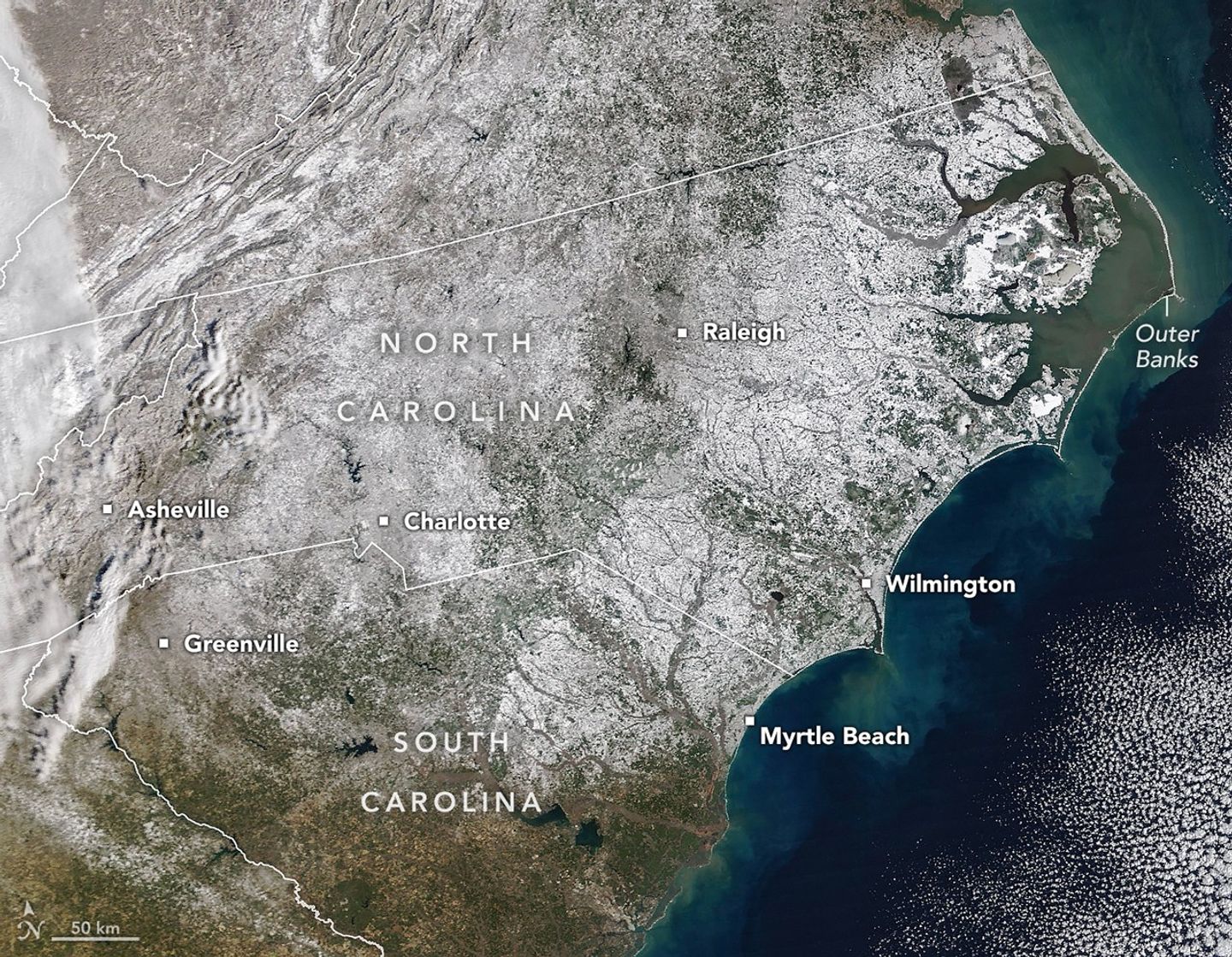
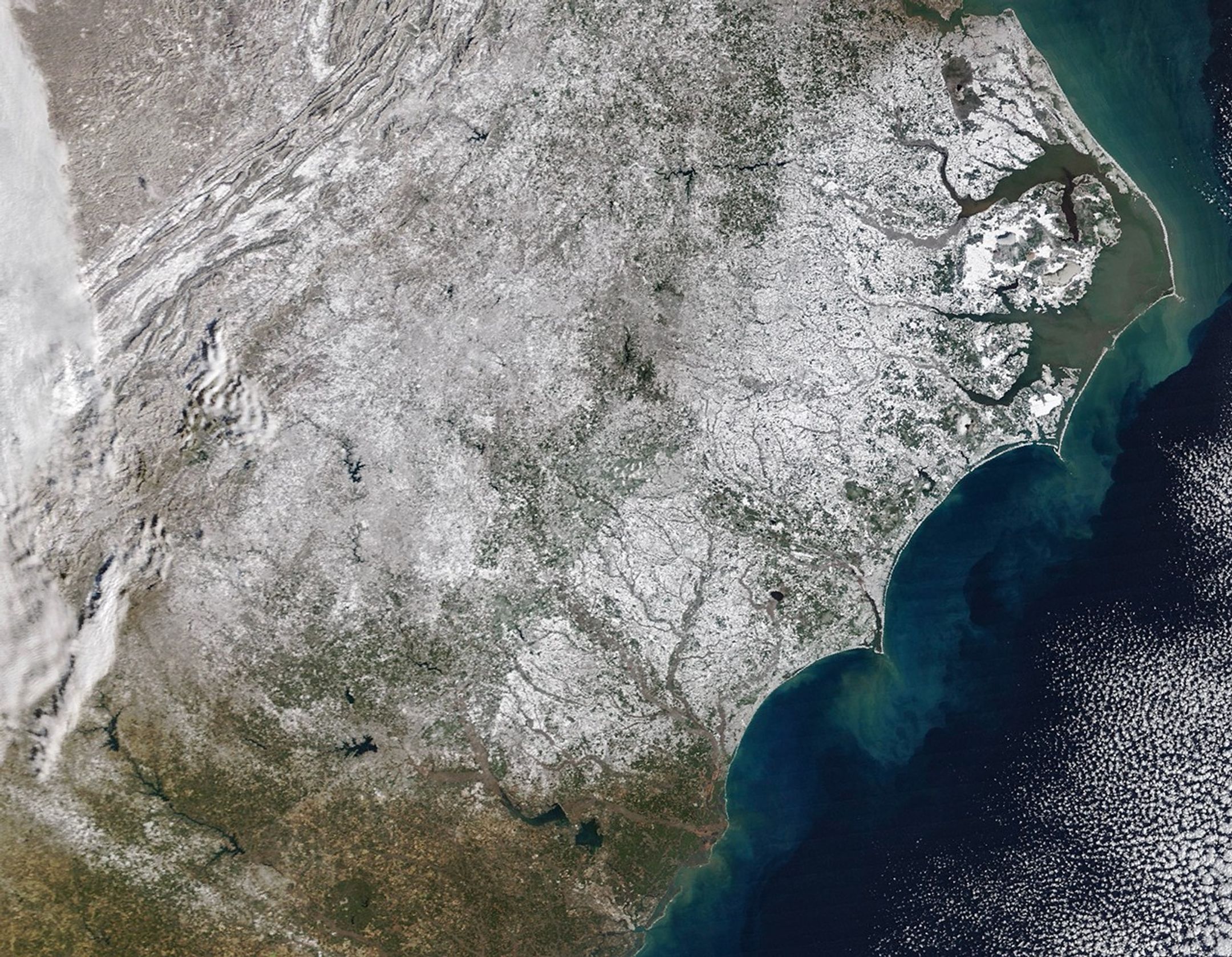
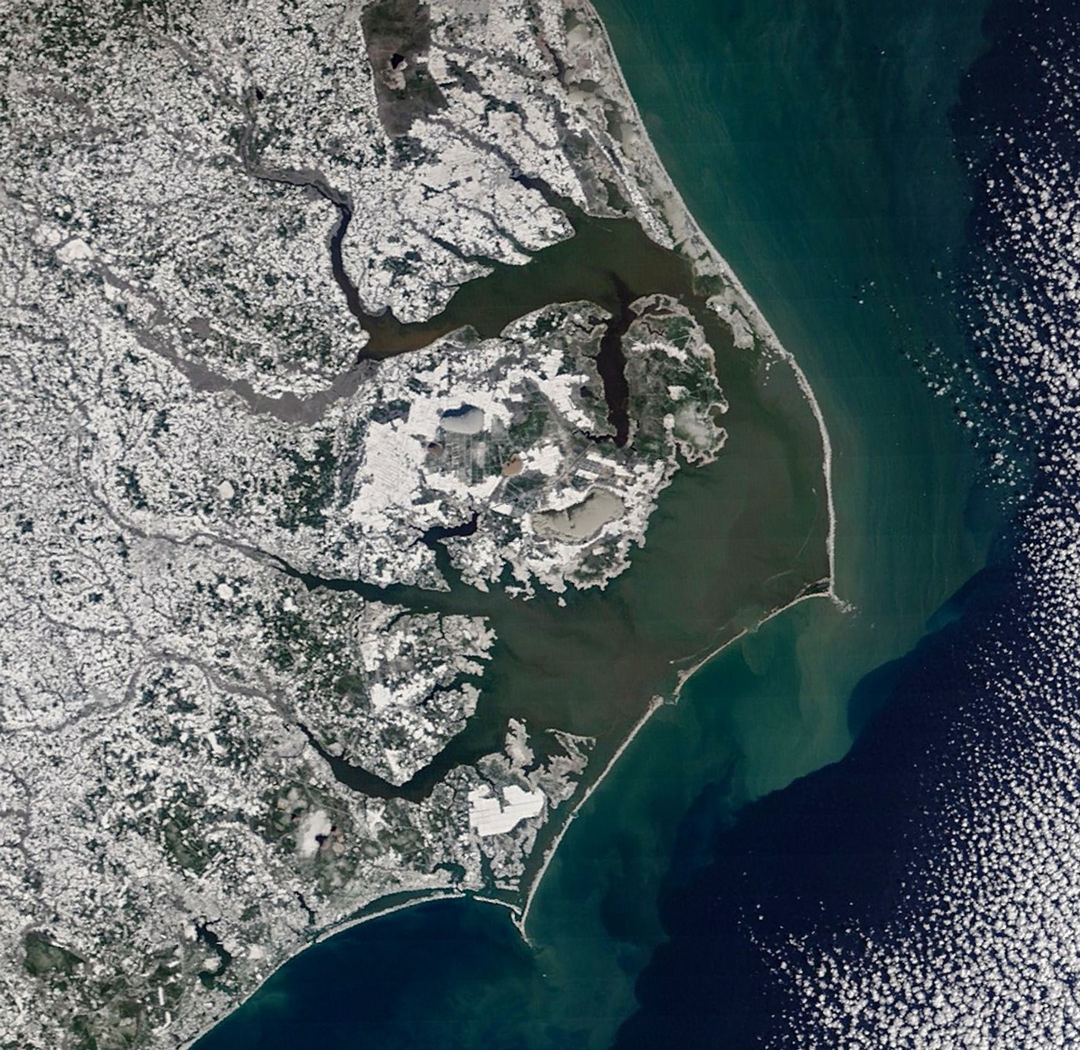
A potent winter storm in late January 2026 left much of North Carolina dealing with significant snow accumulations. Though the state is no stranger to snow, such widespread coverage is unusual.
This image, acquired on February 2 with the MODIS (Moderate Resolution Imaging Spectroradiometer) on NASA’s Terra satellite, reveals a nearly continuous blanket of white stretching from mountain cities in the west to beachfront towns in the east. According to the North Carolina State Climate Office, measurable snow fell in all 100 counties for the first time in more than a decade.
Snowfall in North Carolina typically requires cold air funneled in from the north to combine with moisture supplied by a low-pressure system. During the January 31 weekend event, Arctic air from earlier in the week lingered across the state as a storm approached along a near-shore track, setting the stage for widespread snow.
Snow totals exceeded a foot in some of the state’s western, mountainous regions, following several years without significant snowfall events, though some locations such as Asheville saw smaller amounts. The storm even pushed south into Greenville, South Carolina, in the foothills of the Blue Ridge Mountains, where the downtown area saw about 5 inches (13 centimeters) by the evening of January 31, according to the National Weather Service.
In the Piedmont region, the hilly central part of the state, Charlotte received nearly a foot of snow—the most since 2004—while Raleigh saw a lighter accumulation of 2.8 inches, according to the state climate center.

Even coastal parts of the state traded brown sandy beaches for a blanket of white, with more than a foot reported in parts of Carteret County. Beaufort, a mainland town in the southern Outer Banks area, experienced heavy blowing snow. Slightly inland, Greenville received 14 inches, an amount not seen since a large storm in March 1980.
Though appearing serene from space, the storm posed real hazards on the ground. Dangerous road conditions snarled traffic and caused collisions, according to local news reports, while coastal areas saw high winds and waves. Overwash on Highway 12 in the Outer Banks coated parts of the road in standing water and sand, while several homes along the shore of Hatteras Island collapsed into the sea.
NASA Earth Observatory images by Michala Garrison, using MODIS data from NASA EOSDIS LANCE and GIBS/Worldview. Story by Kathryn Hansen.
References & Resources
- The Charlotte Observer (2026, January 31) I-85 north of Charlotte reopens after 100+ vehicles stuck from collision and snow. Accessed February 5, 2026.
- Island Free Press (2026, February 1) Ocean overwash reported Sunday morning on Hatteras, Ocracoke Islands. Accessed February 5, 2026.
- National Weather Service Charleston SC (2026, February 1) January 31 – February 1, 2026 Winter Storm. Accessed February 5, 2026.
- National Weather Service Newport/Morehead City NC (2026, February 1) Total Snowfall Reports Through Noon. Accessed February 5, 2026.
- The New York Times (2026, February 1) A ‘Historic’ Snowfall Hits the Carolinas. Accessed February 5, 2026.
- North Carolina State Climate Office Large-Scale Winter Patterns. Accessed February 5, 2026.
- North Carolina State Climate Office (2026, February 2) Rapid Reaction: A Statewide Snowstorm for the Ages. Accessed February 5, 2026.
- The Washington Post (2026, February 1) ‘Historic storm’ delivers biggest snowfall in decades for North Carolina. Accessed February 5, 2026.
You may also be interested in:
Stay up-to-date with the latest content from NASA as we explore the universe and discover more about our home planet.

A landmass that was once encased in the ice of the Alsek Glacier is now surrounded by water.
A moderately intense season of surface melting left part of the ice sheet dirty gray in summer 2025, but snowfall…

Satellite data show that Arctic sea ice likely reached its annual minimum extent on September 10, 2025.
Discover More from NASA Earth Science


from NASA https://ift.tt/274aGfg


No comments:
Post a Comment