
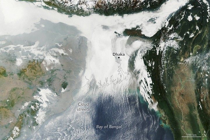
Winter weather took hold across the Indo-Gangetic Plain in early January 2026, bringing dense fog and cold temperatures to much of the flat, fertile lands that span from Pakistan and northern India to Bangladesh.
This image shows low-lying clouds over the delta on the morning of January 6, captured by the MODIS (Moderate Resolution Imaging Spectroradiometer) on NASA’s Terra satellite. Dense fog, particularly radiation fog, is common this time of year, forming when ground temperatures are cool, winds are light, and moisture is abundant near the surface. The meteorological departments of both Bangladesh and India called for moderate to very dense fog over the region that day amid an ongoing cold wave.
Other relatively low-level clouds extend from the land areas and over the Bay of Bengal. These long, parallel bands of clouds, known as cloud streets, can form when cold air passes over warmer open water, gaining heat and moisture. Rising thermals ascend until they reach a temperature inversion that acts like a lid, forcing the air to roll into long, parallel rotating cylinders. Clouds develop where the air rises, while clear skies appear where the air sinks.
While it appears scenic from above, foggy conditions can pose hazards and snarl daily life for people on the ground. For instance, dense fog early in the month caused major disruptions at the international airport in Dhaka, according to local news reports. Similar disruptions, along with travel delays on roads and railways, were reported in parts of northern, central, and eastern India.
NASA Earth Observatory image by Lauren Dauphin, using MODIS data from NASA EOSDIS LANCE and GIBS/Worldview. Story by Kathryn Hansen.
References & Resources
- Bangladesh Meteorological Department (2026, January 5) Weather Forecast Valid For 120 Hours Commencing 06 PM of 05.01.2026. Accessed January 8, 2026.
- Dhaka Tribune (2026, January 2) Flights diverted one after another as dense fog disrupts Dhaka airport operations. Accessed January 8, 2026.
- India Meteorological Department (2026, January 5) Press Release. Accessed January 8, 2026.
- NASA Earth Observatory (2024, January 18) Fog Blankets the Indo-Gangetic Plain. Accessed January 8, 2026.
- The New Indian Express (2026, January 4) Cold wave persist in Delhi, northern India, flights disrupted amid dense fog. Accessed January 8, 2026.

You may also be interested in:
Stay up-to-date with the latest content from NASA as we explore the universe and discover more about our home planet.
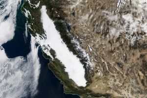
The right combination of conditions allowed this distinctive low cloud to form in California’s Central Valley for weeks.

Scientists say the seasonal crop fires are burning later in the day than in previous years.

A prolonged high-pressure weather system brought unusually warm September temperatures to British Columbia and the Pacific Northwest.
Discover More from NASA Earth Science


from NASA https://ift.tt/iKgD1dy


No comments:
Post a Comment