
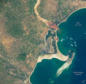
December 17, 2025
January 25, 2026
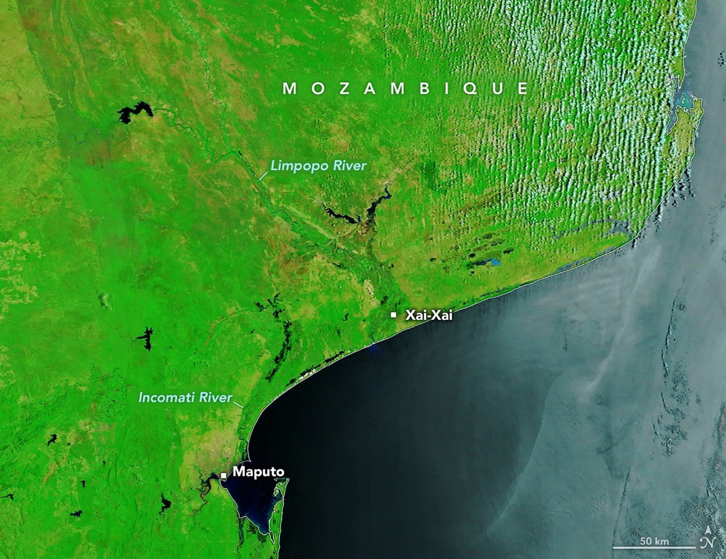
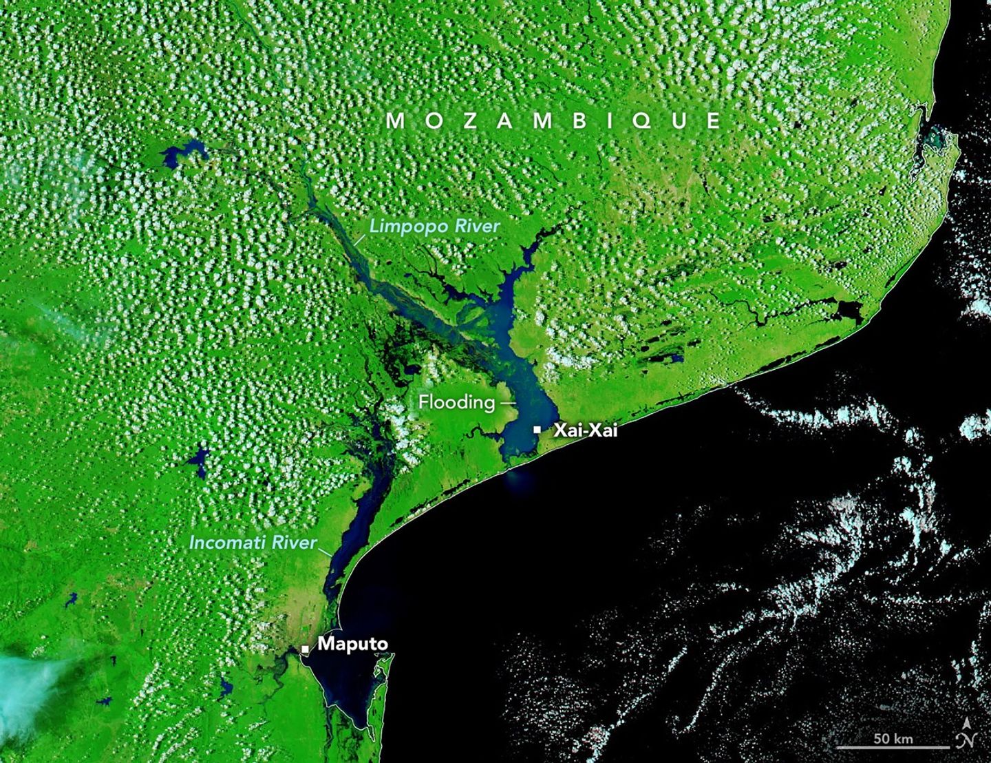
Residents of southern Mozambique who live or farm near rivers are accustomed to heading to higher ground during the wet season. But even by local standards, the deluge in January 2026 was remarkable for its scale and severity.
In December and January, weeks of intense rain swelled rivers and overwhelmed key reservoirs, sending floodwaters spilling into heavily populated areas along the Limpopo and Incomati rivers.
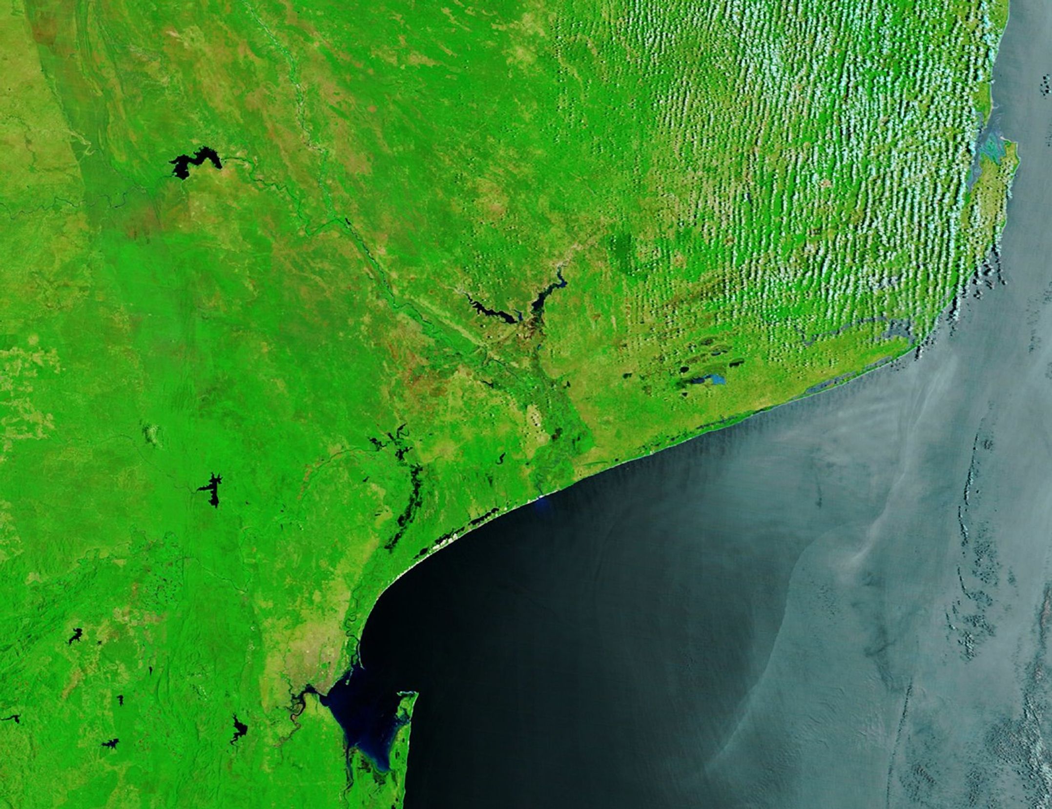
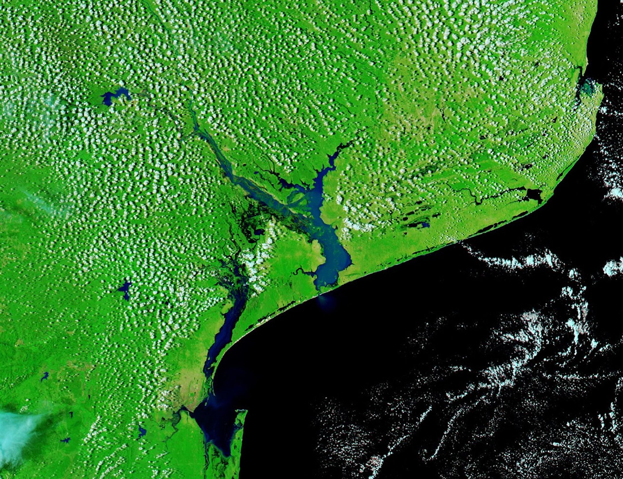
The MODIS (Moderate Resolution Imaging Spectroradiometer) on NASA’s Aqua satellite captured this false-color image (bands 7-2-1) of floodwaters coursing down the two rivers on January 25, 2026 (right). The image on the left, captured by the Terra satellite, shows the same area on December 17, 2025, before the flooding. A natural-color version of the image shows thick plumes of water rich in suspended sediment flowing down the rivers and into the Mozambique Channel.
Flooding has affected at least 600,000 people, displaced hundreds of thousands, and destroyed or damaged at least 30,000 homes, according to Mozambique’s National Disasters Management Institute, though it’s likely the numbers will increase due to ongoing search and rescue operations. Some of the hardest-hit cities include Maputo, Xai-Xai, and Chókwè.
Agriculture officials report the flooding of at least 180,000 hectares (440,000 acres) of crops and the loss of more than 150,000 head of livestock. Health experts are warning of elevated risk of cholera, diarrhea, and other waterborne diseases, and authorities from at least one city have reported crocodile attacks.
NASA Earth Observatory images by Michala Garrison, using MODIS data from NASA EOSDIS LANCE and GIBS/Worldview. Story by Adam Voiland.
References & Resources
- ABC News (2026, January 19) Floods in Mozambique displace more than 300,000 people in one province, governor says. Accessed January 26, 2026.
- Aimnews.org (2026) English. Accessed January 26, 2026.
- BBC (2026, January 25) People cling to treetops as ‘worst floods in a generation’ sweep Mozambique. Accessed January 26, 2026.
- Cima Foundation (2026, January 17) Mozambique, heavy rainfall in the South: cooperation and monitoring to manage flood risk. Accessed January 26, 2026.
- Club of Mozambique (2026, January 23) Mozambique: Floods destroy 180,000 hectares of crops and 150,000 livestock. Accessed January 26, 2026.
- The International Charter (2026, January 25) Flood in Mozambique. Accessed January 26, 2026.
- The International Organization for Migration (2026, January 22) IOM Scales Up Emergency Response as Floods Displace Over Half a Million People in Mozambique. Accessed January 26, 2026.
- NASA (2022, September 21) Monitoring and Modeling Floods using Earth Observations. Accessed January 26, 2026.
- PBS News (2026, January 23) Floods push crocodiles into Mozambican towns as health concerns rise. Accessed January 26, 2026.
- ReliefWeb (2026) Mozambique: Floods – Dec 2025. Accessed January 26, 2026.
You may also be interested in:
Stay up-to-date with the latest content from NASA as we explore the universe and discover more about our home planet.

Heavy rains and flooding across the country since June 2025 have displaced millions of people, devastated infrastructure, and submerged farmland.

The Guiana Shield’s rugged terrain shapes Guyana’s waterways, but mining has altered their clarity.
Sediment from the riverbed, especially during periods of higher flow, helps shape the surrounding beaches and sandbars.
Discover More from NASA Earth Science


from NASA https://ift.tt/bvS28WO


No comments:
Post a Comment