
The Global Learning and Observations to Benefit the Environment (GLOBE) Program has launched a new feature that connects citizen scientists directly to Landsat observations. Through GLOBE, volunteers around the world collect environmental data in support of Earth system science, including land observations. GLOBE land cover observations may include photos of the landscape and a classification of the land cover, providing a valuable dataset of ground-truth observations.
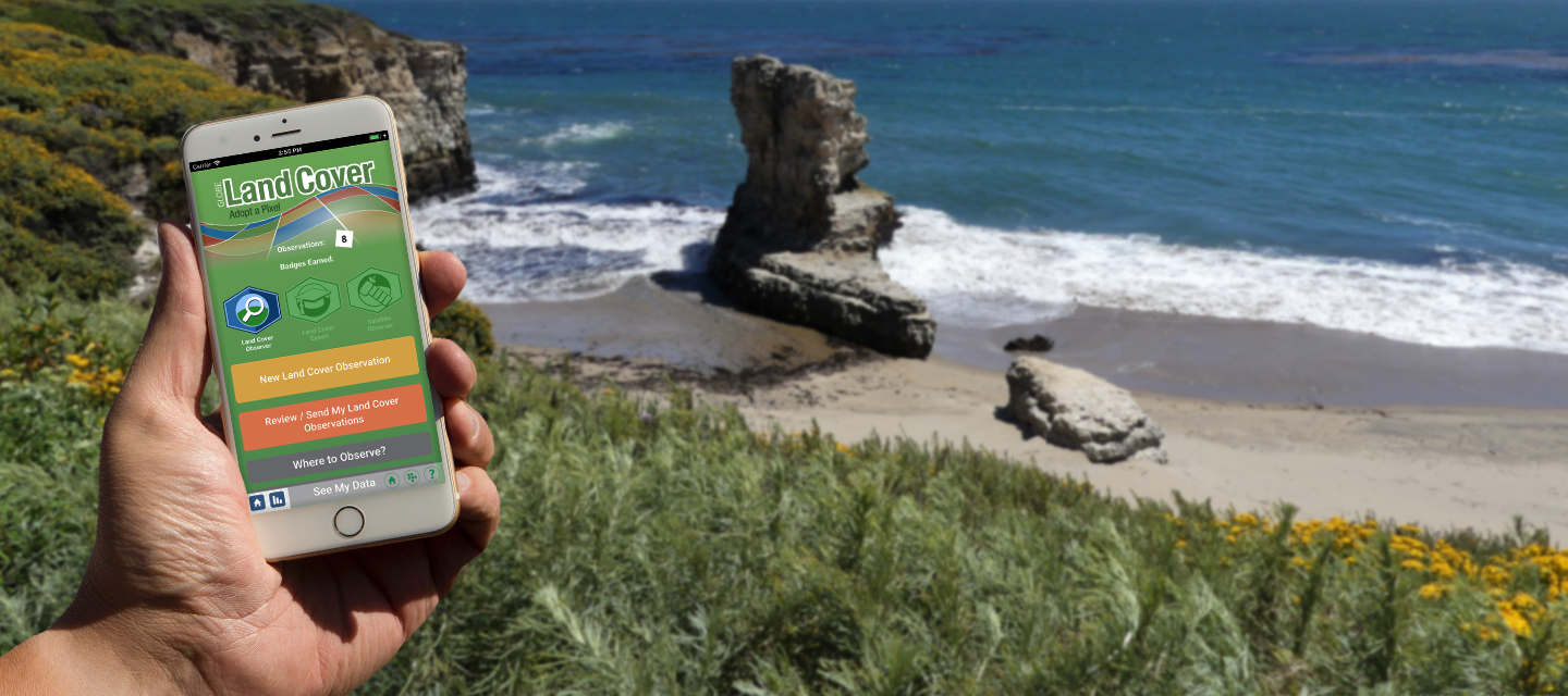
As of September, when volunteers submit land cover observations to GLOBE, they will receive an email comparing their findings to Landsat and Sentinel-2 satellite observations of the same location in the same timeframe. This direct comparison helps bridge the gap between space-based remote sensing and ground-based observations, building on the successful legacy of GLOBE cloud observations that have been matched with satellite data for years.
Why Is GLOBE Including Land Cover?
Land cover classification plays a crucial role in understanding and managing our environment. This information is essential for risk analysis related to natural disasters such as floods, wildfires, and landslides. It also enables scientists to track the impacts of land use changes over time and create detailed maps of wildlife habitats. Landsat is a key dataset in many national and global land cover classification products such as the National Land Cover Database (NLCD).
GLOBE land cover allows anyone, from a highschooler to a university professor, to contribute to our understanding of Earth’s changing surface.
For more information about Landsat’s new role in GLOBE, read GLOBE’s feature or explore GLOBE Land Cover.
Explore More
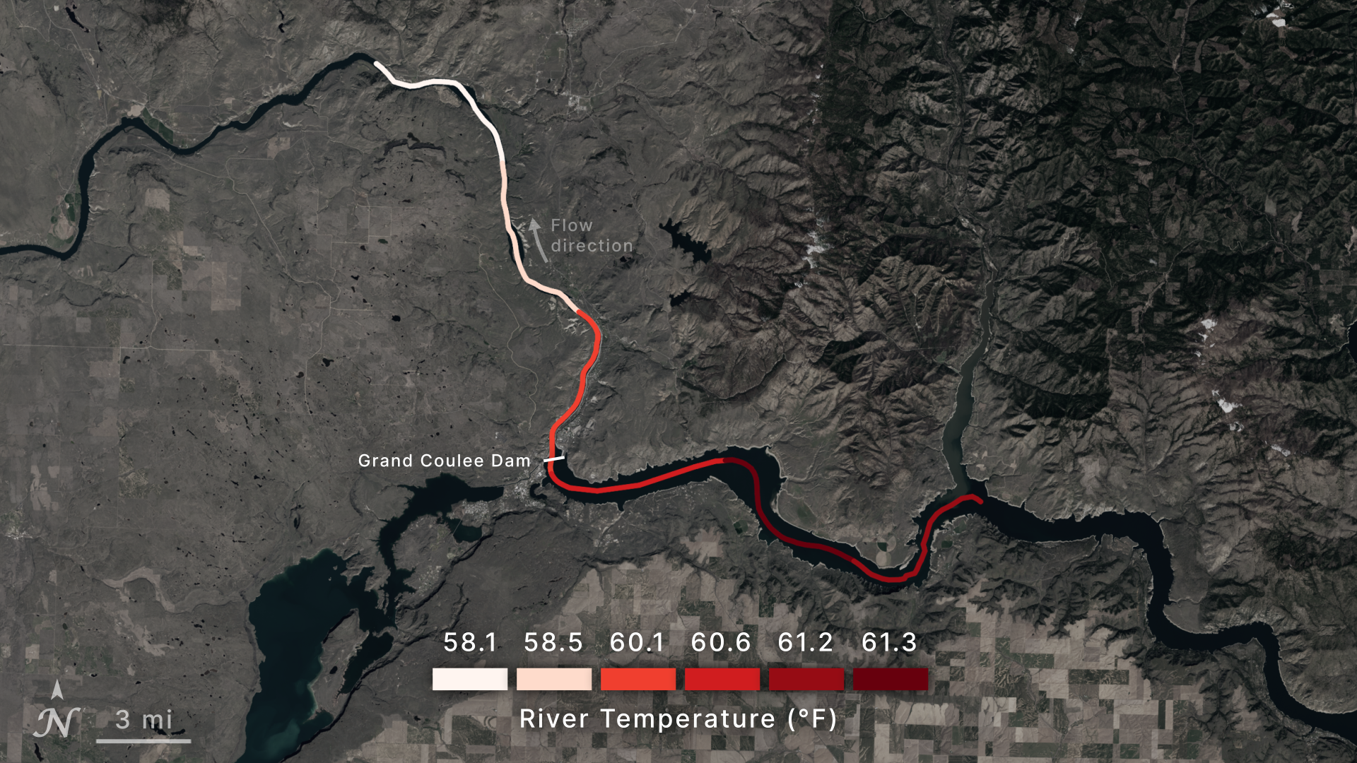
Tool Uses NASA Data to Take Temperature of Rivers from Space
New research uses more than 40 years of data from NASA and the U.S. Geological…
Article
1 week ago

from NASA https://ift.tt/oHrSfcC

No comments:
Post a Comment