5 min read
Updates on NASA Field Campaigns
Snippets from The Earth Observer’s Editor’s Corner
PACE-PAX
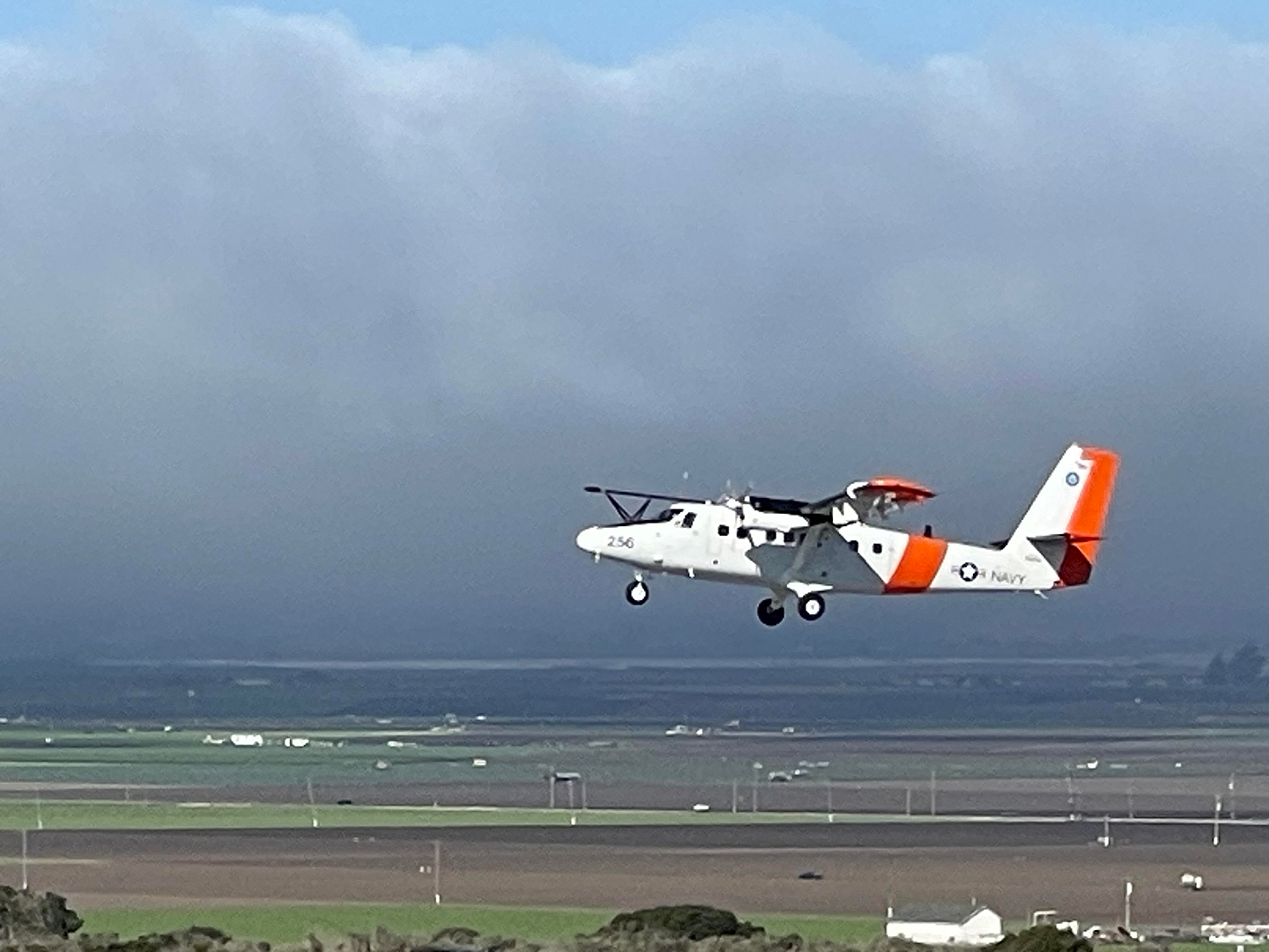
PACE–PAX had as its primary objective to gather data to validate measurements from NASA’s PACE mission. A secondary objective was validation of observations by the European Space Agency’s recently launched Earth Cloud, Aerosol, and Radiation Explorer (EarthCARE) mission. The operations spanned Southern and Central California and nearby coastal regions, logging 81 flight hours for the NASA ER-2, which operated out of NASA’s Armstrong Flight Research Center (AFRC) in Edwards, CA, and 60 hours for the Twin Otter aircraft, which was operated by the Center for Interdisciplinary Remotely Piloted Aircraft Studies (CIRPAS) at the Naval Postgraduate School (Monterey, CA) out of Marina Municipal Airport in Marina, CA – see Photo.

NASA’s ER-2 aircraft flies at an altitude of approximately 20 km, well above the troposphere. PACE–PAX researchers used the unique high-altitude vantage point to make observations of the atmosphere, ocean, and land surface in a similar manner to that of PACE. In so doing, they can verify the accuracy of data gathered by the satellite in orbit. Meanwhile, the Twin Otter flew at a much lower altitude in the atmosphere (~3 km). The instrumentation onboard the Twin Otter was used to sample and measure cloud droplet size, aerosol size, and the amount of light scattered or absorbed by the particles. These aircraft observations are the same atmospheric properties that PACE observes from its broader vantage point in polar orbit. In addition to the PACE and aircraft observations, the R/V Shearwater operated 15 day trips out of Santa Barbara, CA, gathering additional surface-based observations along with other vessels and floats.
Field campaigns, such as PACE–PAX, are designed to collect measurements at different scales and conditions for comparison to satellite observations. When it comes to doing this successfully, timing is everything. PACE–PAX observations were carefully coordinated so that the two aircraft were in flight and taking observations at the same time, so observations were being obtained at the surface (e.g., on the ship) as well as the satellite passing overhead. This takes a tremendous amount of effort on the part of the organizers.
BlueFlux
BlueFlux was set up to study the wetland ecosystems of South Florida. Wetland ecosystems represent the ever-changing line between land and sea, and are exceptionally vulnerable to climate disturbances, such as sea level rise and tropical cyclones. As these threats intensify, wetland ecology – and its role as a critical sink of CO2 – faces an uncertain future.
BlueFlux observations will contribute to the development of a new, remote-sensing data product called “Daily Flux Predictions for South Florida,” which will help research teams led by Ben Poulter [GSFC] explain and quantify the changing relationship between wetlands and atmospheric greenhouse gas concentrations (GHG). The goal is to refine global GHG budget analyses and provide regional stakeholders with information to evaluate how Florida’s wetlands are responding to natural and anthropogenic pressures in real time.
The “Daily Flux Predictions for South Florida” product will use retrievals of surface spectral reflectance captured by the Moderate Resolution Imaging Spectroradiometer (MODIS) instrument on NASA’s Aqua and Terra satellites to estimate the rate at which various gasses are exchanged between Earth’s surface and the atmosphere. Such flux measurements in coastal wetlands are historically limited on account of the relative inaccessibility of these ecosystems. To contribute to a more robust understanding of how Florida’s coastal ecology fits into the carbon cycle, BlueFlux conducted a series of airborne fieldwork deployments out of the Miami Homestead Air Reserve Base and the Miami Executive Airport in Miami-Dade County, which are adjacent to the eastern border of the Everglades National Park. The full study region – broadly referred to as South Florida – is narrowly defined by the wetland ecosystems that extend from Lake Okeechobee and its Northern estuaries to the saltwater marshland and mangrove forests along the state’s southernmost shore.
Flux measurements were made along each flight track using a payload known as the CARbon Airborne Flux Experiment (CARAFE) flying at between about 90 m and 3000 m. The researchers configured airborne observations, along with additional ground-based flux measurements, to match the spatial and temporal resolution of spectra collected by MODIS sensors, which produce surface reflectance retrievals at a 500 m daily resolution. Mirroring the scale of MODIS observations was necessary to both train the flux product’s underlying machine-learning algorithms and validate the accuracy of predictions made using satellite data alone. Data collected during BlueFlux fieldwork campaigns is available to the general public through NASA’s Oak Ridge National Laboratory (ORNL) Distributed Active Archive Center (DAAC). The “Daily Flux Predictions for South Florida” data product will also be accessible through NASA’s ORNL DAAC by early 2025.
Steve Platnick
EOS Senior Project Scientist
from NASA https://ift.tt/NmQBbID


No comments:
Post a Comment