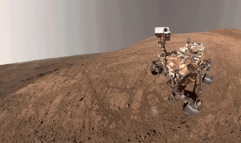
Perseverance self portrait, acquired by the WATSON camera on Sol 1500 on Mars. The Bell Island borehole where the rover acquired a sample is visible in the workspace in front of the rover.
NASA/JPL-Caltech/MSSS
Written by Athanasios Klidaras, Ph.D. candidate at Purdue University, and Megan Kennedy Wu, Senior Mission Operations Specialist at Malin Space Science Systems
To celebrate her 1,500th Martian day (“Sol”) exploring the red planet, the Perseverance rover used its robotic arm to take a selfie of the rover and the surrounding landscape. But when team members reviewed the photo, they were surprised to find that Perseverance had been photobombed!
As the rover sat at the “Pine Pond” workspace, located on the outer rim of Jezero crater, which it has been exploring for the past several months, the Wide Angle Topographic Sensor for Operations and eNgineering (WATSON) camera on the end of its arm was used to acquire a 59-image mosaic of the rover. This is the fifth “selfie” that Perseverance has acquired since landing on Mars in 2021. The rover’s robotic arm is not visible in the self portrait because — just like a selfie you would take with your own cellphone camera — rover operators make sure not to have the arm get “in the way” of the body of the rover. This is even easier to do on Mars because Perseverance needs to take 59 different images at slightly different arm positions to build up the selfie, and the elbow of the robotic arm is kept out of the way while the images are acquired. You can find more details about the Sol 1500 selfie here, and this YouTube video shows how the rover arm moves when these activities take place.
While snapping away, Perseverance was photobombed by a dust devil in the distance! These are relatively common phenomena both on Mars and in Earth’s desert regions, and form from rising and rotating columns of warm air, which gives the appearance of a dust tornado. Just like many other weather patterns, there is a peak “season” for dust-devil activity, and Jezero crater is in the peak of that season now (late northern spring). The one seen in the selfie is fairly large, about 100 meters, or 328 feet, across. While Perseverance regularly monitors the horizon for dust-devil activity with Navcam movies, this is the first time the WATSON camera on the end of the robotic arm has ever captured an image of a dust devil!
The dark hole in front of the rover, surrounded by gray rock powder created during the drilling process, shows the location of Perseverance’s 26th sample. Nicknamed “Bell Island” after an island near Newfoundland, Canada, this rock sample contains small spherules, thought to have formed by volcanic eruptions or impacts early in Martian history. Later, this ancient rock was uplifted during the impact that formed Jezero crater. Now that the rover has successfully acquired the spherule sample the science team was searching for, Perseverance is leaving the area to explore new rock exposures. Last week, the rover arrived at an exposure of light-toned bedrock called “Copper Cove,” and the science team was interested to determine if this unit underlies or overlies the rock sequence explored earlier. After performing an abrasion to get a closer look at the chemistry and textures, the rover drove south to scout out more sites along the outer edge of the Jezero crater rim.
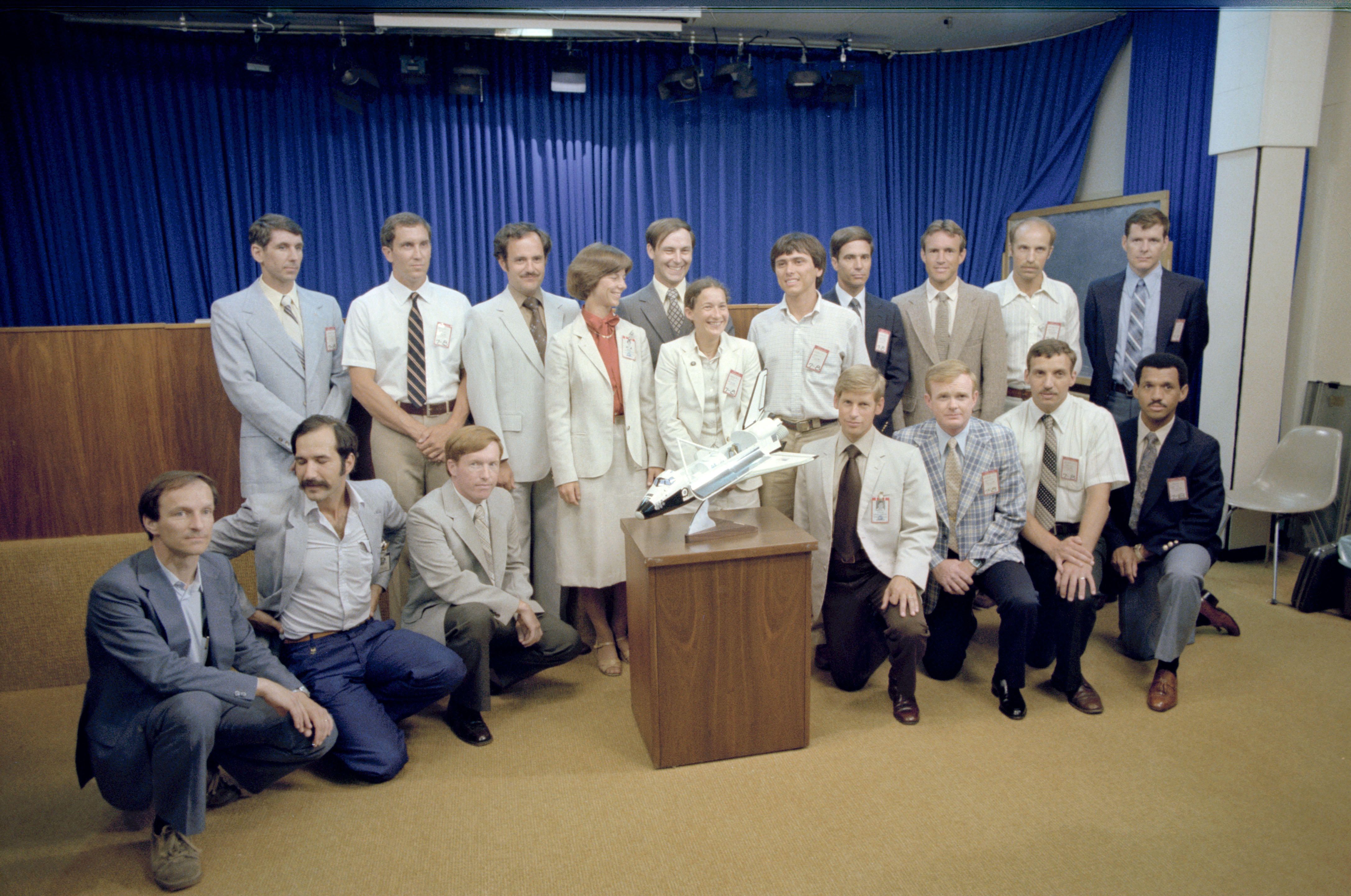
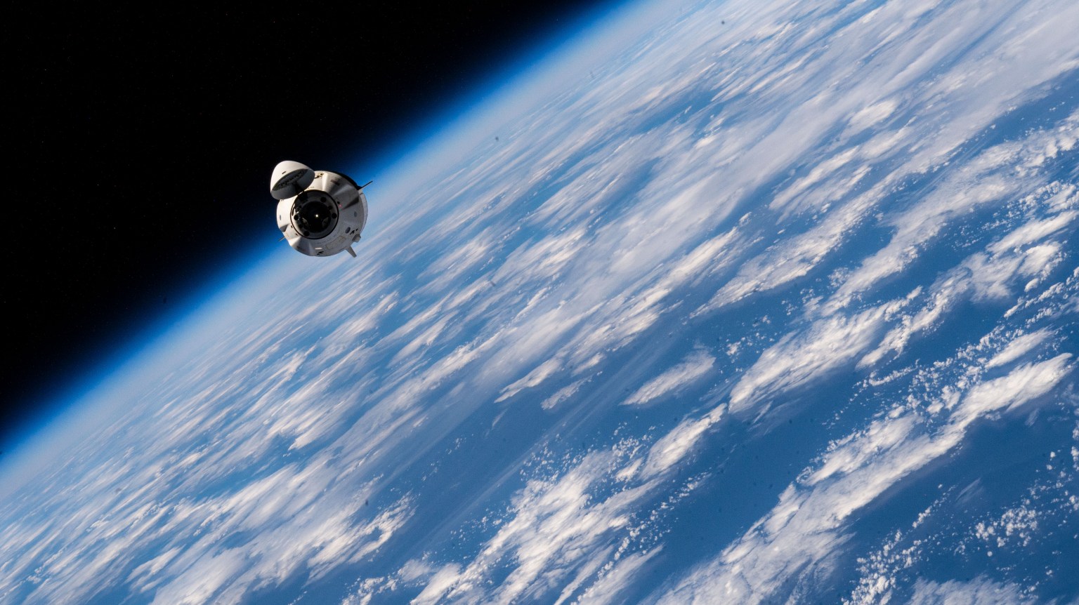
Nearly all of NASA’s ninth class of astronaut candidates, along with two European trainees, poses for photos in the briefing room in the public affairs facility at NASA’s Johnson Space Center in Houston on July 7, 1980.
Group 9 was announced on May 29, 1980; the candidates would go on to make history in spaceflight and at NASA. For example, Charles Bolden (kneeling at far right) traveled to orbit four times aboard the space shuttle between 1986 and 1994, then became the agency’s first African American administrator in 2009. Franklin Chang-Diaz (fifth from the right, standing) was the first Hispanic American to fly in space and Jerry Ross (middle, standing in the back) was the first person to be launched into space seven times.
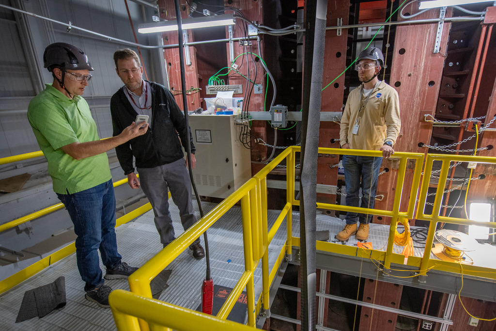
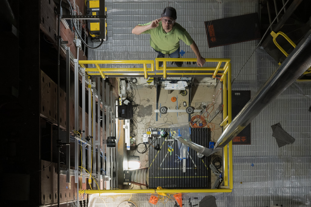
Preparations for Next Moonwalk Simulations Underway (and Underwater)
Advancing new hazard detection and precision landing technologies to help future space missions successfully achieve safe and soft landings is a critical area of space research and development, particularly for future crewed missions. To support this, NASA’s Space Technology Mission Directorate (STMD) is pursuing a regular cadence of flight testing on a variety of vehicles, helping researchers rapidly advance these critical systems for missions to the Moon, Mars, and beyond.
“These flight tests directly address some of NASA’s highest-ranked technology needs, or shortfalls, ranging from advanced guidance algorithms and terrain-relative navigation to lidar-and optical-based hazard detection and mapping,” said Dr. John M. Carson III, STMD technical integration manager for precision landing and based at NASA’s Johnson Space Center in Houston.
Since the beginning of this year, STMD has supported flight testing of four precision landing and hazard detection technologies from many sectors, including NASA, universities, and commercial industry. These cutting-edge solutions have flown aboard a suborbital rocket system, a high-speed jet, a helicopter, and a rocket-powered lander testbed. That’s four precision landing technologies tested on four different flight vehicles in four months.
“By flight testing these technologies on Earth in spaceflight-relevant trajectories and velocities, we’re demonstrating their capabilities and validating them with real data for transitioning technologies from the lab into mission applications,” said Dr. Carson. “This work also signals to industry and other partners that these capabilities are ready to push beyond NASA and academia and into the next generation of Moon and Mars landers.”
The following NASA-supported flight tests took place between February and May:
Suborbital Rocket Test of Vision-Based Navigation System
Identifying landmarks to calculate accurate navigation solutions is a key function of Draper’s Multi-Environment Navigator (DMEN), a vision-based navigation and hazard detection technology designed to improve safety and precision of lunar landings.
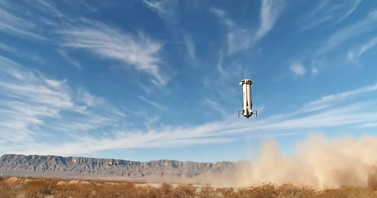
Aboard Blue Origin’s New Shepard reusable suborbital rocket system, DMEN collected real-world data and validated its algorithms to advance it for use during the delivery of three NASA payloads as part of NASA’s Commercial Lunar Payload Services (CLPS) initiative. On Feb. 4, DMEN performed the latest in a series of tests supported by NASA’s Flight Opportunities program, which is managed at NASA’s Armstrong Flight Research Center in Edwards, California.
During the February flight, which enabled testing at rocket speeds on ascent and descent, DMEN scanned the Earth below, identifying landmarks to calculate an accurate navigation solution. The technology achieved accuracy levels that helped Draper advance it for use in terrain-relative navigation, which is a key element of landing on other planets.
New Shepard booster lands during the flight test on February 4, 2025.
Blue Origin
High-Speed Jet Tests of Lidar-Based Navigation
Several highly dynamic maneuvers and flight paths put Psionic’s Space Navigation Doppler Lidar (PSNDL) to the test while it collected navigation data at various altitudes, velocities, and orientations.
Psionic licensed NASA’s Navigation Doppler Lidar technology developed at Langley Research Center in Hampton, Virginia, and created its own miniaturized system with improved functionality and component redundancies, making it more rugged for spaceflight. In February, PSNDL along with a full navigation sensor suite was mounted aboard an F/A-18 Hornet aircraft and underwent flight testing at NASA Armstrong.
The aircraft followed a variety of flight paths over several days, including a large figure-eight loop and several highly dynamic maneuvers over Death Valley, California. During these flights, PSNDL collected navigation data relevant for lunar and Mars entry and descent.
The high-speed flight tests demonstrated the sensor’s accuracy and navigation precision in challenging conditions, helping prepare the technology to land robots and astronauts on the Moon and Mars. These recent tests complemented previous Flight Opportunities-supported testing aboard a lander testbed to advance earlier versions of their PSNDL prototypes.
The Psionic Space Navigation Doppler Lidar (PSNDL) system is installed in a pod located under the right wing of a NASA F/A-18 research aircraft for flight testing above Death Valley near NASA’s Armstrong Flight Research Center in Edwards, California, in February 2025.
NASA
Helicopter Tests of Real-Time Mapping Lidar
Researchers at NASA’s Goddard Space Flight Center in Greenbelt, Maryland, developed a state-of-the-art Hazard Detection Lidar (HDL) sensor system to quickly map the surface from a vehicle descending at high speed to find safe landing sites in challenging locations, such as Europa (one of Jupiter’s moons), our own Moon, Mars, and other planetary bodies throughout the solar system. The HDL-scanning lidar generates three-dimensional digital elevation maps in real time, processing approximately 15 million laser measurements and mapping two football fields’ worth of terrain in only two seconds.
In mid-March, researchers tested the HDL from a helicopter at NASA’s Kennedy Space Center in Florida, with flights over a lunar-like test field with rocks and craters. The HDL collected numerous scans from several different altitudes and view angles to simulate a range of landing scenarios, generating real-time maps. Preliminary reviews of the data show excellent performance of the HDL system.
The HDL is a component of NASA’s Safe and Precise Landing – Integrated Capabilities Evolution (SPLICE) technology suite. The SPLICE descent and landing system integrates multiple component technologies, such as avionics, sensors, and algorithms, to enable landing in hard-to-reach areas of high scientific interest. The HDL team is also continuing to test and further improve the sensor for future flight opportunities and commercial applications.
NASA’s Hazard Detection Lidar field test team at Kennedy Space Center’s Shuttle Landing Facility in Florida in March 2025.
Lander Tests of Powered-Descent Guidance Software
Providing pinpoint landing guidance capability with minimum propellant usage, the San Diego State University (SDSU) powered-descent guidance algorithms seek to improve autonomous spacecraft precision landing and hazard avoidance. During a series of flight tests in April and May, supported by NASA’s Flight Opportunities program, the university’s software was integrated into Astrobotic’s Xodiac suborbital rocket-powered lander via hardware developed by Falcon ExoDynamics as part of NASA TechLeap Prize’s Nighttime Precision Landing Challenge.
The SDSU algorithms aim to improve landing capabilities by expanding the flexibility and trajectory-shaping ability and enhancing the propellant efficiency of powered-descent guidance systems. They have the potential for infusion into human and robotic missions to the Moon as well as high-mass Mars missions.
As part of a series of tethered and free-flight tests in April and May 2025, algorithms developed by San Diego State University guided the descent of the Xodiac lander testbed vehicle.
Astrobotic
By advancing these and other important navigation, precision landing, and hazard detection technologies with frequent flight tests, NASA’s Space Technology Mission Directorate is prioritizing safe and successful touchdowns in challenging planetary environments for future space missions.
After a decade of searching, NASA’s MAVEN (Mars Atmosphere Volatile Evolution) mission has, for the first time, reported a direct observation of an elusive atmospheric escape process called sputtering that could help answer longstanding questions about the history of water loss on Mars.
Scientists have known for a long time, through an abundance of evidence, that water was present on Mars’ surface billions of years ago, but are still asking the crucial question, “Where did the water go and why?”
Early on in Mars’ history, the atmosphere of the Red Planet lost its magnetic field, and its atmosphere became directly exposed to the solar wind and solar storms. As the atmosphere began to erode, liquid water was no longer stable on the surface, so much of it escaped to space. But how did this once thick atmosphere get stripped away? Sputtering could explain it.
Sputtering is an atmospheric escape process in which atoms are knocked out of the atmosphere by energetic charge particles.
“It’s like doing a cannonball in a pool,” said Shannon Curry, principal investigator of MAVEN at the Laboratory for Atmospheric and Space Physics at the University of Colorado Boulder and lead author of the study. “The cannonball, in this case, is the heavy ions crashing into the atmosphere really fast and splashing neutral atoms and molecules out.”
While scientists had previously found traces of evidence that this process was happening, they had never observed the process directly. The previous evidence came from looking at lighter and heavier isotopes of argon in the upper atmosphere of Mars. Lighter isotopes sit higher in the atmosphere than their heavier counterparts, and it was found that there were far fewer lighter isotopes than heavy argon isotopes in the Martian atmosphere. These lighter isotopes can only be removed by sputtering.
“It is like we found the ashes from a campfire,” said Curry. “But we wanted to see the actual fire, in this case sputtering, directly.”
To observe sputtering, the team needed simultaneous measurements in the right place at the right time from three instruments aboard the MAVEN spacecraft: the Solar Wind Ion Analyzer, the Magnetometer, and the Neutral Gas and Ion Mass Spectrometer. Additionally, the team needed measurements across the dayside and the nightside of the planet at low altitudes, which takes years to observe.
The combination of data from these instruments allowed scientists to make a new kind of map of sputtered argon in relation to the solar wind. This map revealed the presence of argon at high altitudes in the exact locations that the energetic particles crashed into the atmosphere and splashed out argon, showing sputtering in real time. The researchers also found that this process is happening at a rate four times higher than previously predicted and that this rate increases during solar storms.
The direct observation of sputtering confirms that the process was a primary source of atmospheric loss in Mars’ early history when the Sun’s activity was much stronger.
“These results establish sputtering’s role in the loss of Mars’ atmosphere and in determining the history of water on Mars,” said Curry.
The finding, published this week in Science Advances, is critical to scientists’ understanding of the conditions that allowed liquid water to exist on the Martian surface, and the implications that it has for habitability billions of years ago.
The MAVEN mission is part ofNASA’s Mars Exploration Program portfolio.MAVEN’s principal investigator is based at the Laboratory for Atmospheric and Space Physics (LASP) at the University of Colorado Boulder, which is also responsible for managing science operations and public outreach and communications.NASA’s Goddard Space Flight Center in Greenbelt, Maryland, manages the MAVEN mission. Lockheed Martin Space built the spacecraft and is responsible for mission operations. NASA’s Jet Propulsion Laboratory in Southern California provides navigation and Deep Space Network support.
Preparations for Next Moonwalk Simulations Underway (and Underwater)
Researchers look at a bend that occurred in the 94-foot triangular, rollable and collapsible boom during an off-axis compression test.
NASA/David C. Bowman
Researchers at NASA’s Langley Research Center in Hampton, Virginia, have developed a technique to test long, flexible, composite booms for use in space in such a way that gravity helps, rather than hinders, the process. During a recent test campaign inside a 100-foot tower at a NASA Langley lab, researchers suspended a 94-foot triangular, rollable, and collapsible boom manufactured by Florida-based aerospace company, Redwire, and applied different forces to the boom to see how it would respond.
Having a facility tall enough to accommodate vertical testing is advantageous because horizontal tests require extra equipment to keep gravity from bending the long booms, but this extra equipment in turn affects how the boom responds. These mechanical tests are important because NASA and commercial space partners could use long composite booms for several functions including deployable solar sails and deployable structures, such as towers for solar panels, that could support humans living and working on the Moon.
Redwire will be able to compare the results of the physical testing at NASA Langley to their own numerical models and get a better understanding of their hardware. NASA’s Game Changing Development program in the agency’s Space Technology Mission Directorate funded the tests.
Researchers conducted the tests inside a 100-foot tower at NASA Langley.
Join NASA for a free screening of Cosmic Dawn, the incredible true story of the James Webb Space Telescope–humanity’s mission to unveil the early universe, against all odds.
Cosmic Dawn is the incredible true story of the James Webb Space Telescope – humanity’s largest and most powerful space telescope – on a mission to unveil the early universe, against all odds.
The 90-minute documentary brings viewers on an unprecedented journey through Webb’s delicate assembly, rigorous testing, and triumphant launch, showcasing the sheer complexity and breathtaking risks involved in creating a telescope capable of peering billions of years into the past. Follow the telescope from an idea developed at NASA’s Goddard Space Flight Center all the way to the launchpad in French Guiana, with never-before-seen footage captured by the Webb film crew offering intimate access to the challenges and triumphs along the way.
Wednesday, June 11th 2025 | 7:00 PM EDT, doors open at 6:00 PM EDT
The Greenbelt Theater | 129 Centerway, Greenbelt, MD 20770
Space is limited, so please RSVP HERE by June 9th to reserve your free tickets.
We look forward to sharing how NASA achieves the remarkable.
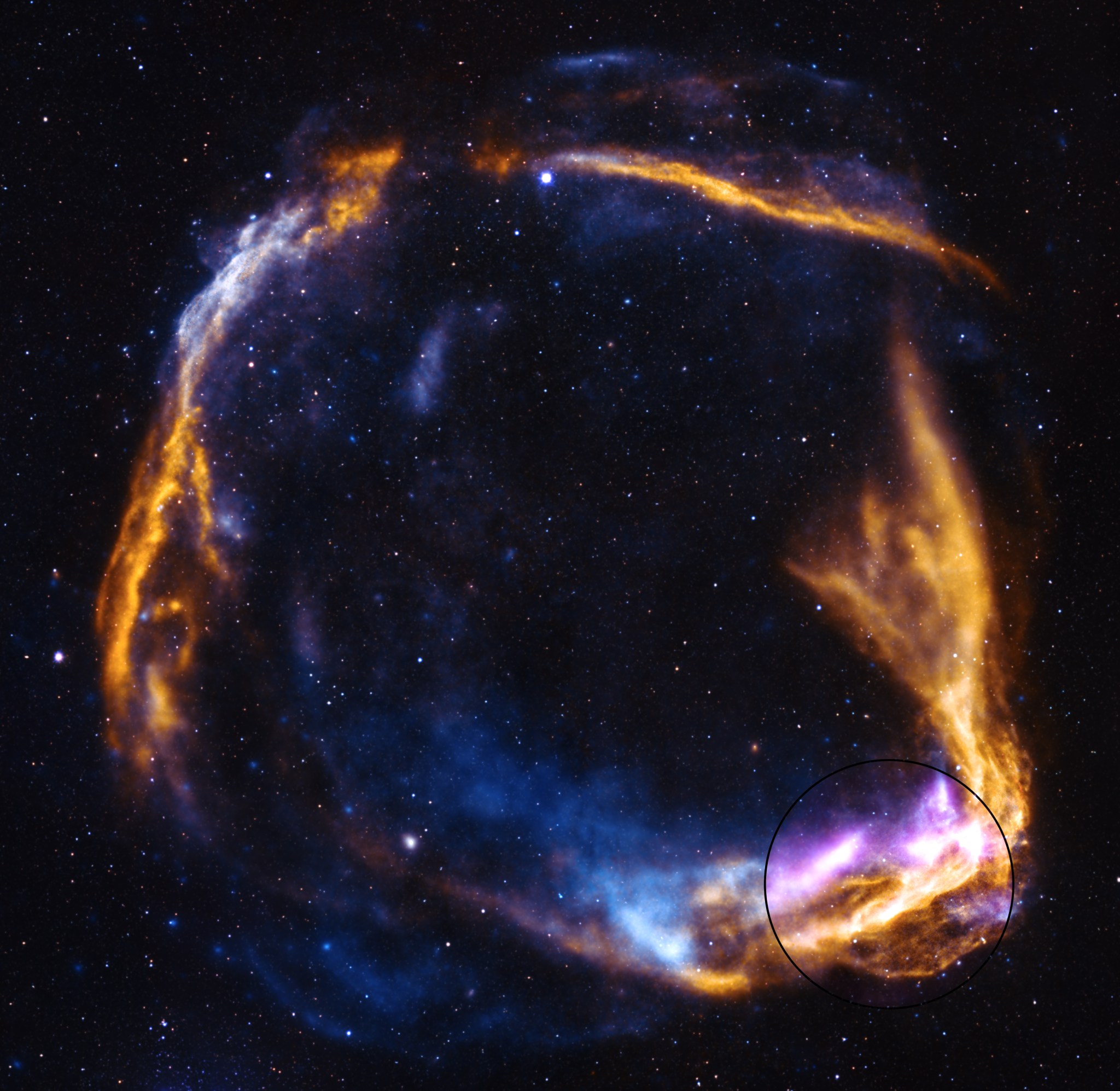
This NASA/ESA Hubble Space Telescope image features the remote galaxy HerS 020941.1+001557, which appears as a red arc that partially encircles a foreground elliptical galaxy.
ESA/Hubble & NASA, H. Nayyeri, L. Marchetti, J. Lowenthal
This NASA/ESA Hubble Space Telescope image offers us the chance to see a distant galaxy now some 19.5 billion light-years from Earth (but appearing as it did around 11 billion years ago, when the galaxy was 5.5 billion light-years away and began its trek to us through expanding space). Known as HerS 020941.1+001557, this remote galaxy appears as a red arc partially encircling a foreground elliptical galaxy located some 2.7 billion light-years away. Called SDSS J020941.27+001558.4, the elliptical galaxy appears as a bright dot at the center of the image with a broad haze of stars outward from its core. A third galaxy, called SDSS J020941.23+001600.7, seems to be intersecting part of the curving, red crescent of light created by the distant galaxy.
The alignment of this trio of galaxies creates a type of gravitational lens called an Einstein ring. Gravitational lenses occur when light from a very distant object bends (or is ‘lensed’) around a massive (or ‘lensing’) object located between us and the distant lensed galaxy. When the lensed object and the lensing object align, they create an Einstein ring. Einstein rings can appear as a full or partial circle of light around the foreground lensing object, depending on how precise the alignment is. The effects of this phenomenon are much too subtle to see on a local level but can become clearly observable when dealing with curvatures of light on enormous, astronomical scales.
Gravitational lenses not only bend and distort light from distant objects but magnify it as well. Here we see light from a distant galaxy following the curve of spacetime created by the elliptical galaxy’s mass. As the distant galaxy’s light passes through the gravitational lens, it is magnified and bent into a partial ring around the foreground galaxy, creating a distinctive Einstein ring shape.
The partial Einstein ring in this image is not only beautiful, but noteworthy. A citizen scientist identified this Einstein ring as part of the SPACE WARPS project that asked citizen scientists to search for gravitational lenses in images.
Preparations for Next Moonwalk Simulations Underway (and Underwater)
A digital rendering of the NASA-supported commercial space station, Vast’s Haven-1, which will provide a microgravity environment for crew, research, and in-space manufacturing.
Vast
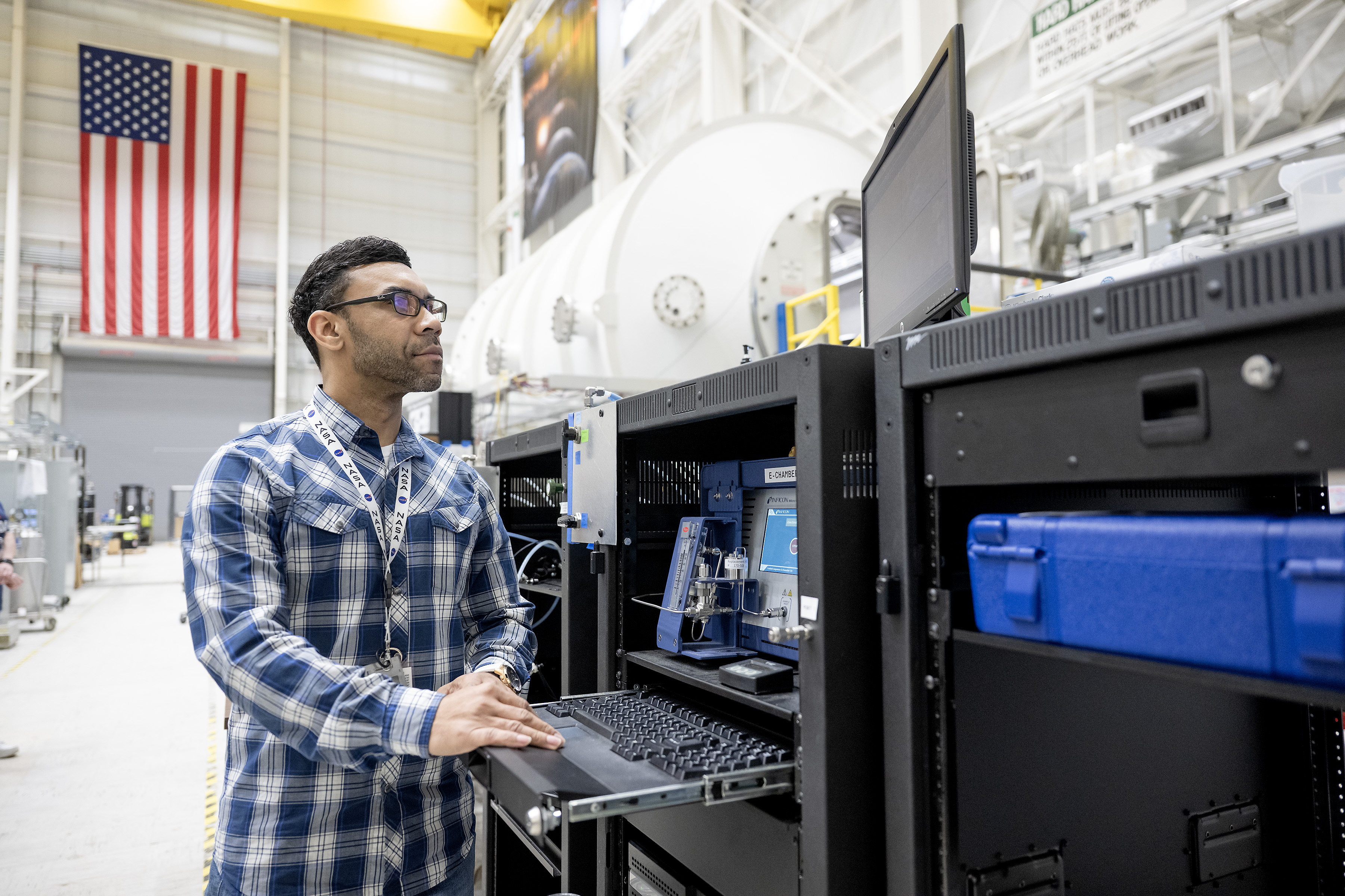
NASA-supported commercial space station, Vast’s Haven-1, recently completed a test of a critical air filter system for keeping future astronauts healthy in orbit. Testing confirmed the system can maintain a safe and healthy atmosphere for all planned Haven-1 mission phases.
Testing of the trace contaminant control system was completed at NASA’s Marshall Space Flight Center in Huntsville, Alabama, as part of a reimbursable Space Act Agreement. Vast also holds an unfunded Space Act Agreement with NASA as part of the second Collaborations for Commercial Space Capabilities initiative.
Adrian Johnson, air chemist at NASA’s Marshall Space Flight Center in Huntsville, Alabama, operates the Micro-GC, which is used to measure carbon monoxide levels, during a trace contaminant control system test in the environmental chamber.
NASA
The subsystem of the environmental control and life support system is comprised of various filters designed to scrub hazardous chemicals produced by both humans and materials on the commercial station. During the test, a representative chemical environment was injected into a sealed environmental chamber, and the filtration system was turned on to verify the trace contaminant control system could maintain a healthy atmosphere.
“Testing of environmental control systems and subsystems is critical to ensure the health and safety of future commercial space station crews,” said Angela Hart, program manager for NASA’s Commercial Low Earth Orbit Development Program at the agency’s Johnson Space Center in Houston. “Through NASA’s agreements with Vast and our other industry partners, the agency is contributing technical expertise, technologies, services, and facilities to support companies in the development of commercial stations while providing NASA important insight into the development and readiness to support future agency needs and services in low Earth orbit.”
NASA-supported commercial space station, Vast’s Haven-1, trace contaminant control filters and support hardware pictured within the environmental chamber at the agency’s Marshall Space Flight Center, Huntsville, Alabama.
NASA
Experts used the same environmental chamber at Marshall to test the International Space Station environmental control and life support system.
The knowledge and data gained during the recent testing will help validate Vast’s Haven-1 and support future Haven-2 development.
NASA supports the design and development of multiple commercial space stations through funded and unfunded agreements. NASA plans to procure services from one or more companies following the design and development phase as part of the agency’s strategy to become one of many customers for low Earth orbit stations.
For more information about commercial space stations, visit:
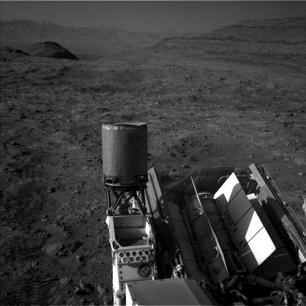
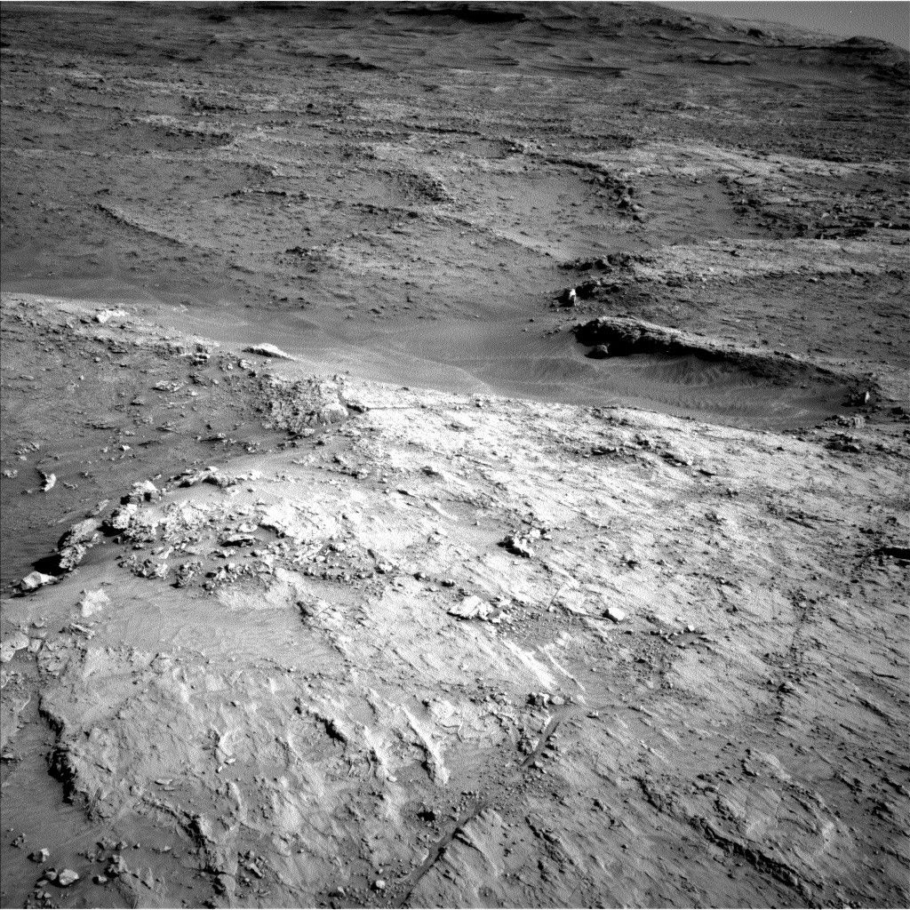
Sols 4549-4552: Keeping Busy Over the Long Weekend
NASA’s Mars rover Curiosity acquired this image using its Left Navigation Camera on May 23, 2025 — Sol 4548, or Martian day 4,548 of the Mars Science Laboratory mission — at 07:17:19 UTC.
NASA/JPL-Caltech
Written by Conor Hayes, Graduate Student at York University
Earth planning date: Friday, May 23, 2025
In Wednesday’s mission update, Alex mentioned that this past Monday’s plan included a “marathon” drive of 45 meters (148 feet). Today, we found ourselves almost 70 meters (230 feet) from where we were on Wednesday. This was our longest drive since the truly enormous 97-meter (318-foot) drive back on sol 3744.
Today’s plan looks a little different from our usual weekend plans. Because of the U.S. Memorial Day holiday on Monday, the team will next assemble on Tuesday, so an extra sol had to be appended to the weekend plan. This extra sol is mostly being used for our next drive (about 42 meters or 138 feet), which means that all of the science that we have planned today can be done “targeted,” i.e., we know exactly where the rover is. As a result, we can use the instruments on our arm to poke at specific targets close to the rover, rather than filling our science time exclusively with remote sensing activities of farther-away features.
The rover’s power needs are continuing to dominate planning. Although we passed aphelion (the farthest distance Mars is from the Sun) a bit over a month ago and so are now getting closer to the Sun, we’re just about a week away from winter solstice in the southern hemisphere. This is the time of year when Gale Crater receives the least amount of light from the Sun, leading to particularly cold temperatures even during the day, and thus more power being needed to keep the rover and its instruments warm. On the bright side, being at the coldest time of the year means that we have only warmer sols to look forward to!
Given the need to keep strictly to our allotted power budget, everyone did a phenomenal job finding optimizations to ensure that we could fit as much science into this plan as possible. All together, we have over four hours of our usual targeted and remote sensing activities, as well as over 12 hours of overnight APXS integrations.
Mastcam is spending much of its time today looking off in the distance, particularly focusing on the potential boxwork structures that we’re driving towards. These structures get two dedicated mosaics, totaling 42 images between the two of them. Mastcam will also observe “Mishe Mokwa” (a small butte about 15 meters, or 49 feet, to our south) and some bedrock troughs in our workspace, and will take two tau observations to characterize the amount of dust in the atmosphere.
ChemCam has just one solo imaging-only observation in this plan: an RMI mosaic of Texoli butte off to our east. ChemCam will be collaborating with APXS to take some passive spectral observations (i.e., no LIBS) to measure the composition of the atmosphere. Mastcam and ChemCam will also be working together on observations of LIBS activities. This plan includes an extravagant three LIBS, on “Orocopia Mountains,” “Dripping Springs,” and “Mountain Center.” Both Mastcam and ChemCam also have a set of “dark” observations intended to characterize the performance of the instruments with no light on their sensors, something that’s very important for properly calibrating their measurements.
Our single set of arm activities includes APXS, DRT, and MAHLI activities on “Camino Del Mar” and “Mount Baden-Powell,” both of which are bedrock targets in our workspace.
Of course, I can’t forget to mention the collection of Navcam observations that we have in this plan to monitor the environment. These include a 360-degree survey looking for dust devils, two line-of-sight activities to measure the amount of dust in the air within Gale, and three cloud movies. As always, we’ve also got a typical collection of REMS, RAD, and DAN activities throughout.