
Wednesday, 31 January 2018
Spinoff 2018 Highlights Space Technology Improving Life on Earth

The 2018 edition of NASA's annual Spinoff publication, released Tuesday, features 49 technologies the agency helped create that are used in almost every facet of modern life. These include innovations that help find disaster survivors trapped under rubble (an innovation develop by JPL), purify air and surfaces to stop the spread of germs, and test new materials for everything from airplanes to athletic shoes.
"NASA's work represents an investment in the future, not just for air and space travel, but for the nation," said Stephen Jurczyk, associate administrator of the Space Technology Mission Directorate in Washington. "At the same time that NASA's space exploration missions are inspiring young people to become scientists and engineers, the agency's work in support of those missions is creating jobs for them across many industrial sectors. Commercial technology spun off from NASA research and technology programs, and missions creates new companies, grows the economy, saves money, keeps us safer, and even saves lives."
In Spinoff 2018, you'll learn how:
- Ultra-sensitive radar technology used to detect gravity fluctuations was repurposed to identify the vital signs of disaster survivors trapped under rubble;
- A technique developed to preserve plants in a spacecraft led to devices that eliminate bacteria, viruses, molds and volatile organic compounds from air, surfaces and even laundry;
- One company's work on high-speed stereo photogrammetry for space shuttle analysis now enables low-cost, highly-accurate materials testing to improve designs for everything from running shoes to jetliners.
Other highlights include: artificial intelligence that helps drones avoid collisions and could one day enable self-driving cars; a business jet that is both the fastest and the most efficient in its class; and a computer program that, 50 years after its creation, is still used to design cars, buildings and much more.
"NASA technologies dating as far back as the Apollo missions still are improving our quality of life," says Daniel Lockney, NASA's Technology Transfer Program executive. "Meanwhile, innovations made in support of upcoming missions, such as the Orion capsule and the James Webb Space Telescope, are already finding commercial applications. The benefits of the space program continue to accumulate every year."
The book also features a Spinoffs of Tomorrow section that highlights 20 NASA technologies ripe for commercial application and available for licensing. These include an algae photobioreactor that cleans wastewater while producing biofuels, a revolutionary all-in-one gear and bearing, and the combined technologies of the highly dexterous humanoid robot Robonaut 2.
Spinoff is a part of the agency's Technology Transfer Program, which is charged with finding the widest possible applications for NASA technology through partnerships and licensing agreements with industry, ensuring that NASA's investments in its missions and research find additional applications that benefit the nation and the world.
Print and digital versions of Spinoff 2018 are available on the Spinoff website at:
An iPad version of Spinoff 2018, including shortened versions of the stories, multimedia and interactive features, also is available for download in the Apple iTunes store.
For more information about NASA's Technology Transfer Program, visit:
News Media Contact
Gina Anderson
NASA Headquarters, Washington
202-358-1160
gina.n.anderson@nasa.gov
2018-017
from News and Features http://ift.tt/2nuUbwu
via IFTTT
Tuesday, 30 January 2018
Space Exploration Educators to Speak with NASA Astronaut Aboard Space Station
from NASA Breaking News http://ift.tt/2GrVGUM
via IFTTT
NASA TV to Air Russian Spacewalk at the International Space Station
from NASA Breaking News http://ift.tt/2DOJ1h0
via IFTTT
Monday, 29 January 2018
NASA Television to Air Live Coverage of Upcoming Rare Lunar Eclipse
from NASA Breaking News http://ift.tt/2Gserra
via IFTTT
NASA Invites Media to Upcoming NOAA GOES-S Satellite Launch
from NASA Breaking News http://ift.tt/2njRMp5
via IFTTT
Thursday, 25 January 2018
NASA Covers Wildfires from Many Sources

NASA's satellite instruments are often the first to detect wildfires burning in remote regions, and the locations of new fires are sent directly to land managers worldwide within hours of the satellite overpass. Together, NASA instruments, including a number built and managed by NASA's Jet Propulsion Laboratory in Pasadena, California, detect actively burning fires, track the transport of smoke from fires, provide information for fire management, and map the extent of changes to ecosystems, based on the extent and severity of burn scars.
NASA has a fleet of Earth-observing instruments, many of which contribute to our understanding of fire in the Earth system. Satellites in orbit around the poles provide observations of the entire planet several times per day, whereas satellites in a geostationary orbit provide coarse-resolution imagery of fires, smoke and clouds every five to 15 minutes.
"NASA's satellite, airborne and field research capture the full impact of fires in the Earth system, from rapid detection of actively burning fires, transport of smoke and changes in ecosystems in the days to decades following fire," said Doug Morton, a research scientist at NASA's Goddard Space Flight Center in Greenbelt, Maryland.
Sharing Data with Partners
Much of the remote-sensing data that NASA collects on wildfires is quickly put to work in aiding disaster response efforts around the world. The NASA Earth Science Disasters Program supports this application science and mobilizes for global intensive risk events that span a range of natural hazards -- not only wildfires but earthquakes, tsunamis, floods, landslides, severe weather, winter storms, tropical cyclones and volcanoes. Over the last two years, NASA's Disasters Program has ramped up to build infrastructure and continue to forge new relationships between international, regional and local natural disaster response agencies and other Earth-observing space agencies around the world.
Satellites and Instruments
NASA has two different types of satellite systems to help track wildfires: polar orbiters and geostationary platforms. Polar orbiters like NASA's Terra and Aqua satellites and NASA-NOAA's Suomi NPP satellite provide detailed views of fires and smoke globally up to twice a day.
In contrast, geostationary satellites like GOES (which is operated by NOAA but was designed and built by NASA) orbit Earth in an equatorial plane with a 24-hour period, the same rate at which Earth rotates, and therefore they remain at a fixed longitude above the equator. This enables the geostationary satellites to provide frequent (five-minute) repeat imaging of a portion of the globe; however, they typically have coarser spatial resolution than the polar orbiters, which fly at much lower altitudes (about 435 miles, or 700 kilometers, above Earth's surface).
The NASA-operated polar-orbiting satellite instruments that are relevant for fire monitoring and management are described below. In addition, other satellites used for fire forecasting and risk assessment include the Gravity Recovery and Climate Experiment (GRACE),Global Precipitation Measurement mission (GPM) and Soil Moisture Active Passive or (SMAP) satellites.
Finally, burned area mapping leverages data from Landsat and the European Space Agency's Sentinel-2 satellite, along with the Moderate Resolution Imaging Spectrometer (MODIS) and Visible Infrared Imaging Radiometer Suite (VIIRS) instruments. Post-fire assessment of damages to human and natural systems is a key part of understanding the potential for debris flows and landslides, as well as the influence of changing frequency and severity of wildfires.
ASTER Instrument
The Advanced Spaceborne Thermal Emission and Reflection Radiometer (ASTER) instrument flies aboard NASA's Terra satellite. With its spectral bands from the visible to the thermal infrared wavelength region and its high spatial resolution of about 50 to 300 feet (15 to 90 meters), ASTER images Earth to map and monitor the changing surface of our planet. The broad spectral coverage of ASTER provides scientists in numerous disciplines with critical information for surface mapping and monitoring of dynamic conditions and temporal change. False-color ASTER composite images are created using visible, near-infrared, and thermal infrared wavelengths, each making different features such as smoke, active fires and ground surfaces, stand out. ASTER's U.S. science team is located at JPL.
AIRS Instrument
Data from the JPL-built and managed Atmospheric Infrared Sounder (AIRS) instrument on NASA's Aqua spacecraft provide a look at concentrations and global transport of carbon monoxide pollution from fires burning. Various bands of AIRS imagery can be combined to provide a false-color composite image to show carbon monoxide concentrations and temperatures. The highest concentrations of carbon monoxide are shown in yellows and reds in AIRS imagery.
AIRS is sensitive to carbon monoxide in the mid-troposphere at heights between 1.2 and 6.2 miles (2 and 10 kilometers), with a peak sensitivity at an altitude of approximately 3.1 miles (5 kilometers). Strong winds at these altitudes are conducive to the long-range transport of pollution lifted by heat from strong fires.
MISR Instrument
The JPL-built and managed Multi-angle Imaging SpectroRadiometer (MISR) instrument aboard NASA's Terra satellite also provides unique information on wildfire smoke plume characteristics. MISR's nine cameras, each viewing Earth at a different angle, are used to determine the heights of smoke plumes above the surface in much the same way that our two eyes, pointing in slightly different directions, give us depth perception. Plume height is an important parameter that governs how far the smoke particles travel in the atmosphere; injection of the particles to higher altitudes generally impacts air quality farther away from the source. MISR's multi-angular observing strategy also enables estimation of the concentrations of the airborne smoke particles. Inhalation of these particles increases the risk of cardiovascular and respiratory disease.
CALIOP Instrument
The Cloud-Aerosol Lidar with Orthogonal Polarization (CALIOP) instrument, which flies on the Cloud-Aerosol Lidar and Infrared Pathfinder Satellite Observation (CALIPSO) satellite, provides information on smoke plume injection height and the vertical distribution of aerosols through the atmosphere. These lidar data are unique in their ability to detect optically thin smoke layers at a fine vertical resolution, and CALIOP is able to view extensive smoke plumes that do not have clear boundaries. When paired with models, this instrument is able to provide novel information, such as the attribution of a river of smoke to numerous fires and the evolution of smoke-plume injection height over a day, which has implications for climate (black carbon transport and deposition on snow and ice, albedo change), air quality and human health.
MODIS Instrument
The MODIS instrument flies aboard two NASA satellites: Terra and Aqua. MODIS provides daytime visible imagery and infrared night-time imagery.
In the images, actively burning areas or hot spots, as detected by MODIS's thermal bands, are outlined in red. Each hot spot is an area where the thermal detectors on the MODIS instrument recognized temperatures higher than background. Such hot spots are diagnostic for detecting fire whether or not they are accompanied by plumes of smoke.
MODIS imagery can also be false-colored to show the extent of burned areas, the brick red color in false-colored images.
MOPITT Instrument
The specific focus of the NASA Terra satellite's Measurement of Pollution in the Troposphere (MOPITT) instrument is on the distribution, transport, sources and sinks of carbon monoxide in the troposphere. Carbon monoxide, which is expelled from factories, cars and forest fires, hinders the atmosphere's natural ability to rid itself of harmful pollutants.
VIIRS Instrument
NASA-NOAA's Suomi NPP satellite's VIIRS has provided daytime and night-time imagery of wildfires. VIIRS is the younger sister of MODIS and provides finer spatial resolution imagery (1,230 feet or 375 meters). Daytime imagery shows both the extent of smoke and heat signatures from the fires burning.
Also, the VIIRS "day/night band" provides a look at the heat of fires at night. It detects light in a range of wavelengths from green to near-infrared and uses filtering techniques to observe signals such as city lights, auroras and wildfires.
Aircraft
NASA has a fleet of research aircraft carrying the latest sensor technologies that can be used for Earth observations. NASA's ER-2 aircraft, based at Armstrong Flight Research Center (AFRC) in Palmdale, California, flies as high as 70,000 feet (21,300 meters), almost twice as high as a commercial airliner, and is used for science research missions over much of the world. In December 2017, the aircraft flew locally over California wildfire events, testing early versions of science instruments that may one day be launched into space aboard a satellite to observe our home planet Earth.
AVIRIS Instrument
During the December engineering test flights, the ER-2 carried a JPL-built spectrometer called the Airborne Visible/Infrared Imaging Spectrometer (AVIRIS-classic). AVIRIS is a modern instrument with an extensive heritage that has demonstrated the ability to estimate vegetation fuel types (e.g., vegetation species and densities) and fuel condition (live vs. dead, as well as moisture status). Because it provides the full spectral signature of the landscape it is imaging, spanning the visible to shortwave infrared, it can provide a total spectral "fingerprint" of its imaging area and can be used to estimate fire temperature.
HyTES and MASTER
The Hyperspectal Thermal Emission Spectrometer (HyTES) and the MODIS/ASTER (MASTER) Airborne Simulator are both airborne instruments that fly on different aircraft. HyTES is a new airborne imaging spectrometer developed by JPL. The overall goal of the HyTES project is to provide precursor high spectral and spatial resolution thermal infrared (temperature) data. Products generated provide temperature, emissivity and gas detection. HyTES can be used to efficiently detect and characterize the spatial structures of individual plumes of methane, hydrogen sulfide, ammonia, nitrogen dioxide and sulfur dioxide. The airborne MASTER instrument collects ASTER-like and MODIS-like land datasets to validate the ASTER and MODIS satellite instrument data.
Uninhabited Aerial Vehicle Synthetic Aperture Radar (UAVSAR)
The JPL-built and managed UAVSAR is a fully polarimetric radar instrument operating in the microwave portion of the electromagnetic spectrum. It is an active sensor, sending out polarized electromagnetic pulses that interact with ground cover in complex but quantifiable ways, enabling the characterization of changes in Earth's surface through clouds, smoke and dust. UAVSAR has been used to estimate fire fuel and map fire scars, with particular success in certain types of vegetation cover, such as chaparral. The changes associated with these fires are detectable by UAVSAR for several years, enabling the ability to monitor long-term vegetation recovery after a fire. UAVSAR is an airborne testbed for the orbital NISAR instrument, a joint mission with the Indian Space Research Organisation, which is expected to launch in 2021.
International Space Station
Astronauts aboard the International Space Station have a unique vantage point and provide camera and video imagery of wildfires and smoke transport while they orbit Earth. These ISS datasets also contribute to the library of continuous monitoring and observations of wildfires and other Earth phenomena that scientists and fire managers use daily here on Earth to make effective discoveries and support wildfire management decision processes.
All of these satellite and airborne systems, combined together in a sensor-web, give us a much improved understanding of the role and extent of wildfires on our planet.
NASA maintains the NASA Fire and Smoke webpage, where many of the products are posted with updates on various incidents around the world.
For more information, see NASA's Fire and Smoke page:
and NASA's Earth Observatory Natural Hazards page:
https://earthobservatory.nasa.gov/NaturalHazards/
News Media Contact
Alan Buis
Jet Propulsion Laboratory, Pasadena, California
818-354-0474
Alan.Buis@jpl.nasa.gov
2018-016
from News and Features http://ift.tt/2E5KyMs
via IFTTT
Wednesday, 24 January 2018
Dust Storms Linked to Gas Escape from Mars Atmosphere

Fast Facts:
› Rising air during global dust storms on Mars hoists water vapor high in the atmosphere, researchers using NASA's Mars Reconnaissance Orbiter report.
› Regional dust storms every year uplift water to a lesser extent and appear to drive a seasonal pattern in loss of hydrogen from the top of Mars' atmosphere.
› If Mars has a global dust storm in 2018, observations could aid understanding of its effects.
Some Mars experts are eager and optimistic for a dust storm this year to grow so grand it darkens skies around the entire Red Planet.
This biggest type of phenomenon in the environment of modern Mars could be examined as never before possible, using the combination of spacecraft now at Mars.
A study published this week based on observations by NASA's Mars Reconnaissance Orbiter (MRO) during the most recent Martian global dust storm -- in 2007 -- suggests such storms play a role in the ongoing process of gas escaping from the top of Mars' atmosphere. That process long ago transformed wetter, warmer ancient Mars into today's arid, frozen planet.
"We found there's an increase in water vapor in the middle atmosphere in connection with dust storms," said Nicholas Heavens of Hampton University, Hampton, Virginia, lead author of the report in Nature Astronomy. "Water vapor is carried up with the same air mass rising with the dust."
A link between the presence of water vapor in Mars' middle atmosphere -- roughly 30 to 60 miles (50 to 100 kilometers) high -- and escape of hydrogen from the top of the atmosphere has been detected by NASA's Hubble Space Telescope and the European Space Agency's Mars Express orbiter, but mainly in years without the dramatic changes produced in a global dust storm. NASA's MAVEN mission arrived at Mars in 2014 to study the process of atmosphere escape.
"It would be great to have a global dust storm we could observe with all the assets now at Mars, and that could happen this year," said David Kass of NASA's Jet Propulsion Laboratory, Pasadena, California. He is a co-author of the new report and deputy principal investigator for the instrument that is the main source of data for it, MRO's Mars Climate Sounder.
Not all Mars watchers are thrilled with the idea of a global dust storm, which can adversely affect ongoing missions. For instance: Opportunity, as a solar powered rover, would have to hunker down to save energy; the upcoming InSight lander's parameters would need to be adjusted for safe entry, descent and landing in November; and all the cameras on rovers and orbiters would need to deal with low visibility.
Decades of Mars observations document a pattern of multiple regional dust storms arising during the northern spring and summer. In most Martian years, which are nearly twice as long as Earth years, all the regional storms dissipate and none swells into a global dust storm. But such expansion happened in 1977, 1982, 1994, 2001 and 2007. The next Martian dust storm season is expected to begin this summer and last into early 2019.
The Mars Climate Sounder on MRO can scan the atmosphere to directly detect dust and ice particles and can indirectly sense water vapor concentrations from effects on temperature. Heavens and co-authors of the new paper report the sounder's data show slight increases in middle-atmosphere water vapor during regional dust storms and reveal a sharp jump in the altitude reached by water vapor during the 2007 global dust storm. Using recently refined analysis methods for the 2007 data, the researchers found an increase in water vapor by more than a hundred-fold in the middle atmosphere during that global storm.
Before MAVEN reached Mars, many scientists expected to see loss of hydrogen from the top of the atmosphere occurring at a rather steady rate, with variation tied to changes in the solar wind's flow of charged particles from the Sun. Data from MAVEN and Mars Express haven't fit that pattern, instead showing a pattern that appears more related to Martian seasons than to solar activity. Heavens and coauthors present the dust storms' hoisting of water vapor to higher altitudes as a likely key to the seasonal pattern in hydrogen escape from the top of the atmosphere. MAVEN observations during the stronger effects of a global dust storm could boost understanding of their possible link to the escape of gas from the atmosphere.
News Media Contact
Guy Webster
Jet Propulsion Laboratory, Pasadena, Calif.
818-354-6278
guy.webster@jpl.nasa.gov
Laurie Cantillo / Dwayne Brown
NASA Headquarters, Washington
202-358-1077 / 202-358-1726
laura.l.cantillo@nasa.gov / dwayne.c.brown@nasa.gov
2018-012
from News and Features http://ift.tt/2DvQLQV
via IFTTT
Spinoff 2018 Highlights Space Technology Improving Life on Earth
from NASA Breaking News http://ift.tt/2E4fJI1
via IFTTT
Dust on Snow Controls Springtime River Rise in West

A new study has found that dust, not spring warmth, controls the pace of spring snowmelt that feeds the headwaters of the Colorado River. Contrary to conventional wisdom, the amount of dust on the mountain snowpack controls how fast the Colorado Basin's rivers rise in the spring regardless of air temperature, with more dust correlated with faster spring runoff and higher peak flows.
The finding is valuable for western water managers and advances our understanding of how freshwater resources, in the form of snow and ice, will respond to warming temperatures in the future. By improving knowledge of what controls the melting of snow, it improves understanding of the controls on how much solar heat Earth reflects back into space and how much it absorbs -- an important factor in studies of weather and climate.
When snow gets covered by a layer of windblown dust or soot, the dark topcoat increases the amount of heat the snow absorbs from sunlight. Tom Painter of NASA's Jet Propulsion Laboratory in Pasadena, California, has been researching the consequences of dust on snowmelt worldwide. This is the first study to focus on which has a stronger influence on spring runoff: warmer air temperatures or a coating of dust on the snow.
Windblown dust has increased in the U.S. Southwest as a result of changing climate patterns and human land-use decisions. With rainfall decreasing and more disturbances of the land, protective crusts on soil are removed and more bare soil is exposed. Winter and spring winds pick up the dusty soil and drop it on the Colorado Rockies to the northeast. Historical lake sediment analyses show there is currently an annual average of five to seven times more dust falling on the Rocky Mountain snowpack than there was before the mid-1800s.
Painter and colleagues looked at data on air temperature and dust in a mountain basin in southwestern Colorado from 2005 to 2014, and streamflow from three major tributary rivers that carry snowmelt from these mountains to the Colorado River. The Colorado River's basin spans about 246,000 square miles (637,000 square kilometers) in parts of seven western states.
The researchers found that the effects of dust dominated the pace of the spring runoff even in years with unusually warm spring air temperatures. Conversely, there was almost no statistical correlation between air temperature and the pace of runoff.
"We found that when it's clean, the rise to the peak streamflow is slower, and generally you get a smaller peak." Painter said. "When the snowpack is really dusty, water just blasts out of the mountains." The finding runs contrary to the widely held assumption that spring air temperature determines the likelihood of flooding.
Coauthor McKenzie Skiles, an assistant professor in the University of Utah Department of Geography, said that while the impacts of dust in the air, such as reduced air quality, are well known, the impacts of the dust once it's been deposited on the land surface are not as well understood. "Given the reliance of the western U.S. on the natural snow reservoir, and the Colorado River in particular, it is critical to evaluate the impact of increasing dust deposition on the mountain snowpack," she said.
Painter pointed out that the new finding doesn't mean air temperatures in the region can be ignored in considering streamflows and flooding, especially in the future. "As air temperature continues to climb, it's going to have more influence," he said. Temperature controls whether precipitation falls as snow or as rain, for example, so ultimately it controls how much snow there is to melt. But, he said, "temperature is unlikely to control the variability in snowmelt rates. That will still be controlled by how dirty or clean the snowpack is."
Skiles noted, "Dust on snow does not only impact the mountains that make up the headwaters of Colorado River. Surface darkening has been observed in mountain ranges all over the world, including the Alps and the Himalaya. What we learn about the role of dust deposition for snowmelt timing and intensity here in the western U.S. has global implications for improved snowmelt forecasting and management of snow water resources."
The study, titled "Variation in rising limb of Colorado River snowmelt runoff hydrograph controlled by dust radiative forcing in snow," was published today in the journal Geophysical Research Letters. Coauthors are from the University of Utah, Salt Lake City; University of Colorado, Boulder; and University of California, Santa Barbara.
News Media Contact
Alan Buis
Jet Propulsion Laboratory, Pasadena, California
818-354-0474
Alan.Buis@jpl.nasa.gov
Lisa Potter
University of Utah, Salt Lake City
949-533-7899
lisa.potter@utah.edu
Written by Carol Rasmussen
NASA's Earth Science News Team
2018-015
from News and Features http://ift.tt/2E5wrGM
via IFTTT
NASA's Next Mars Lander Spreads its Solar Wings

NASA's next mission to Mars passed a key test Tuesday, extending the solar arrays that will power the InSight spacecraft once it lands on the Red Planet this November.
The test took place at Lockheed Martin Space just outside of Denver, where InSight was built and has been undergoing testing ahead of its launch. The mission is led by NASA's Jet Propulsion Laboratory in Pasadena, California.
While in the landed configuration for the last time before arriving on Mars, NASA's InSight lander was commanded to deploy its solar arrays to test and verify the exact process that it will use on the surface of the Red Planet. During the test on Jan. 23, 2018, in a Lockheed Martin clean room in Littleton, Colorado, engineers and technicians evaluated that the solar arrays fully deployed and conducted an illumination test to confirm that the solar cells were collecting power. This time lapse video of the deployment is courtesy Lockheed Martin Space.
"This is the last time we will see the spacecraft in landed configuration before it arrives at the Red Planet," said Scott Daniels, Lockheed Martin InSight Assembly, Test and Launch Operations (ATLO) Manager. "There are still many steps we have to take before launch, but this is a critical milestone before shipping to Vandenberg Air Force Base in California." The InSight launch window opens in May.
The fan-like solar panels are specially designed for Mars' weak sunlight, caused by the planet's distance from the Sun and its dusty, thin atmosphere. The panels will power InSight for at least one Martian year (two Earth years) for the first mission dedicated to studying Mars' deep interior. InSight's full name is Interior Exploration using Seismic Investigations, Geodesy and Heat Transport.
"Think of InSight as Mars' first health checkup in more than 4.5 billion years," said Bruce Banerdt of JPL, the mission's principal investigator. "We'll study its pulse by 'listening' for marsquakes with a seismometer. We'll take its temperature with a heat probe. And we'll check its reflexes with a radio experiment."
In addition to the solar panel test, engineers added a final touch: a microchip inscribed with more than 1.6 million names submitted by the public. It joins a chip containing almost 827,000 names that was glued to the top of InSight back in 2015, adding up to a total of about 2.4 million names going to Mars. "It's a fun way for the public to feel personally invested in the mission," Banerdt said. "We're happy to have them along for the ride."
The chips were inscribed at JPL's Microdevices Laboratory, which has added names and images to a number of spacecraft, including the Mars Spirit, Opportunity and Curiosity rovers. Each character on the InSight microchips is just 400 nanometers wide. Compare that to a human hair, 100,000 nanometers wide, or a red blood cell, 8,000 nanometers wide.
For more information on InSight, visit:
https://mars.nasa.gov/insight/
News Media Contact
Andrew Good
Jet Propulsion Laboratory, Pasadena, Calif.
818-393-2433
andrew.c.good@jpl.nasa.gov
2018-014
from News and Features http://ift.tt/2E3zy2h
via IFTTT
Explorer 1: The Beginning of American Space Science

Sixty years ago next week, the hopes of Cold War America soared into the night sky as a rocket lofted skyward above Cape Canaveral, a soon-to-be-famous barrier island off the Florida coast.
The date was Jan. 31, 1958. NASA had yet to be formed, and the honor of this first flight belonged to the U.S. Army. The rocket's sole payload was a javelin-shaped satellite built by the Jet Propulsion Laboratory in Pasadena, California. Explorer 1, as it would soon come to be called, was America's first satellite.
"The launch of Explorer 1 marked the beginning of U.S. spaceflight, as well as the scientific exploration of space, which led to a series of bold missions that have opened humanity's eyes to new wonders of the solar system," said Michael Watkins, current director of JPL. "It was a watershed moment for the nation that also defined who we are at JPL."
In the mid-1950s, both the United States and the Soviet Union were proceeding toward the capability to put a spacecraft in orbit. Yet great uncertainty hung over the pursuit. As the Cold War between the two countries deepened, it had not yet been determined whether the sovereignty of a nation's borders extended upward into space. Accordingly, then-President Eisenhower sought to ensure that the first American satellites were not perceived to be military or national security assets.
In 1954, an international council of scientists called for artificial satellites to be orbited as part of a worldwide science program called the International Geophysical Year (IGY), set to take place from July 1957 to December 1958. Both the American and Soviet governments seized on the idea, announcing they would launch spacecraft as part of the effort. Soon, a competition began between the Army, Air Force and Navy to develop a U.S. satellite and launch vehicle capable of reaching orbit.
At that time, JPL, which was part of the California Institute of Technology in Pasadena, primarily performed defense work for the Army. (The "jet" in JPL's name traces back to rocket motors used to provide "jet assisted" takeoff for Army planes during World War II.) In 1954, the laboratory's engineers began working with the Army Ballistic Missile Agency in Alabama on a project called "Orbiter." The Army team included Wernher von Braun (who would later design NASA's Saturn V rocket) and his team of engineers. Their work centered around the Redstone Jupiter-C rocket, which was derived from the V-2 missile Germany had used against Britain during the war.
JPL's role was to prepare the three upper stages for the launch vehicle, which included the satellite itself. These used solid rocket motors the laboratory had developed for the Army's Sergeant guided missile. JPL would also be responsible for receiving and transmitting the orbiting spacecraft's communications. In addition to JPL's involvement in the Orbiter program, the laboratory's then-director, William Pickering, chaired the science committee on satellite tracking for the U.S. launch effort overall.
The Navy's entry, called Vanguard, had a competitive edge in that it was not derived from a ballistic missile program -- its rocket was designed, from the ground up, for civilian scientific purposes. The Army's Jupiter-C rocket had made its first successful suborbital flight in 1956, so Army commanders were confident they could be ready to launch a satellite fairly quickly. Nevertheless, the Navy's program was chosen to launch a satellite for the IGY.
University of Iowa physicist James Van Allen, whose instrument proposal had been chosen for the Vanguard satellite, was concerned about development issues on the project. Thus, he made sure his scientific instrument payload -- a cosmic ray detector -- would fit either launch vehicle. Meanwhile, although their project was officially mothballed, JPL engineers used a pre-existing rocket casing to quietly build a flight-worthy satellite, just in case it might be needed.
The world changed on Oct. 4, 1957, when the Soviet Union launched a 23-inch (58-centimeter) metal sphere called Sputnik. With that singular event, the space age had begun. The launch resolved a key diplomatic uncertainty about the future of spaceflight, establishing the right to orbit above any territory on the globe. The Russians quickly followed up their first launch with a second Sputnik just a month later. Under pressure to mount a U.S. response, the Eisenhower administration decided a scheduled test flight of the Vanguard rocket, already being planned in support of the IGY, would fit the bill. But when the Vanguard rocket was, embarrassingly, destroyed during the launch attempt on Dec. 6, the administration turned to the Army's program to save the country's reputation as a technological leader.
Unbeknownst to JPL, von Braun and his team had also been developing their own satellite, but after some consideration, the Army decided that JPL would still provide the spacecraft. The result of that fateful decision was that JPL's focus shifted permanently -- from rockets to what sits on top of them.
The Army team had its orders to be ready for launch within 90 days. Thanks to its advance preparation, 84 days later, its satellite stood on the launch pad at Cape Canaveral Air Force Station in Florida.
The spacecraft was launched at 10:48 p.m. EST on Friday, Jan. 31, 1958. An hour and a half later, a JPL tracking station in California picked up its signal transmitted from orbit. In keeping with the desire to portray the launch as the fulfillment of the U.S. commitment under the International Geophysical Year, the announcement of its success was made early the next morning at the National Academy of Sciences in Washington, with Pickering, Van Allen and von Braun on hand to answer questions from the media.
Following the launch, the spacecraft was given its official name, Explorer 1. (In the following decades, nearly a hundred spacecraft would be given the designation "Explorer.") The satellite continued to transmit data for about four months, until its batteries were exhausted, and it ceased operating on May 23, 1958.
Later that year, when the National Aeronautics and Space Administration (NASA) was established by Congress, Pickering and Caltech worked to shift JPL away from its defense work to become part of the new agency. JPL remains a division of Caltech, which manages the laboratory for NASA.
The beginnings of U.S. space exploration were not without setbacks -- of the first five Explorer satellites, two failed to reach orbit. But the three that made it gave the world the first scientific discovery in space -- the Van Allen radiation belts. These doughnut-shaped regions of high-energy particles, held in place by Earth's magnetic field, may have been important in making Earth habitable for life. Explorer 1, with Van Allen's cosmic ray detector on board, was the first to detect this phenomenon, which is still being studied today.
In advocating for a civilian space agency before Congress after the launch of Explorer 1, Pickering drew on Van Allen's discovery, stating, "Dr. Van Allen has given us some completely new information about the radiation present in outer space....This is a rather dramatic example of a quite simple scientific experiment which was our first step out into space."
Explorer 1 re-entered Earth's atmosphere and burned up on March 31, 1970, after more than 58,000 orbits.
For more information about Explorer 1 and the 60 years of U.S. space exploration that have followed it, visit:
https://explorer1.jpl.nasa.gov
News Media Contact
Alan Buis
Jet Propulsion Laboratory, Pasadena, Calif.
818-354-0474
alan.buis@jpl.nasa.gov
Written by Preston Dyches
JPL Media Relations
Much of this story is adapted from the JPL-produced documentary, "Beginnings of the Space Age: Explorer 1."
2018-013
from News and Features http://ift.tt/2GbHbEb
via IFTTT
NASA Media Call Previews Upcoming Mission to Explore Atmospheric Border
from NASA Breaking News http://ift.tt/2GbvEET
via IFTTT
Celebrating 60 Years of America in Space on Jan. 31
from NASA Breaking News http://ift.tt/2Gax0Qg
via IFTTT
NASA Honors Its Fallen Heroes, Marks 15th Anniversary of Columbia Accident
from NASA Breaking News http://ift.tt/2Bn8Dvm
via IFTTT
Friday, 19 January 2018
Asteroid 2002 AJ129 to Fly Safely Past Earth February 4

Asteroid 2002 AJ129 will make a close approach to Earth on Feb. 4, 2018 at 1:30 p.m. PST (4:30 p.m. EST / 21:30 UTC). At the time of closest approach, the asteroid will be no closer than 10 times the distance between Earth and the Moon (about 2.6 million miles, or 4.2 million kilometers).
2002 AJ129 is an intermediate-sized near-Earth asteroid, somewhere between 0.3 miles (0.5 kilometers) and 0.75 miles (1.2 kilometers) across. It was discovered on Jan. 15, 2002, by the former NASA-sponsored Near Earth Asteroid Tracking project at the Maui Space Surveillance Site on Haleakala, Hawaii. The asteroid's velocity at the time of closest approach, 76,000 mph (34 kilometers per second), is higher than the majority of near-Earth objects during an Earth flyby. The high flyby velocity is a result of the asteroid's orbit, which approaches very close to the Sun -- 11 million miles (18 million kilometers). Although asteroid 2002 AJ129 is categorized as a Potentially Hazardous Asteroid (PHA), it does not pose an actual threat of colliding with our planet for the foreseeable future.
"We have been tracking this asteroid for over 14 years and know its orbit very accurately," said Paul Chodas, manager of NASA's Center for Near-Earth Object Studies at the Jet Propulsion Laboratory, Pasadena, California. "Our calculations indicate that asteroid 2002 AJ129 has no chance - zero - of colliding with Earth on Feb. 4 or any time over the next 100 years."
JPL hosts the Center for Near-Earth Object Studies for NASA's Near-Earth Object Observations Program, an element of the Planetary Defense Coordination Office within the agency's Science Mission Directorate.
More information about asteroids and near-Earth objects can be found at:
https://www.jpl.nasa.gov/asteroidwatch
For more information about NASA's Planetary Defense Coordination Office, visit:
https://www.nasa.gov/planetarydefense
For asteroid and comet news and updates, follow AsteroidWatch on Twitter:
News Media Contact
DC Agle
Jet Propulsion Laboratory, Pasadena, Calif.
818-393-9011
agle@jpl.nasa.gov
2018-011
from News and Features http://ift.tt/2mSfI1x
via IFTTT
NASA Announces Updated Crew Assignments for Space Station Missions
from NASA Breaking News http://ift.tt/2FP4Mum
via IFTTT
Thursday, 18 January 2018
Long-Term Warming Trend Continued in 2017: NASA, NOAA
from NASA Breaking News http://ift.tt/2DlFR3Y
via IFTTT
Sneak Peek of JPL Missions and Activities

The year 2017 marked several milestones in science, technology and flight projects for NASA's Jet Propulsion Laboratory, Pasadena, California. Voyager 1 returned data from interstellar space as it surpassed 40 years in flight. NASA's Cassini Spacecraft ended its 13-year tour of Saturn. JPL celebrated the 25th anniversary of the launch of the Earth-orbiting Topex/Poseidon satellite.
As JPL turns 82 in 2018, its missions and activities will continue to inspire. Here is a preview of events planned for JPL (some dates subject to change):
Anniversary
60th Launch Anniversary: Jan. 31, 2018
Launched on: Jan. 31, 1958
Summary:
- First satellite launched by the United States, less than four months after the Soviet Union launched Sputnik 1
- Designed, built and operated by JPL
- Discovered belts of charged particle radiation held in place by Earth's magnetic field. The first discovery of the Space Age, the radiation belts were later named in honor of their discoverer, the principal investigator of Explorer 1's cosmic ray detector, James Van Allen.
Objective:
- Begin U.S. space exploration
Mars
First Launch Opportunity: May 5, 2018
Date of Landing: Nov. 26, 2018
Summary:
- Will study the deep interior of Mars using a lander to investigate seismic waves -- energy flowing outward from the core -- and the planet's side-to-side movement as it rotates
- Will be equipped with science instruments to give Mars a "check-up" by taking its temperature, monitoring its pulse and checking its reflexes
Objective:
- Illuminate the earliest evolution of rocky planets, including Earth
- Investigate the dynamics of Martian tectonic activity and meteorite impacts
Date of Launch: July/August 2020
Date of Landing: February 2021
Summary:
- The rover will use a drill to collect the most promising samples of rocks and soils and store them on Mars' surface -- the first step toward potentially returning these samples to Earth.
- Science instruments, rover wheels and many other components are being developed. In 2018, the rover's "body" itself will begin to take shape.
Objective:
- Seek signs of past microbial life
- Collect and cache samples
- Study Mars' habitability
- Prepare for future human-crew missions
Technology
Date of Launch: Mid 2018
Summary:
- A technology demonstration of a small, extremely stable atomic clock
- Up to 50 times more accurate than today's best navigation clocks
Objective:
- Improve navigation of spacecraft to distant destinations like Mars or Jupiter's moon Europa
- Enable more precise data collection
Earth
Gravity Recovery and Climate Experiment Follow-On (GRACE-FO)
Date of Launch: Spring 2018
Summary:
- Will continue the work of the original GRACE mission, which completed its science mission in October after more than 15 years in orbit
- Consists of twin spacecraft that map variations in Earth's gravity field
- Will demonstrate a new laser-ranging technology to dramatically improve the precision of its measurement system, while continuing to track Earth's water movement and changes caused by the addition of water to the ocean
Objective:
- Provide a unique view of the Earth system, with far-reaching benefits to society
ECOsystem Spaceborne Thermal Radiometer Experiment on Space Station (ECOSTRESS)
Date of Launch: Summer 2018
Summary:
- A high-resolution thermal infrared radiometer, which works like a giant thermometer from space, will measure the temperature of plants and the amount of heat radiating from Earth's surface
- Will monitor one of the most basic processes in living plants, the loss of water through the tiny pores in leaves, by measuring plant temperature
Objective:
- Measure the temperature of plants and use that information to better understand how much water plants need and how they respond to stress
Compact Ocean Wind Vector Radiometer (COWVR)
Date of Launch: 2018
Summary:
- A next-generation passive microwave radiometer instrument, on a small satellite, to measure ocean winds
- Developed by JPL for the U.S. Air Force
Objective:
- Demonstrate a new, lower cost technology for measuring ocean winds, ultimately leading to more sensors in space and improved accuracy of U.S. military weather forecasts
Educational Events
National Science Bowl Regional Competition
Date: Jan. 27, 2018
Location: JPL
Summary:
- Math and science competition among teams of high-school students
- Fast-paced question-and-answer categories include astronomy, biology, physics, chemistry, math and current events in the scientific community, as well as computer, Earth and general sciences
National Ocean Sciences Bowl Competition
Date: Feb. 24, 2018
Location: JPL
Summary:
- Student teams compete by answering questions about biology, chemistry, geology and physics of the oceans, as well as navigation, geography and related history and literature.
FIRST Robotics - Los Angeles Regional
Dates: March 15-17, 2018
Location: Fairplex, Pomona, California
Summary:
- Students team up with engineers from businesses, universities and research institutions.
- The program gives students a hands-on, inside look at the engineering profession as they design and build their own "champion robot."
Explore JPL
Dates: June 9-10, 2018
Location: JPL
Summary: During this free event, pre-ticketed members of the public can visit JPL for a firsthand look at such highlights as mission control, a life-size model of the Mars rover Curiosity; and robots on display; and hear from people working on such future Mars missions as Insight and Mars 2020. Tickets for this popular event are limited. Details about how and when to request tickets will be posted several weeks in advance at http://ift.tt/2mL9vUj.
News Media Contact
Alan Buis
Jet Propulsion Laboratory, Pasadena, Calif.
818-354-0474
Alan.Buis@jpl.nasa.gov
Written by Elyssia Widjaja
JPL Newsroom
2018-009
from News and Features http://ift.tt/2FLj4fI
via IFTTT
Wednesday, 17 January 2018
Cassini Finds Saturn Moon Has 'Sea Level' Like Earth

Saturn's moon Titan may be nearly a billion miles away from Earth, but a recently published paper based on data from NASA's Cassini spacecraft reveals a new way this distant world and our own are eerily similar. Just as the surface of oceans on Earth lies at an average elevation Jia-Rui Cook Jet Propulsion Laboratory, Pasadena, Calif. 818-354-0724 jccook@jpl.nasa.gov that we call "sea level," Titan's seas also lie at an average elevation.
This is the latest finding that shows remarkable similarities between Earth and Titan, the only other world we know of in our solar system that has stable liquid on its surface. The twist at Titan is that its lakes and seas are filled with hydrocarbons rather than liquid water, and water ice overlain by a layer of solid organic material serves as the bedrock surrounding these lakes and seas.
The new paper, led by Alex Hayes at Cornell University in Ithaca, New York, and published in the journal Geophysical Research Letters, finds that Titan's seas follow a constant elevation relative to Titan's gravitational pull -- just like Earth's oceans. Smaller lakes on Titan, it turns out, appear at elevations several hundred feet, or meters, higher than Titan's sea level. Lakes at high elevation are commonly found on Earth. The highest lake navigable by large ships, Lake Titicaca, is over 12,000 feet [3,700 meters] above sea level.
The new study suggests that elevation is important because Titan's liquid bodies appear to be connected under the surface in something akin to an aquifer system at Earth. Hydrocarbons appear to be flowing underneath Titan's surface similar to the way water flows through underground porous rock or gravel on Earth, so that nearby lakes communicate with each other and share a common liquid level.
The paper was based on data obtained by Cassini's radar instrument until just months before the spacecraft burned up in the Saturn atmosphere last year. It also used a new topographical map published in the same issue of Geophysical Research Letters.
For more details on the two papers, visit:
The Cassini-Huygens mission is a cooperative project of NASA, ESA (European Space Agency) and the Italian Space Agency. NASA's Jet Propulsion Laboratory, a division of Caltech in Pasadena, manages the mission for NASA's Science Mission Directorate, Washington. JPL designed, developed and assembled the Cassini orbiter. The radar instrument was built by JPL and the Italian Space Agency, working with team members from the U.S. and several European countries.
More information about Cassini:
News Media Contact
Jia-Rui Cook
Jet Propulsion Laboratory, Pasadena, Calif.
818-354-0724
jccook@jpl.nasa.gov
2018-010
from News and Features http://ift.tt/2DpwqQc
via IFTTT
NASA Briefing Thursday Will Preview Upcoming US Spacewalks
from NASA Breaking News http://ift.tt/2DE9H0w
via IFTTT
Massachusetts Students to Speak with Astronauts on Space Station
from NASA Breaking News http://ift.tt/2EPbRtM
via IFTTT
Friday, 12 January 2018
NASA, NOAA to Announce 2017 Global Temperatures, Climate Conditions
from NASA Breaking News http://ift.tt/2EBVXT7
via IFTTT
Idaho Students to Speak with NASA Astronaut on International Space Station
from NASA Breaking News http://ift.tt/2D7kRy0
via IFTTT
Multi-planet System Found Through Crowdsourcing

A system of at least five exoplanets has been discovered by citizen scientists through a project called Exoplanet Explorers, part of the online platform Zooniverse, using data from NASA's Kepler space telescope. This is the first multi-planet system discovered entirely through crowdsourcing. A study describing the system has been accepted for publication in The Astronomical Journal.
Thousands of citizen scientists got to work on Kepler data in 2017 when Exoplanet Explorers launched. It was featured on a program called Stargazing Live on the Australia Broadcasting Corporation (ABC). On the final night of the three-day program, researchers announced the discovery of a four-planet system. Since then, they have named it K2-138 and determined that it has a fifth planet -- and perhaps even a sixth, according to the new paper.
Another batch of 2017 Kepler data was recently uploaded to Exoplanet Explorers for citizen scientists to peer through. Astronomers have not yet searched through most of it for planets.
NASA's Ames Research Center manages the Kepler and K2 missions for NASA's Science Mission Directorate. NASA's Jet Propulsion Laboratory in Pasadena, California, managed Kepler mission development. Ball Aerospace & Technologies Corporation operates the flight system with support from the Laboratory for Atmospheric and Space Physics at the University of Colorado in Boulder.
News Media Contact
Elizabeth Landau
Jet Propulsion Laboratory, Pasadena, California
818-354-6425
Elizabeth.R.Landau@jpl.nasa.gov
Alison Hawkes
Ames Research Center, California's Silicon Valley
650-604-0281
alison.j.hawkesbak@nasa.gov
2018-006
from News and Features http://ift.tt/2D4UWHf
via IFTTT
NASA's Aerospace Safety Advisory Panel Releases 2017 Annual Report
from NASA Breaking News http://ift.tt/2D66ysm
via IFTTT
GeoCarb: A New View of Carbon Over the Americas

A new NASA Earth science mission in the early stages of design may achieve a transformational advance in our understanding of the global carbon cycle by mapping concentrations of key carbon gases from a new vantage point: geostationary orbit. Satellites in geostationary orbit travel at the same speed as Earth's rotation, allowing them to remain over the same place on Earth's surface at all times.
The Geostationary Carbon Observatory (GeoCarb), targeted for launch in the early 2020s, will build on the success of NASA's Orbiting Carbon Observatory-2 (OCO-2) mission by placing a similar instrument on a commercial SES-Government Solutions communications satellite flying in geostationary orbit. Its longitude will allow "wall-to-wall" observations over the Americas between 55 degrees North and South latitude -- from the southern tip of Hudson Bay to the southern tip of South America. Perched 22,236 miles (35,800 kilometers) above the Americas, GeoCarb will collect 10 million daily observations of the concentrations of carbon dioxide, methane, carbon monoxide and solar-induced fluorescence (SIF) at a spatial resolution of about 3 to 6 miles (5 to 10 kilometers).
The abundance and distribution of carbon-bearing gases in the atmosphere are determined by both the exchange of carbon between Earth's land areas, oceans and the atmosphere, and their transport by prevailing winds. These exchanges are best understood by making frequent, densely spaced observations. While satellites in sun-synchronous, polar low-Earth orbits like OCO-2 provide global coverage, they have long revisit times, large gaps in coverage, and always look at the landscape at the same time of day. Because weather affects ecosystems on timescales of days to weeks, polar orbiting satellites may miss these changes and how they interconnect with the activities of living organisms -- information that is crucial to developing better models of Earth system processes.
"GeoCarb will complement measurements by OCO-2 and other low-Earth orbiting satellites by filling in data gaps in both time and space," said Principal Investigator Berrien Moore of the University of Oklahoma in Norman. "It will be more of a regional mapping mission than a global sampling mission."
Moore said that just as geostationary weather satellites can sit and stare at storms and map them, GeoCarb will let us see how different weather patterns influence carbon dioxide and methane concentrations. "That's the power a geostationary orbit brings," he said. "Data from OCO-2 have already shown that large-scale weather patterns such as El Niño and La Niña affect the large-scale pattern of atmospheric carbon dioxide concentrations, and that's extremely important."
GeoCarb will address a number of unanswered questions in carbon cycle science, with a focus on the Americas. For example, to what extent does the Amazonia basin remove carbon dioxide from the atmosphere and store it in forests, and are methane emission estimates over the continental United States underestimated?
GeoCarb will also be the first U.S. satellite to measure methane near Earth's surface, information that will be useful for the energy industry. Methane leakage from natural gas production costs U.S. industry $5 billion to $10 billion a year.
Like OCO-2, GeoCarb's oxygen spectral band, which is needed to convert abundances of carbon gases to concentrations, will also measure SIF. This faint glow, emitted by the chlorophyll molecules in the leaves of plants, is an indicator that photosynthesis -- the process by which plants convert sunlight into chemical energy and capture carbon from the atmosphere -- is occurring. GeoCarb will make daily, near wall-to-wall measurements of SIF under all weather conditions, allowing scientists and others to track the effects of drought on photosynthesis in forests, crops and grasslands.
GeoCarb stands on the foundation set by OCO-2, which was built by NASA's Jet Propulsion Laboratory in Pasadena, California. Like OCO-2, GeoCarb uses a grating spectrometer, but adds a fourth spectral band to measure carbon monoxide and methane. It will use the same detector technology, algorithms and calibration techniques as OCO-2.
"We would never be able to do GeoCarb without OCO-2," said Moore. "In designing our instrument we said, let's do OCO, but in geostationary orbit. We're building on JPL's work in designing and building OCO-2 and processing its data. In fact, many members of our science team are also working on the OCO-2 mission."
The GeoCarb instrument views reflected light from Earth through a narrow slit. When the slit is projected onto Earth's surface, it sees an area measuring about 1,740 miles (2,800 kilometers) from north to south and about 3.7 miles (6 kilometers) from east to west. In comparison, OCO-2's swath is about 6.2 miles (10 kilometers) wide. GeoCarb stares at that area for about 4-1/2 seconds, then the slit is moved half a slit width -- 1.9 miles, or 3 kilometers -- to the west, allowing for double sampling. With this technique, GeoCarb can scan the entire continental United States in about 2-1/4 hours, and from Brazil to South America's West Coast in about 2-3/4 hours. It is not designed to observe the oceans, as reflectivity over the oceans is too low to provide useful data.
GeoCarb's exact orbital slot will be assigned by SES-Government Solutions. A slot farther to the west will favor U.S. observations over South America, and vice versa for a slot farther to the east. In the future, Moore says two to three more GeoCarb-like instruments placed in geostationary orbit at different longitudes could provide near-global coverage of Earth's terrestrial landscape outside of the poles.
Moore says GeoCarb and TEMPO, another NASA atmospheric chemistry/air quality mission currently in development, are serving as pathfinders for geostationary, commercially-hosted NASA Earth-observing missions. "If we can work out the legal and practical day-to-day issues, I can see these missions changing the face of Earth science from space. You don't have to pay for a separate spacecraft or launcher. You're essentially buying condo space on a spacecraft and paying for data downlink. The future here is very exciting."
News Media Contact
Alan Buis
Jet Propulsion Laboratory, Pasadena, California
818-354-0474
Alan.Buis@jpl.nasa.gov
2018-008
from News and Features http://ift.tt/2D1vkdr
via IFTTT
Steep Slopes on Mars Reveal Structure of Buried Ice

Researchers using NASA's Mars Reconnaissance Orbiter (MRO) have found eight sites where thick deposits of ice beneath Mars' surface are exposed in faces of eroding slopes.
These eight scarps, with slopes as steep as 55 degrees, reveal new information about the internal layered structure of previously detected underground ice sheets in Mars' middle latitudes.
The ice was likely deposited as snow long ago. The deposits are exposed in cross section as relatively pure water ice, capped by a layer one to two yards (or meters) thick of ice-cemented rock and dust. They hold clues about Mars' climate history. They also may make frozen water more accessible than previously thought to future robotic or human exploration missions.
Researchers who located and studied the scarp sites with the High Resolution Imaging Science Experiment (HiRISE) camera on MRO reported the findings today in the journal Science. The sites are in both northern and southern hemispheres of Mars, at latitudes from about 55 to 58 degrees, equivalent on Earth to Scotland or the tip of South America.
"There is shallow ground ice under roughly a third of the Martian surface, which records the recent history of Mars," said the study's lead author, Colin Dundas of the U.S. Geological Survey's Astrogeology Science Center in Flagstaff, Arizona. "What we've seen here are cross-sections through the ice that give us a 3-D view with more detail than ever before."
Windows into underground ice
The scarps directly expose bright glimpses into vast underground ice previously detected with spectrometers on NASA's Mars Odyssey (MRO) orbiter, with ground-penetrating radar instruments on MRO and on the European Space Agency's Mars Express orbiter, and with observations of fresh impact craters that uncover subsurface ice. NASA sent the Phoenix lander to Mars in response to the Odyssey findings; in 2008, the Phoenix mission confirmed and analyzed the buried water ice at 68 degrees north latitude, about one-third of the way to the pole from the northernmost of the eight scarp sites.
The discovery reported today gives us surprising windows where we can see right into these thick underground sheets of ice," said Shane Byrne of the University of Arizona Lunar and Planetary Laboratory, Tucson, a co-author on today's report. "It's like having one of those ant farms where you can see through the glass on the side to learn about what's usually hidden beneath the ground."
Scientists have not determined how these particular scarps initially form. However, once the buried ice becomes exposed to Mars' atmosphere, a scarp likely grows wider and taller as it "retreats," due to sublimation of the ice directly from solid form into water vapor. At some of them, the exposed deposit of water ice is more than 100 yards, or meter, thick. Examination of some of the scarps with MRO's Compact Reconnaissance Imaging Spectrometer for Mars (CRISM) confirmed that the bright material is frozen water. A check of the surface temperature using Odyssey's Thermal Emission Imaging System (THEMIS) camera helped researchers determine they're not seeing just thin frost covering the ground.
Researchers previously used MRO's Shallow Radar (SHARAD) to map extensive underground water-ice sheets in middle latitudes of Mars and estimate that the top of the ice is less than about 10 yards beneath the ground surface. How much less? The radar method did not have sufficient resolution to say. The new ice-scarp studies confirm indications from fresh-crater and neutron-spectrometer observations that a layer rich in water ice begins within just one or two yards of the surface in some areas.
Astronauts' access to Martian water
The new study not only suggests that underground water ice lies under a thin covering over wide areas, it also identifies eight sites where ice is directly accessible, at latitudes with less hostile conditions than at Mars' polar ice caps. "Astronauts could essentially just go there with a bucket and a shovel and get all the water they need," Byrne said.
The exposed ice has scientific value apart from its potential resource value because it preserves evidence about long-term patterns in Mars' climate. The tilt of Mars' axis of rotation varies much more than Earth's, over rhythms of millions of years. Today the two planets' tilts are about the same. When Mars tilts more, climate conditions may favor buildup of middle-latitude ice. Dundas and co-authors say that banding and color variations apparent in some of the scarps suggest layers "possibly deposited with changes in the proportion of ice and dust under varying climate conditions."
This research benefited from coordinated use of multiple instruments on Mars orbiters, plus the longevities at Mars now exceeding 11 years for MRO and 16 years for Odyssey. Orbital observations will continue, but future missions to the surface could seek additional information.
"If you had a mission at one of these sites, sampling the layers going down the scarp, you could get a detailed climate history of Mars," suggested MRO Deputy Project Scientist Leslie Tamppari of NASA's Jet Propulsion Laboratory, Pasadena, California. "It's part of the whole story of what happens to water on Mars over time: Where does it go? When does ice accumulate? When does it recede?"
The University of Arizona operates HiRISE, which was built by Ball Aerospace & Technologies Corp., Boulder, Colorado. The Johns Hopkins University Applied Physics Laboratory, Laurel, Maryland, leads MRO's CRISM investigation. The Italian Space Agency provided MRO's SHARAD instrument, Sapienza University of Rome leads SHARAD operations, and the Planetary Science Institute, based in Tucson, Arizona, leads U.S. involvement in SHARAD. Arizona State University, Tempe, leads the Odyssey mission's THEMIS investigation. JPL, a division of Caltech in Pasadena, California, manages the MRO and Odyssey projects for the NASA Science Mission Directorate in Washington. Lockheed Martin Space, Denver, built both orbiters and supports their operation.
News Media Contact
Guy Webster
Jet Propulsion Laboratory, Pasadena, Calif.
818-354-6278
guy.webster@jpl.nasa.gov
Jennifer LaVista
U.S. Geological Survey, Denver
303-202-4764
jlavista@usgs.gov
Laurie Cantillo / Dwayne Brown
NASA Headquarters, Washington
202-358-1077 / 202-358-1726
laura.l.cantillo@nasa.gov / dwayne.c.brown@nasa.gov
2018-007
from News and Features http://ift.tt/2ATd8xy
via IFTTT
Thursday, 11 January 2018
NASA Awards Engineering, Research Support Contract
from NASA Breaking News http://ift.tt/2ExC8ML
via IFTTT
NASA's Great Observatories Team Up to Find Magnified and Stretched Image of Distant Galaxy

An intensive survey deep into the universe by NASA's Hubble and Spitzer space telescopes has yielded the proverbial needle-in-a-haystack: the farthest galaxy yet seen in an image that has been stretched and amplified by a phenomenon called gravitational lensing.
The embryonic galaxy named SPT0615-JD existed when the universe was just 500 million years old. Though a few other primitive galaxies have been seen at this early epoch, they have essentially all looked like red dots, given their small size and tremendous distances. However, in this case, the gravitational field of a massive foreground galaxy cluster not only amplified the light from the background galaxy but also smeared the image of it into an arc (about 2 arcseconds long).
"No other candidate galaxy has been found at such a great distance that also gives you the spatial information that this arc image does. By analyzing the effects of gravitational lensing on the image of this galaxy, we can determine its actual size and shape," said the study's lead author, Brett Salmon of the Space Telescope Science Institute in Baltimore. He is presenting his research at the 231st meeting of the American Astronomical Society in Washington.
First predicted by Albert Einstein a century ago, the warping of space by the gravity of a massive foreground object can brighten and distort the images of far more distant background objects. Astronomers use this "zoom lens" effect to go hunting for amplified images of distant galaxies that otherwise would not be visible with today's telescopes.
SPT0615-JD was identified in Hubble's Reionization Lensing Cluster Survey (RELICS) and companion S-RELICS Spitzer program. "RELICS was designed to discover distant galaxies like these that are magnified brightly enough for detailed study," said Dan Coe, principal investigator of RELICS. RELICS observed 41 massive galaxy clusters for the first time in infrared with Hubble to search for such distant lensed galaxies. One of these clusters was SPT-CL J0615-5746, which Salmon analyzed to make this discovery. Upon finding the lens-arc, Salmon thought, "Oh, wow! I think we're on to something!"
By combining the Hubble and Spitzer data, Salmon calculated the lookback time to the galaxy of 13.3 billion years. Preliminary analysis suggests the diminutive galaxy weighs in at no more than 3 billion solar masses (roughly 1/100th the mass of our fully grown Milky Way galaxy). It is less than 2,500 light-years across, half the size of the Small Magellanic Cloud, a satellite galaxy of our Milky Way. The object is considered prototypical of young galaxies that emerged during the epoch shortly after the big bang.
The galaxy is right at the limits of Hubble's detection capabilities, but just the beginning for the upcoming NASA James Webb Space Telescope's powerful capabilities, said Salmon. "This galaxy is an exciting target for science with the Webb telescope as it offers the unique opportunity for resolving stellar populations in the very early universe." Spectroscopy with Webb will allow for astronomers to study in detail the firestorm of starbirth activity taking place at this early epoch, and resolve its substructure.
NASA's Jet Propulsion Laboratory, Pasadena, California, manages the Spitzer Space Telescope mission for NASA's Science Mission Directorate, Washington, D.C. Science operations are conducted at the Spitzer Science Center at Caltech in Pasadena. Spacecraft operations are based at Lockheed Martin Space, Littleton, Colorado. Data are archived at the Infrared Science Archive housed at IPAC at Caltech. Caltech manages JPL for NASA.
The Hubble Space Telescope is a project of international cooperation between NASA and ESA (European Space Agency). NASA's Goddard Space Flight Center in Greenbelt, Maryland, manages the telescope. The Space Telescope Science Institute (STScI) in Baltimore conducts Hubble science operations. STScI is operated for NASA by the Association of Universities for Research in Astronomy, Inc., in Washington.
News Media Contact
Guy Webster
Jet Propulsion Laboratory, Pasadena, Calif.
818-354-6278
guy.webster@jpl.nasa.gov
Ray Villard
Space Telescope Science Institute, Baltimore, Maryland
410-338-4514
villard@stsci.edu
Laurie Cantillo / Dwayne Brown
NASA Headquarters, Washington
202-358-1077 / 202-358-1726
laura.l.cantillo@nasa.gov / dwayne.c.brown@nasa.gov
2018-005
from News and Features http://ift.tt/2ExUUnc
via IFTTT
NASA Space Telescopes Provide a 3-D Journey Through the Orion Nebula

Astronomers and visualization specialists from NASA's Universe of Learning program have combined visible and infrared vision of the Hubble and Spitzer space telescopes to create an unprecedented, three-dimensional, fly-through view of the picturesque Orion Nebula, a nearby star-forming region.
This visualization explores the Orion Nebula using both visible and infrared light. The sequence begins with a wide-field view of the sky showing the plane of our Milky Way Galaxy, then zooms down to the scale of the Orion Nebula. The visible light observation (from the Hubble Space Telescope) and the infrared light observation (from the Spitzer Space Telescope) are compared first in two-dimensional images, and then in three-dimensional models.
Viewers experience this nearby stellar nursery "up close and personal" as the new digital visualization ferries them among newborn stars, glowing clouds heated by intense radiation, and tadpole-shaped gaseous envelopes surrounding protoplanetary disks.
Using actual scientific imagery and other data, combined with Hollywood techniques, a team at the Space Telescope Science Institute in Baltimore, and the Caltech/Infrared Processing and Analysis Center (IPAC) in Pasadena, California, has created the best and most detailed multi-wavelength visualization yet of this photogenic nebula. The fly-through enables people to experience and learn about the universe in an exciting new way.
The three-minute movie, which shows the Orion Nebula in both visible and infrared light, was released to the public today. It is available to planetariums and other centers of informal learning worldwide to help audiences explore fundamental questions in science such as, "How did we get here?"
"Being able to fly through the nebula's tapestry in three dimensions gives people a much better sense of what the universe is really like," explained the Space Telescope Science Institute's visualization scientist Frank Summers, who led the team that developed the movie. "By adding depth and structure to the amazing images, this fly-through helps elucidate the universe for the public, both educating and inspiring."
"Looking at the universe in infrared light gives striking context for the more familiar visible-light views. This movie provides a uniquely immersive chance to see how new features appear as we shift to wavelengths of light normally invisible to our eyes," said Robert Hurt, lead visualization scientist at IPAC.
One of the sky's brightest nebulas, the Orion Nebula, is visible to the naked eye. It appears as the middle "star" in the sword of the constellation Orion, the Hunter, and is located about 1,350 light-years away. At only 2 million years old, the nebula is an ideal laboratory for studying young stars and stars that are still forming. It offers a glimpse of what might have happened when the Sun was born 4.6 billion years ago.
The three-dimensional video provides a look at the fantastic topography of the nebula. A torrent of ultraviolet radiation and stellar winds from the massive, central stars of the Trapezium star cluster has carved out a cavernous bowl-like cavity in the wall of a giant cloud of cold molecular hydrogen laced with dust.
Astronomers and visualizers worked together to make a three-dimensional model of the depths of this cavernous region, like plotting mountains and valleys on the ocean floor. Colorful Hubble and Spitzer images were then overlaid on the terrain.
The scientific visualization takes the viewer on a breathtaking flight through the nebula, following the contours of the gas and dust. By toggling between the Hubble and Spitzer views, the movie shows strikingly different details of the Orion Nebula.
Hubble sees objects that glow in visible light, which are typically in the thousands of degrees. Spitzer is sensitive to cooler objects with temperatures of just hundreds of degrees. Spitzer's infrared vision pierces through obscuring dust to see stars embedded deep into the nebula, as well as fainter and less massive stars, which are brighter in infrared than in visible light. The new visualization helps people experience how the two telescopes provide a more complex and complete picture of the nebula.
The visualization is one of a new generation of products and experiences being developed by NASA's Universe of Learning program. The effort combines a direct connection to the science and scientists of NASA's astrophysics missions with attention to audience needs to enable youth, families and lifelong learners to explore fundamental questions in science, experience how science is done, and discover the universe for themselves.
The three-dimensional interpretation is guided by scientific knowledge and scientific intuition. Starting with the two-dimensional Hubble and Spitzer images, Summers and Hurt worked with experts to analyze the structure inside the nebula. They first created a visible-light surface, and then an underlying structure of the infrared features.
To give the nebula its ethereal feel, Summers wrote a special rendering code for efficiently combining the tens of millions of semi-transparent elements of the gas. The customized code allows Summers to run this and other visualizations on desktop workstations, rather than on a supercomputing cluster.
The other components of the nebula were isolated into image layers and modeled separately. These elements included stars, protoplanetary disks, bow shocks, and the thin gas in front of the nebula called "the veil." After rendering, these layers and the gaseous nebula are brought back together to create the visualization.
The three-dimensional structures serve as scientifically reasonable approximations for imagining the nebula. "The main thing is to give the viewer an experiential understanding, so that they have a way to interpret the images from telescopes," explained Summers. "It's a really wonderful thing when they can build a mental model in their head to transform the two-dimensional image into a three-dimensional scene."
This movie demonstrates the power of multi-wavelength astronomy. It helps audiences understand how science is done -- how and why astronomers use multiple regions of the electromagnetic spectrum to explore and learn about our universe. It is also whetting astronomers' appetites for what they will see with NASA's James Webb Space Telescope, which will show much finer details of the deeper, infrared features.
More visualizations and connections between the science of nebulas and learners can be explored through other products produced by NASA's Universe of Learning, such as ViewSpace. ViewSpace is a video exhibit currently at almost 200 museums and planetariums across the United States. Visitors can go beyond video to explore the images produced by space telescopes with interactive tools now available for museums and planetariums.
NASA's Universe of Learning materials are based upon work supported by NASA under award number NNX16AC65A to the Space Telescope Science Institute, working in partnership with Caltech/IPAC, Jet Propulsion Laboratory, Smithsonian Astrophysical Observatory, and Sonoma State University.
News Media Contact
Elizabeth Landau
Jet Propulsion Laboratory, Pasadena, California
818-354-6425
Elizabeth.R.Landau@jpl.nasa.gov
Ann Jenkins / Ray Villard
Space Telescope Science Institute, Baltimore, Maryland
410-338-4488 / 410-338-4514
jenkins@stsci.edu / villard@stsci.edu
Written by Ann Jenkins
2018-004
from News and Features http://ift.tt/2D1qhuf
via IFTTT
Wednesday, 10 January 2018
NASA, Partners Discuss Power for Future Space Exploration
from NASA Breaking News http://ift.tt/2FmZyWr
via IFTTT
Tuesday, 9 January 2018
NASA Invites Media to View Orion Test Capsule, Recovery Hardware
from NASA Breaking News http://ift.tt/2CTplYG
via IFTTT
U.S. Cargo Spacecraft Set for Departure from International Space Station
from NASA Breaking News http://ift.tt/2qJvdOC
via IFTTT
Monday, 8 January 2018
NASA Invites Media to See NOAA Weather Spacecraft Before March Launch
from NASA Breaking News http://ift.tt/2FeroEa
via IFTTT
Sunday, 7 January 2018
NASA Remembers Agency’s Most Experienced Astronaut
from NASA Breaking News http://ift.tt/2CMNwqX
via IFTTT
Saturday, 6 January 2018
Puerto Rico Students to Speak with NASA Astronaut on Space Station
from NASA Breaking News http://ift.tt/2CGol9D
via IFTTT
Friday, 5 January 2018
NASA Hosts Media to Discuss Testing on James Webb Space Telescope
from NASA Breaking News http://ift.tt/2AxHVjc
via IFTTT
NASA Sees First Direct Proof of Ozone Hole Recovery

For the first time, scientists have shown through direct observations of the ozone hole by a satellite instrument, built by NASA's Jet Propulsion Laboratory in Pasadena, California, that levels of ozone-destroying chlorine are declining, resulting in less ozone depletion.
Measurements show that the decline in chlorine, resulting from an international ban on chlorine-containing human-produce chemicals called chlorofluorocarbons (CFCs), has resulted in about 20 percent less ozone depletion during the Antarctic winter than there was in 2005 -- the first year that measurements of chlorine and ozone during the Antarctic winter were made by NASA's Aura satellite.
"We see very clearly that chlorine from CFCs is going down in the ozone hole, and that less ozone depletion is occurring because of it," said lead author Susan Strahan, an atmospheric scientist from NASA's Goddard Space Flight Center in Greenbelt, Maryland.
CFCs are long-lived chemical compounds that eventually rise into the stratosphere, where they are broken apart by the Sun's ultraviolet radiation, releasing chlorine atoms that go on to destroy ozone molecules. Stratospheric ozone protects life on the planet by absorbing potentially harmful ultraviolet radiation that can cause skin cancer and cataracts, suppress immune systems and damage plant life.
Two years after the discovery of the Antarctic ozone hole in 1985, nations of the world signed the Montreal Protocol on Substances that Deplete the Ozone Layer, which regulated ozone-depleting compounds. Later amendments to the Montreal Protocol completely phased out production of CFCs.
Past studies have used statistical analyses of changes in the ozone hole's size to argue that ozone depletion is decreasing. This study is the first to use measurements of the chemical composition inside the ozone hole to confirm that not only is ozone depletion decreasing, but that the decrease is caused by the decline in CFCs.
The study was published Jan. 4 in the journal Geophysical Research Letters.
The Antarctic ozone hole forms during September in the Southern Hemisphere's winter as the returning Sun's rays catalyze ozone destruction cycles involving chlorine and bromine that come primarily from CFCs.To determine how ozone and other chemicals have changed year to year, scientists used data from JPL's Microwave Limb Sounder (MLS) aboard the Aura satellite, which has been making measurements continuously around the globe since mid-2004. While many satellite instruments require sunlight to measure atmospheric trace gases, MLS measures microwave emissions and, as a result, can measure trace gases over Antarctica during the key time of year: the dark southern winter, when the stratospheric weather is quiet and temperatures are low and stable.
The change in ozone levels above Antarctica from the beginning to the end of southern winter -- early July to mid-September -- was computed daily from MLS measurements every year from 2005 to 2016. "During this period, Antarctic temperatures are always very low, so the rate of ozone destruction depends mostly on how much chlorine there is," Strahan said. "This is when we want to measure ozone loss."
They found that ozone loss is decreasing, but they needed to know whether a decrease in CFCs was responsible. When ozone destruction is ongoing, chlorine is found in many molecular forms, most of which are not measured. But after chlorine has destroyed nearly all the available ozone, it reacts instead with methane to form hydrochloric acid, a gas measured by MLS. "By around mid-October, all the chlorine compounds are conveniently converted into one gas, so by measuring hydrochloric acid we have a good measurement of the total chlorine," Strahan said.
Nitrous oxide is a long-lived gas that behaves just like CFCs in much of the stratosphere. The CFCs are declining at the surface but nitrous oxide is not. If CFCs in the stratosphere are decreasing, then over time, less chlorine should be measured for a given value of nitrous oxide. By comparing MLS measurements of hydrochloric acid and nitrous oxide each year, they determined that the total chlorine levels were declining on average by about 0.8 percent annually.
The 20 percent decrease in ozone depletion during the winter months from 2005 to 2016 as determined from MLS ozone measurements was expected. "This is very close to what our model predicts we should see for this amount of chlorine decline," Strahan said. "This gives us confidence that the decrease in ozone depletion through mid-September shown by MLS data is due to declining levels of chlorine coming from CFCs. But we're not yet seeing a clear decrease in the size of the ozone hole because that's controlled mainly by temperature after mid-September, which varies a lot from year to year."
Looking forward, the Antarctic ozone hole should continue to recover gradually as CFCs leave the atmosphere, but complete recovery will take decades. "CFCs have lifetimes from 50 to 100 years, so they linger in the atmosphere for a very long time," said Anne Douglass, a fellow atmospheric scientist at Goddard and the study's co-author. "As far as the ozone hole being gone, we're looking at 2060 or 2080. And even then there might still be a small hole."
To read the study, visit:
For more on MLS, visit:
News Media Contact
Alan Buis
Jet Propulsion Laboratory, Pasadena, California
818-354-0474
Alan.Buis@jpl.nasa.gov
Written by Samson Reiny
NASA's Earth Science News Team
2018-003
from News and Features http://ift.tt/2ArZUYk
via IFTTT
Indiana Students to Speak with Astronauts on International Space Station
from NASA Breaking News http://ift.tt/2qrW81s
via IFTTT
Thursday, 4 January 2018
Lightening Up Soybean Leaves May Boost Food Supply

A new university-led study has shown that lightening the color of soybean leaves may increase the growth and yield of this major world food crop. The finding offers a strategy to help address Earth's future food needs.
A science team led by Donald Ort of the University of Illinois and research scientist Berkley Walker of the University of Düsseldorf, Germany, combined detailed field measurements of nearly 70 varieties of soybeans with a sophisticated model of the above-ground portion of soybean plants, developed by co-author Darren Drewry of NASA's Jet Propulsion Laboratory in Pasadena, California. They set out to examine how variations in the amount of chlorophyll, the key pigment used to capture light for photosynthesis, could provide new avenues for enhancing photosynthesis. This is a key step toward increasing crop yields to help meet the world's growing food requirements.
The team used soybean variants with lighter green leaves than those typically planted for food production. The green pigment chlorophyll gives the leaves their color; a decrease in chlorophyll lightens the leaves. The scientists found that reducing chlorophyll by 20 percent conserved 9 percent of the plant's use of nitrogen, a major component of chlorophyll, without reducing the plant canopy's photosynthesis rate. Over time, it might be possible to breed plants that would apply this extra nitrogen to growing more beans.
"Our study demonstrates that soybean fields can have reduced chlorophyll while still maintaining high levels of photosynthesis," said JPL's Drewry. His model, called MLCan, acts as a synthetic field laboratory, allowing scientists to perform experiments that would require extensive field trials and vast resources if done using actual plants.
"This study was a crucial step in the process to increase food production," Ort said. "The next step is to figure out where to redirect that conserved nitrogen." This study paves the way for future studies to determine how nitrogen can be better distributed for a more efficient plant.
Results are published in the journal Plant Physiology. The research was supported by the Bill and Melinda Gates Foundation, JPL, and the Alexander von Humboldt Foundation. JPL is managed for NASA by Caltech in Pasadena, California.
News Media Contact
Alan Buis
Jet Propulsion Laboratory, Pasadena, California
818-354-0474
Alan.Buis@jpl.nasa.gov
Written by Elyssia Widjaja
JPL Newsroom
2018-002
from News and Features http://ift.tt/2Cm44Cz
via IFTTT
NASA’s Van Allen Probe A to Re-Enter Atmosphere
3 min read Preparations for Next Moonwalk Simulations Underway (and Underwater) NASA’s Van Allen Probe A is expected to re-enter E...
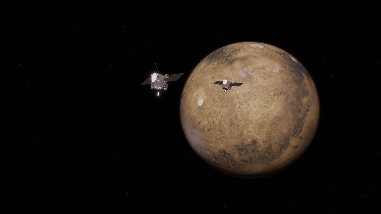
-
NASA has exercised the second option of its Information Technology and Multimedia Services (ITAMS) contract with DB Consulting Group, Inc., ...
-
4 min read NASA X-ray Telescopes Reveal the “Bones” of a Ghostly Cosmic Hand Credit: X-ray: NASA/CXC/Stanford Univ./R. Romani e...
