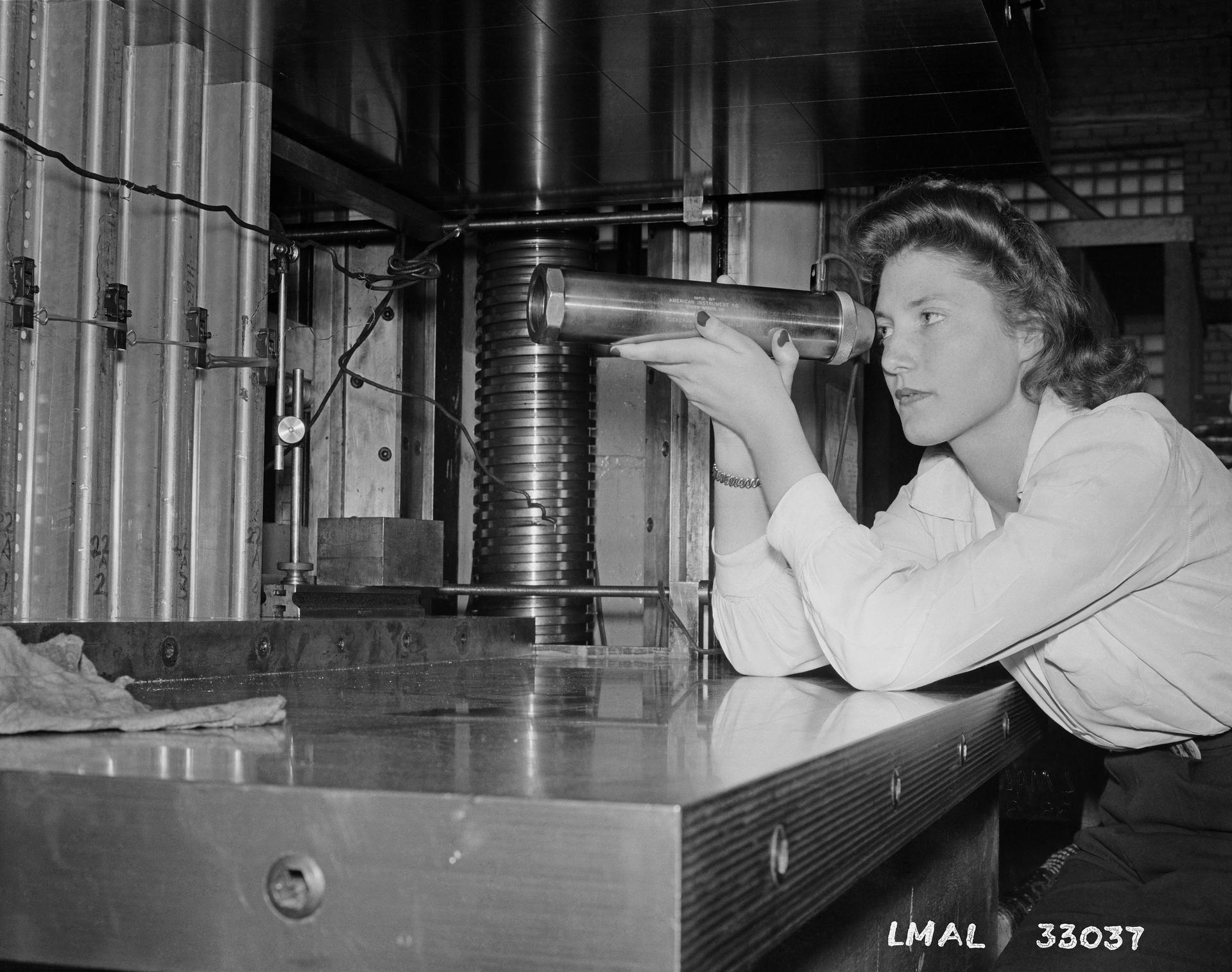
An apprentice at Langley Laboratory (now NASA’s Langley Research Center in Hampton, Virginia) inspects wind tunnel components in this image from May 15, 1943. During World War II, the National Advisory Committee for Aeronautics (NACA), the precursor to NASA, employed apprentices (which NASA has since transitioned into internships) to support meaningful jobs in data computing, testing, and mechanical work.
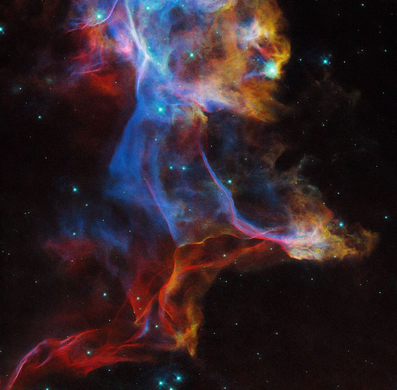
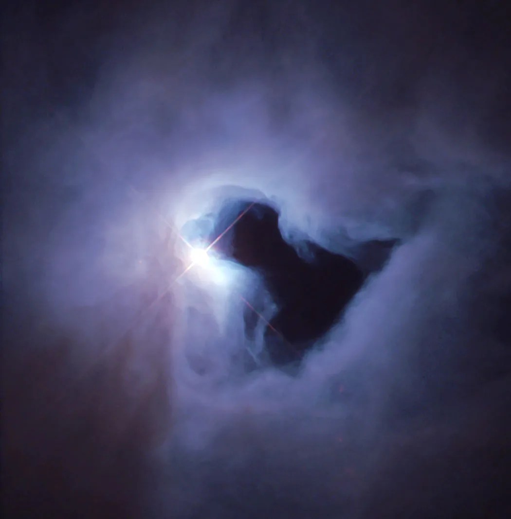
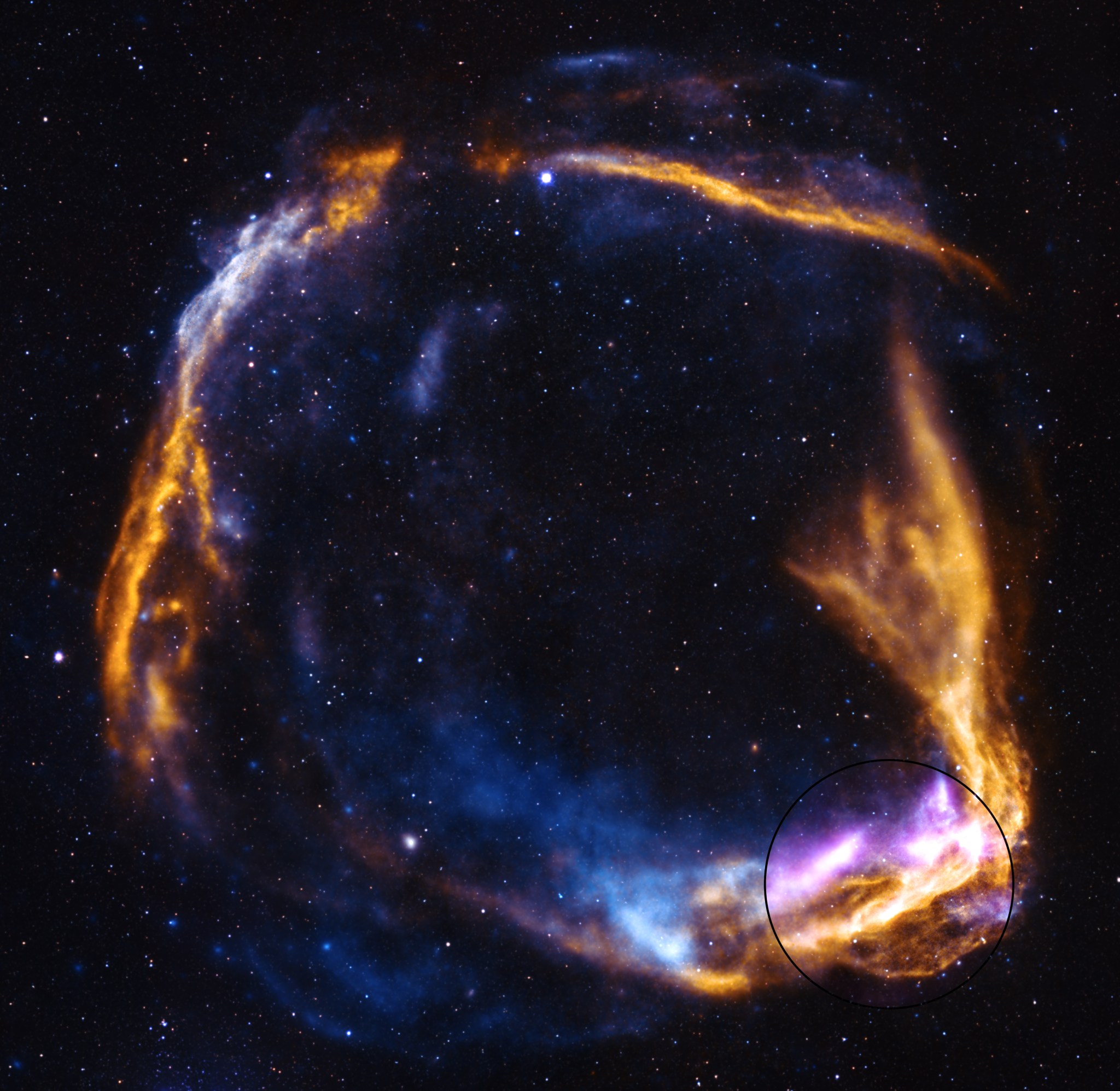
In this NASA/ESA Hubble Space Telescope image, Hubble once again lifts the veil on a famous — and frequently photographed — supernova remnant: the Veil Nebula. The remnant of a star roughly 20 times as massive as the Sun that exploded about 10,000 years ago, the Veil Nebula is situated about 2,400 light-years away in the constellation Cygnus. Hubble images of this photogenic nebula were first taken in 1994 and 1997, and again in 2015.
This view combines images taken in three different filters by Hubble’s Wide Field Camera 3, highlighting emission from hydrogen, sulfur, and oxygen atoms. The image shows just a small fraction of the Veil Nebula; if you could see the entire nebula without the aid of a telescope, it would be as wide as six full Moons placed side-by-side.
Although this image captures the Veil Nebula at a single point in time, it helps researchers understand how the supernova remnant evolves over decades. Combining this snapshot with Hubble observations from 1994 will reveal the motion of individual knots and filaments of gas over that span of time, enhancing our understanding of this stunning nebula.
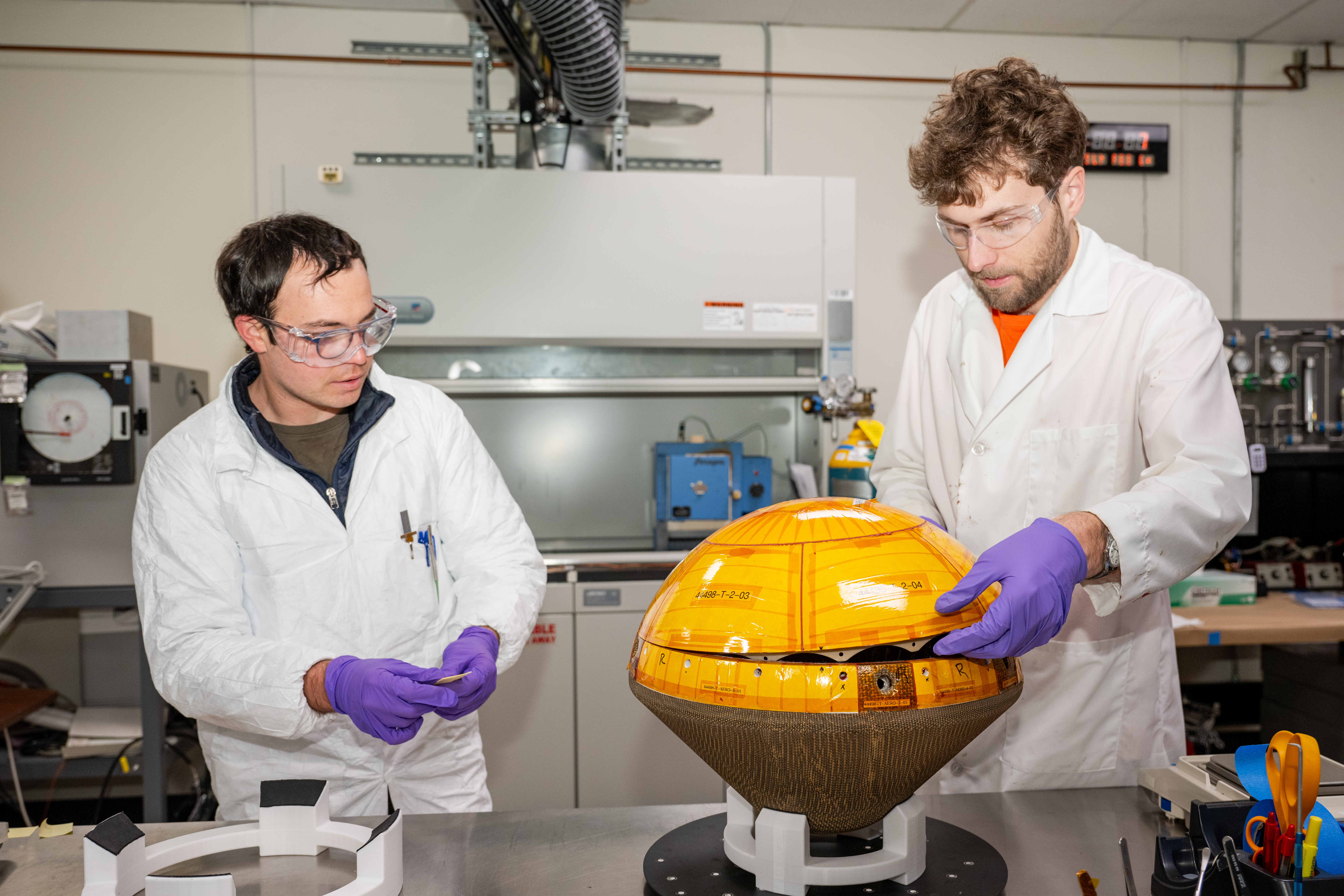
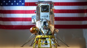
Engineers at NASA’s Ames Research Center in California’s Silicon Valley, Bohdan Wesely, right, and Eli Hiss, left, complete a fit check of the two halves of a space capsule that will study the clouds of Venus for signs of life.
Led by Rocket Lab of Long Beach, California, and their partners at the Massachusetts Institute of Technology in Cambridge, Rocket Lab’s Venus mission will be the first private mission to the planet.
NASA’s role is to help the commercial space endeavor succeed by providing expertise in thermal protection of small spacecraft. Invented at Ames, NASA’s Heatshield for Extreme Entry Environment Technology (HEEET) – the brown, textured material covering the bottom of the capsule in this photo – is a woven heat shield designed to protect spacecraft from temperatures up to 4,500 degrees Fahrenheit. The probe will deploy from Rocket Lab’s Photon spacecraft bus, taking measurements as it descends through the planet’s atmosphere.
Teams at Ames work with private companies, like Rocket Lab, to turn NASA materials into solutions such as the heat shield tailor-made for this spacecraft destined for Venus, supporting growth of the new space economy. NASA’s Small Spacecraft Technology program, part of the agency’s Space Technology Mission Directorate, supported development of the heat shield for Rocket Lab’s Venus mission.
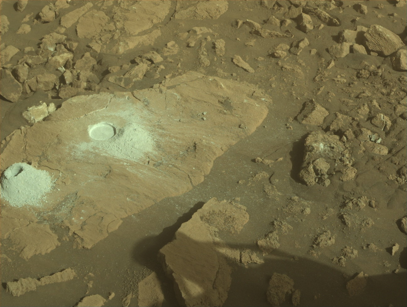
NASA’s Mars rover Curiosity acquired this image using its Front Hazard Avoidance Camera (Front Hazcam) on Feb. 23, 2025 — sol 4462, or Martian day 4,462 of the Mars Science Laboratory mission — at 21:43:37 UTC.
NASA/JPL-Caltech
Written by Lauren Edgar, Planetary Geologist at USGS Astrogeology Science Center
Earth planning date: Monday, Feb. 24, 2025
Over the weekend Curiosity drove about 48 meters (about 157 feet) to the southwest, continuing to march along on our traverse past Texoli butte and Gould Mesa. I was on shift as the LTP today, and it was great to see the good drive progress, interesting workspace, and exciting stratigraphy that lies ahead.
Today’s two-sol plan includes contact science and a drive on the first sol, followed by untargeted remote sensing on the second sol. The Geology theme group got straight to work evaluating contact science targets, and decided on a nodular block named “Matilija Poppy” for APXS and MAHLI observations. Then the team turned their attention to the remote sensing activities. There are a variety of interesting rock textures near the rover, so the team spent some time planning Mastcam imaging and ChemCam LIBS activities to assess the diversity. Some blocks have polygonal fractures with raised ridges, while other blocks are more nodular or well-laminated. In addition to looking at the bedrock, Mastcam will document local troughs in the loose sand between blocks, to understand more recent surface processes. The team planned a ChemCam LIBS observation on one of the polygonal fractures at a target named “East Fork” and two long-distance ChemCam RMI mosaics of Gould Mesa to assess the distant stratigraphy. Then Curiosity will drive about 30 meters (about 98 feet) further to the south, and take post-drive imaging to prepare for Wednesday’s plan.
On the second sol Curiosity will take an autonomously selected ChemCam target, along with multiple environmental monitoring observations to search for dust devils, monitor atmospheric dust, and evaluate clouds. It was a pretty smooth day of planning, and it’s always nice to see how the team works together to accomplish a lot of great science. Looking forward to continuing to make great progress as we start climbing uphill again!
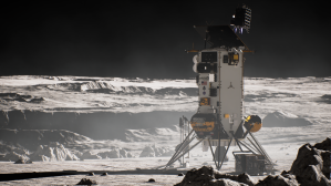
Preparations for Next Moonwalk Simulations Underway (and Underwater)
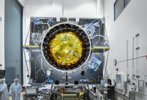
Sunlight gleams off NASA’s Lunar Trailblazer as the dishwasher-size spacecraft orbits the Moon in this artist’s concept. The mission will discover where the Moon’s water is, what form it is in, and how it changes over time, producing the best-yet maps of water on the lunar surface.
Lockheed Martin Space
The small satellite mission will map the Moon to help scientists better understand where its water is, what form it’s in, how much is there, and how it changes over time.
Launching no earlier than Wednesday, Feb. 26, NASA’s Lunar Trailblazer will help resolve an enduring mystery: Where is the Moon’s water? After sharing a ride on a SpaceX Falcon 9 rocket with Intuitive Machines’ IM-2 launch — part of NASA’s CLPS (Commercial Lunar Payload Services) initiative — the small satellite will take several months to arrive in lunar orbit.
Here are six things to know about the mission.
1. Lunar Trailblazer will produce high-resolution maps of water on the lunar surface.
One of the biggest lunar discoveries in recent decades is that the Moon’s surface has quantities of water, but little about its nature is known. To investigate, Lunar Trailblazer will decipher where the water is, what form it is in, how much is there, and how it changes over time. The small satellite will produce the best-yet maps of water on the lunar surface. Observations gathered during the two-year prime mission will also contribute to the understanding of water cycles on airless bodies throughout the solar system.
2. The small satellite will use two state-of-the-art science instruments.
Key to achieving these goals are the spacecraft’s two science instruments: the High-resolution Volatiles and Minerals Moon Mapper (HVM3) infrared spectrometer and the Lunar Thermal Mapper (LTM) infrared multispectral imager. NASA’s Jet Propulsion Laboratory in Southern California provided the HVM3 instrument, while LTM was built by the University of Oxford and funded by the UK Space Agency.
HVM3 will detect and map the spectral fingerprints, or wavelengths of reflected sunlight, of minerals and the different forms of water on the lunar surface. The LTM instrument will map the minerals and thermal properties of the same landscape. Together they will create a picture of the abundance, location, and form of water while also tracking how its distribution changes over time and temperature.
Fueled and attached to an adaptor used for secondary payloads, NASA’s Lunar Trailblazer is seen at SpaceX’s payload processing facility within NASA’s Kennedy Space Center in Florida in early February 2025. The small satellite is riding along on Intuitive Machines’ IM-2 launch.
SpaceX
3. Lunar Trailblazer will take a long and winding road to the Moon.
Weighing only 440 pounds (200 kilograms) and measuring 11.5 feet (3.5 meters) wide with its solar panels fully deployed, Lunar Trailblazer is about the size of a dishwasher and relies on a relatively small propulsion system. To make the spacecraft’s four-to-seven-month trip to the Moon (depending on the launch date) as efficient as possible, the mission’s design and navigation team has planned a looping trajectory that will use the gravity of the Sun, Earth, and Moon to guide Lunar Trailblazer to its final science orbit — a technique called low-energy transfer.
4.The spacecraft will peer into the darkest parts of the Moon’s South Pole.
Lunar Trailblazer’s science orbit positions it to peer into the craters at the Moon’s South Pole using the HVM3 instrument. What makes these craters so intriguing is that they harbor cold traps that may not have seen direct sunlight for billions of years, which means they’re a potential hideout for frozen water. The HVM3 spectrometer is designed to use faint reflected light from the walls of craters to see the floor of even permanently shadowed regions. If Lunar Trailblazer finds significant quantities of ice at the base of the craters, those locations could be pinpointed as a resource for future lunar explorers.
5. Lunar Trailblazer is a high-risk, low-cost mission.
Lunar Trailblazer was a 2019 selection of NASA’s SIMPLEx (Small Innovative Missions for Planetary Exploration), which provides opportunities for low-cost science spacecraft to ride-share with selected primary missions. To maintain a lower overall cost, SIMPLEx missions have a higher risk posture and lighter requirements for oversight and management. This higher risk acceptance allows NASA to enable science missions that could not otherwise be done.
6. Future missions will benefit from Lunar Trailblazer’s data.
Mapping the Moon’s water supports future human and robotic lunar missions. With knowledge from Lunar Trailblazer of where water is located, astronauts could process lunar ice to create water for human use, breathable oxygen, or fuel. And they could conduct science by sampling the ice for later study to determine the water’s origins.
More About Lunar Trailblazer
Lunar Trailblazer is led by Principal Investigator Bethany Ehlmann of Caltech in Pasadena, California. Caltech also leads the mission’s science investigation, and Caltech’s IPAC leads mission operations, which includes planning, scheduling, and sequencing of all spacecraft activities. NASA JPL manages Lunar Trailblazer and provides system engineering, mission assurance, the HVM3 instrument, and mission design and navigation. JPL is managed by Caltech for NASA. Lockheed Martin Space provided the spacecraft, integrated the flight system, and supports operations under contract with Caltech. The University of Oxford developed and provided the LTM instrument, funded by the UK Space Agency. Lunar Trailblazer, part of NASA’s Lunar Discovery Exploration Program, is managed by NASA’s Planetary Mission Program Office at Marshall Space Flight Center in Huntsville, Alabama, for the agency’s Science Mission Directorate in Washington.
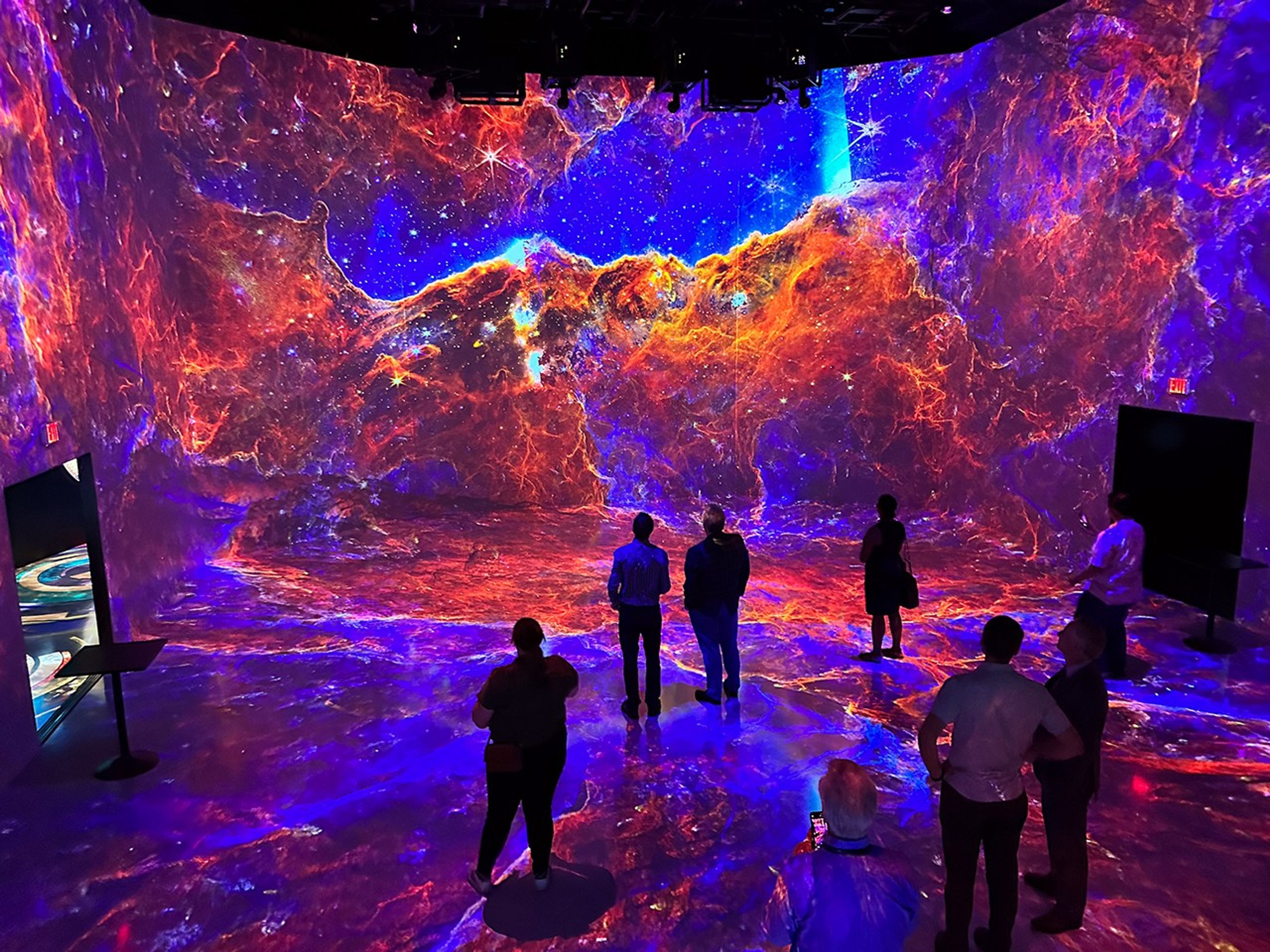
Guests enjoy Beyond the Light, a digital art experience featuring open NASA data, at ARTECHOUSE in Washington, D.C. on September 19, 2023.
NASA/Wade Sisler
An art display powered by NASA science data topped the Salesforce Tower in San Francisco, CA throughout December 2024. Nightly visitors enjoyed “Synchronicity,” a 20-minute-long video art piece by Greg Niemeyer, which used a year’s worth of open data from NASA satellites and other sources to bring the rhythms of the Bay Area to life.
Data for “Synchronicity” included atmospheric data from NASA and NOAA’s GOES (Geostationary Operational Environmental Satellites), vegetation health data from NASA’s Landsat program, and the Sun’s extreme ultraviolet wavelengths as captured by the NASA and ESA (European Space Agency) satellite SOHO (Solar and Heliospheric Observatory). Chelle Gentemann, the program scientist for the Office of the Chief Science Data Officer within NASA’s Science Mission Directorate, advised Niemeyer on incorporating data into the piece.
Greg Niemeyer’s “Synchronicity” was displayed on Salesforce Tower in San Francisco, CA, in December 2024. A recording of the piece on the tower’s display and the original animation are shown here. The video art piece was created using open NASA data, as well as buoy data from the National Oceanographic and Atmospheric Administration (NOAA).
Greg Niemeyer/Emma Strebel
“Artists have a lot to contribute to science,” Gentemann said. “Not only can they play a part in the actual scientific process, looking at things in a different way that will lead to new questions, but they’re also critical for getting more people involved in science.”
NASA’s history of engaging with artists goes back to the 1962 launch of the NASA Art Program, which partnered with artists in bringing the agency’s achievements to a broader audience and telling the story of NASA in a different and unexpected way. Artists such as Andy Warhol, Norman Rockwell, and Annie Leibovitz created works inspired by NASA missions. The Art Program was relaunched in September 2024 with a pair of murals evoking the awe of space exploration for the Artemis Generation.
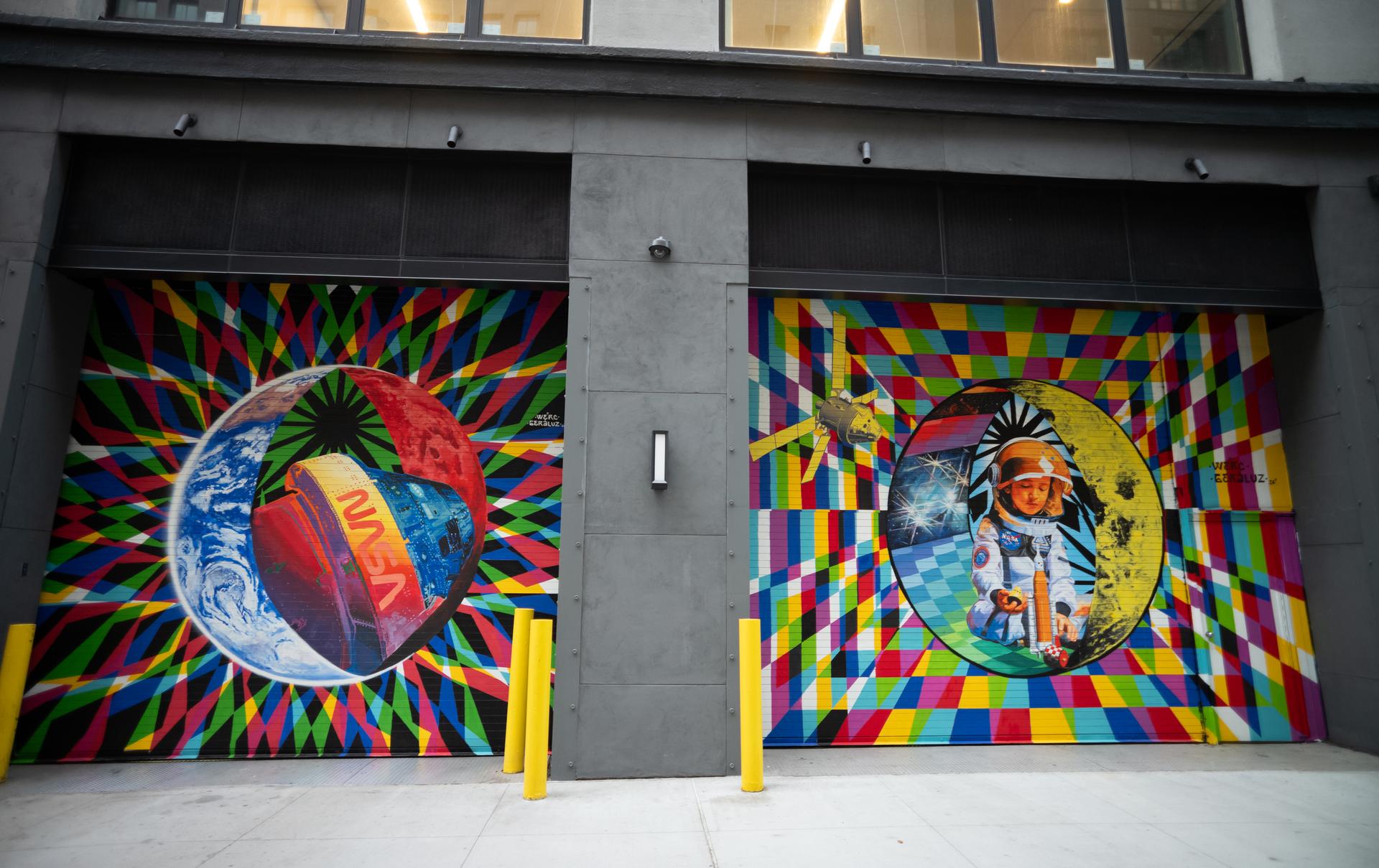
The inaugural murals for the relaunched NASA Art Program appear side-by-side at 350 Hudson Street, Monday, Sept. 23, 2024, in New York City. The murals, titled “To the Moon, and Back,” were created by New York-based artist team Geraluz and WERC and use geometrical patterns to invite deeper reflection on the exploration, creativity, and connection with the cosmos.
NASA/Joel Kowsky
The use of NASA data in art pieces emerged a few decades after the NASA Art Program first launched. Several in-house agency programs, such as NASA’s Scientific Visualization Studio, create stunning animated works from science data. In the realm of audio, NASA’s Chandra X-ray Observatory runs the Universe of Sound project to convert astronomy data into “sonifications” for the public’s listening pleasure.
Collaborations with external artists help bring NASA data to an even broader audience. NASA’s commitment to open science – making it as easy as possible for the public to access science data – greatly reduces the obstacles for creatives looking to fuse their art with cutting-edge science.
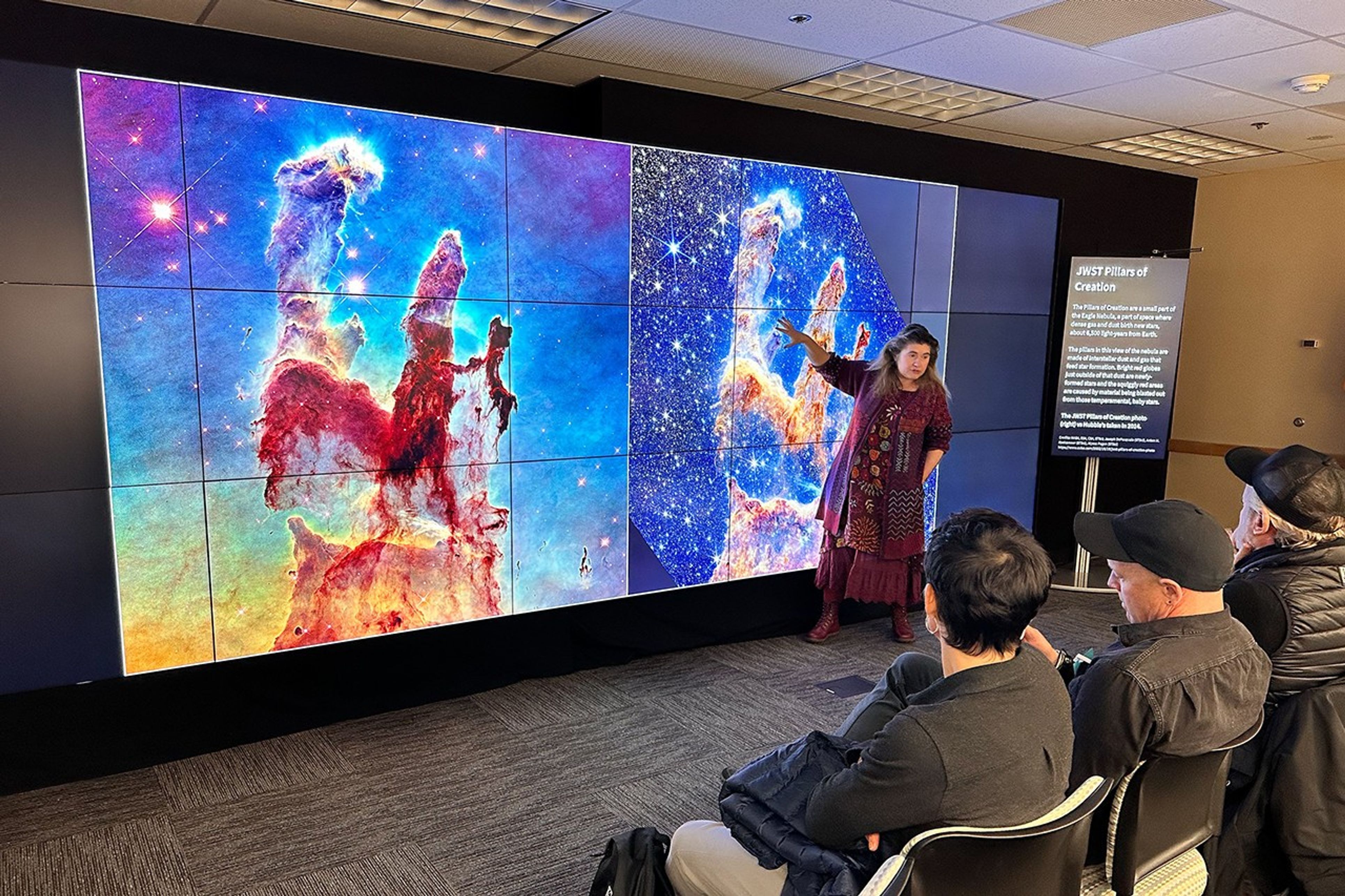
Michelle Thaller, assistant director for science communication at Goddard, presents the “Pillars of Creation” in the Eagle nebula to the ARTECHOUSE team during a brainstorming session at Goddard. The left image is a view from the Hubble Space Telescope, and the right view is from the Webb telescope.
NASA/Wade Sisler
Another recent blend of NASA data and art came when digital art gallery ARTECHOUSE created “Beyond the Light,” a 26-minute immersive video experience featuring publicly available images from the James Webb Space Telescope and Hubble Space Telescope. The experience has been running at various ARTECHOUSE locations since September 2023. The massive potential for art to incorporate science data promises to fuel even more of these collaborations between NASA and artists in the future.
“One of the integral values of open science is providing opportunities for more people to participate in science,” Gentemann said. “I think that by getting the public interested in how this art is done, they also are starting to play with scientific data, maybe for the first time. In that way, art has the power to create new scientists.”